
MyTopo
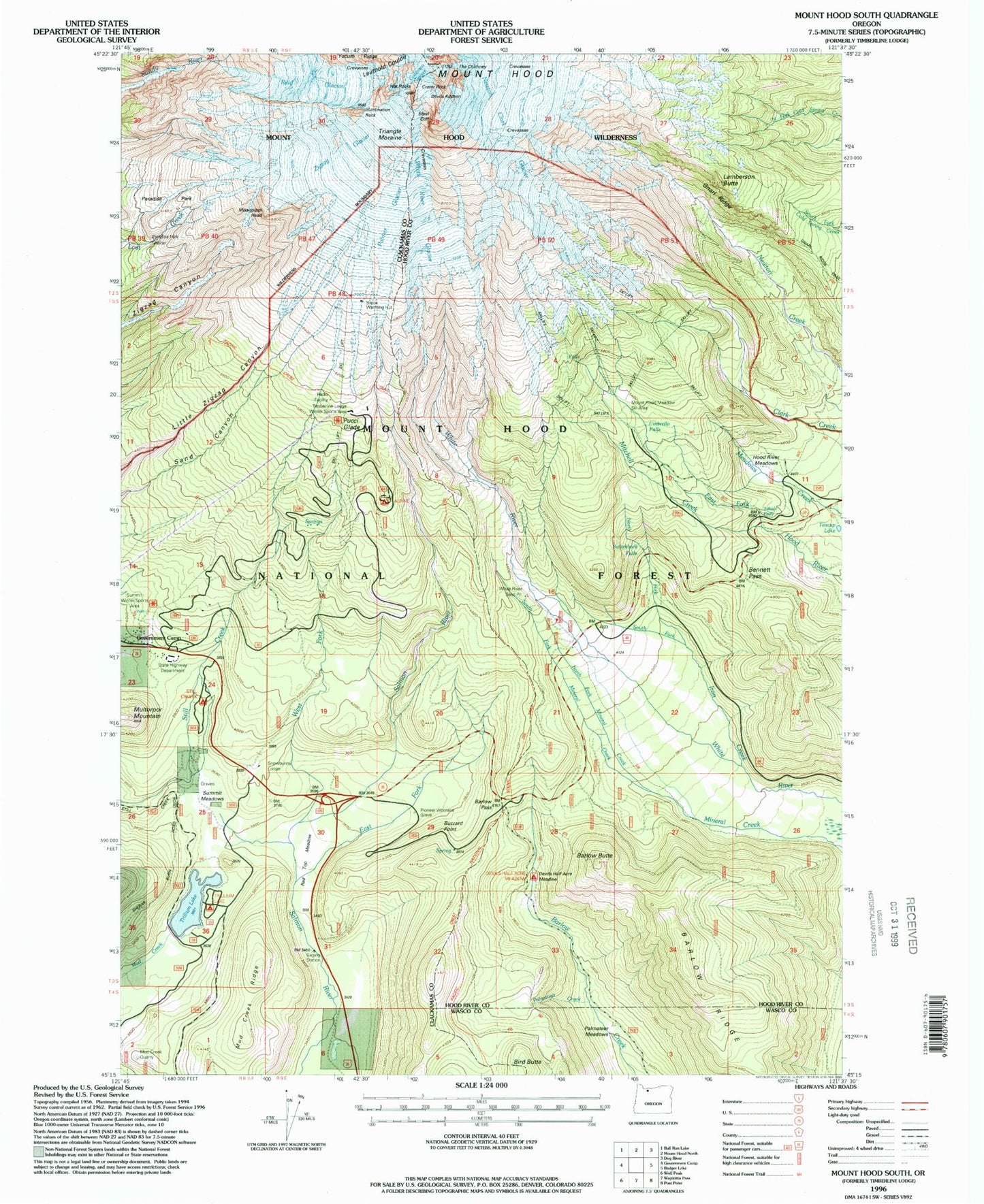
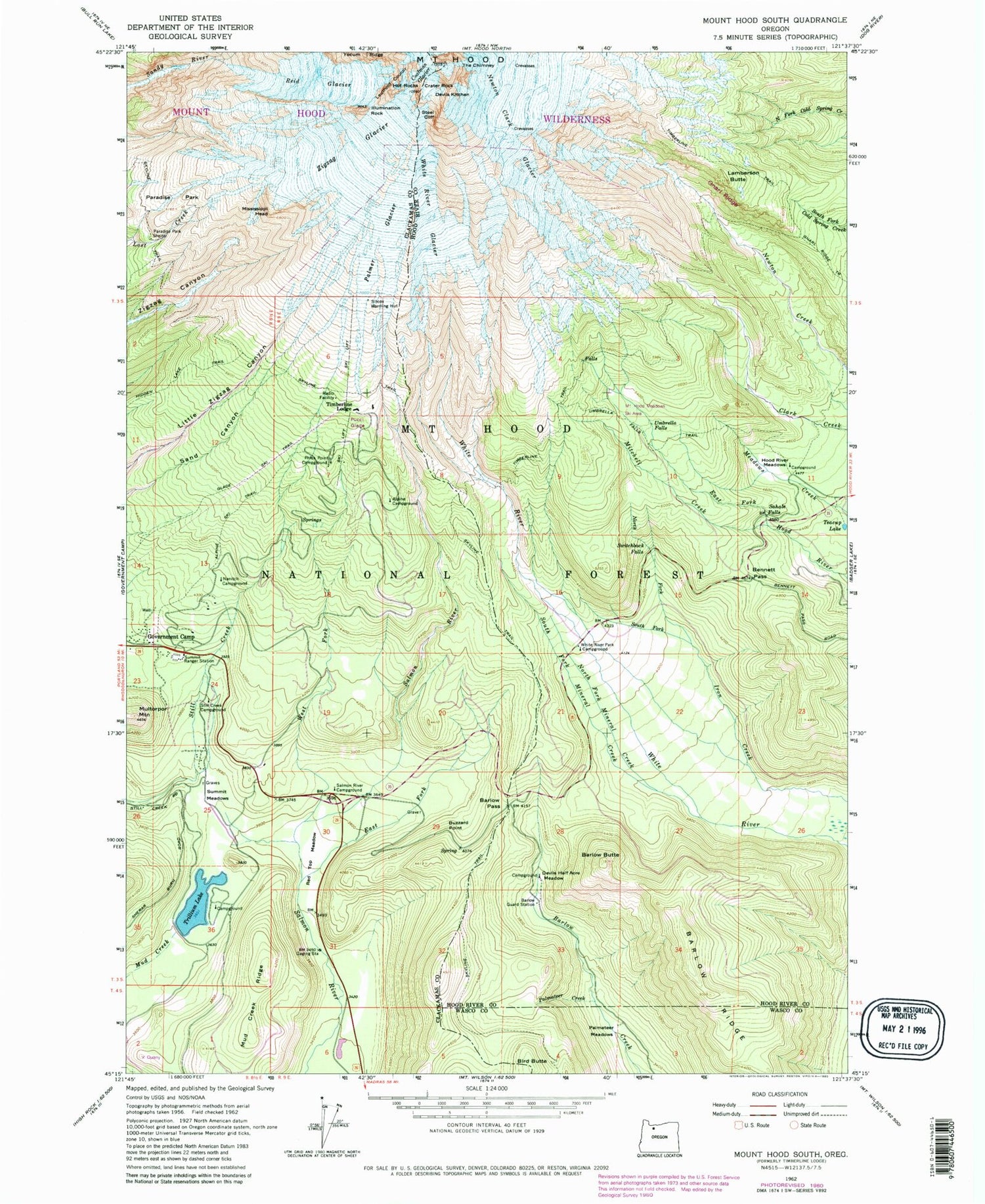
USGS Classic Mount Hood South Oregon 7.5'x7.5' Topo Map
Couldn't load pickup availability
Historical USGS topographic quad map of Mount Hood South in the state of Oregon. Scale: 1:24000. Print size: 24" x 27"
This quadrangle is in the following counties: Clackamas, Hood River, Wasco.
The map contains contour lines, roads, rivers, towns, lakes, and grids including latitude / longitude and UTM / MGRS. Printed on high-quality waterproof paper with UV fade-resistant inks.
Contains the following named places: Newton Clark Glacier, Alpine Recreation Site, Alpine Ski Trail, Barlow Butte, Barlow Guard Station, Barlow Pass, Barlow Ridge, Bennett Pass, Bird Butte, Buzzard Point, Crater Rock, Devils Half Acre Meadow, Devils Kitchen, East Fork Salmon River, Glade Ski Trail, Gnarl Ridge Trail, Hood River Meadows, Mount Hood, Hot Rocks, Illumination Rock, Lamberson Butte, Mineral Creek, Mississippi Head, Mitchell Creek, Multorpor Mountain, Nanitch Campground (historical), North Fork Iron Creek, North Fork Mineral Creek, Palmateer Creek, Palmateer Meadows, Palmer Glacier, Paradise Park Shelter, Phlox Point Recreation Site (historical), Red Top Meadow, Reid Glacier, Sahale Falls, Salmon River Campground (historical), Silcox Hut, South Fork Iron Creek, South Fork Mineral Creek, Steel Cliff, Still Creek Recreation Site, Summit Meadows, Summit Ranger Station, Switchback Falls, Teacup Lake, The Chimney, Trillium Lake, Umbrella Falls, Umbrella Falls Trail, West Fork Salmon River, White River Glacier, White River Park Campground (historical), Yocum Ridge, Zigzag Glacier, Green Apple Creek, Summit Meadows Cemetery, Leuthold Couloir, Gnarl Ridge, Coalman Glacier, Trillium Lake Dam, Snow Bunny Lodge, Pioneer Woman's Grave, Trillium Lake Recreation Site, Devils Half Acre Meadow Recreation Site, Triangle Moraine, Pucci Glade, Swim (historical), Swim Creek, Mud Creek Ridge, Timberline Lodge, Mount Hood Wilderness, Swim Post Office (historical), Timberline Lodge Post Office, Mono Creek, Mount Hood Meadows Ski Resort, Timberline Post Office (historical), Camp Blossom, Hawkins Ridge, Government Camp Safety Rest Area, Mount Hood Meadows Oregon Wastewater Treatment Plant, Trillium Lake Boat Ramp, White River Sand Pit, Mud Creek Quarry