MyTopo
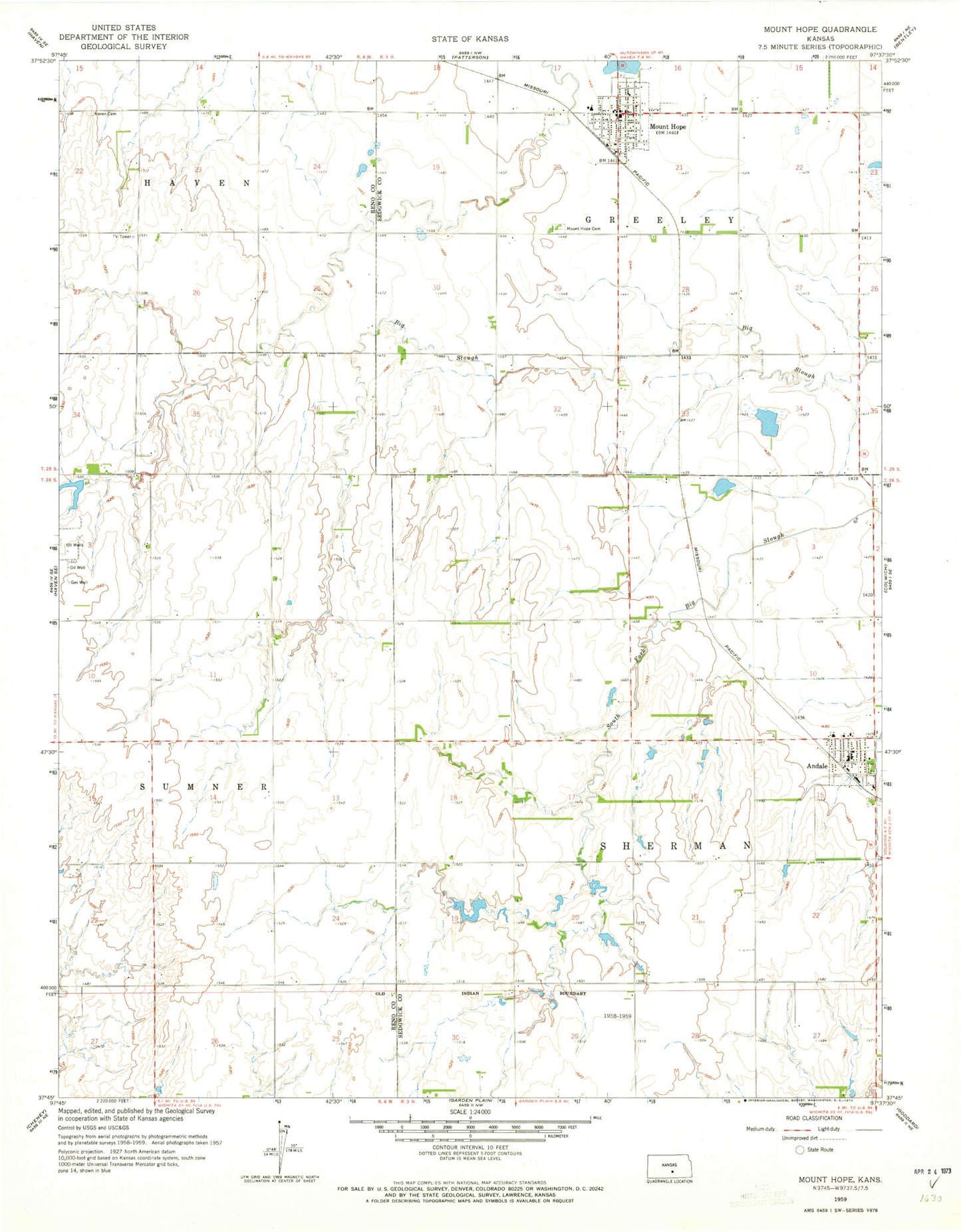
Classic USGS Mount Hope Kansas 7.5'x7.5' Topo Map
Couldn't load pickup availability
Historical USGS topographic quad map of Mount Hope in the state of Kansas. Map scale may vary for some years, but is generally around 1:24,000. Print size is approximately 24" x 27"
This quadrangle is in the following counties: Reno, Sedgwick.
The map contains contour lines, roads, rivers, towns, and lakes. Printed on high-quality waterproof paper with UV fade-resistant inks, and shipped rolled.
Contains the following named places: Andale, Andale Care Center, Andale Elementary - Middle School, Andale High School, Andale Middle School, Andale Police Department, Andale Post Office, Andale Water Tower, City of Andale, City of Mount Hope, Dicks Mobile Home Park, Haven Priest Cemetery, Mount Hope, Mount Hope Cemetery, Mount Hope City Offices, Mount Hope Community Ambulance Service, Mount Hope Elementary School, Mount Hope Federated Church, Mount Hope Fire Department, Mount Hope Municipal Court, Mount Hope Nursing Center, Mount Hope Police Department, Mount Hope Post Office, Mount Hope Public Library, Mount Hope United Methodist Church, Ost, Saint Joseph Cemetery, Sedgewick County Public Library - Andale District, Sedgwick County Fire District 1 Station 31, Team Marketing Alliance Grain Elevator Number 28, Township of Greeley, Township of Sherman, ZIP Codes: 67001, 67108