MyTopo
Classic USGS Mount Hornaday Wyoming 7.5'x7.5' Topo Map
Regular price
$16.95
Regular price
Sale price
$16.95
Unit price
per
Couldn't load pickup availability
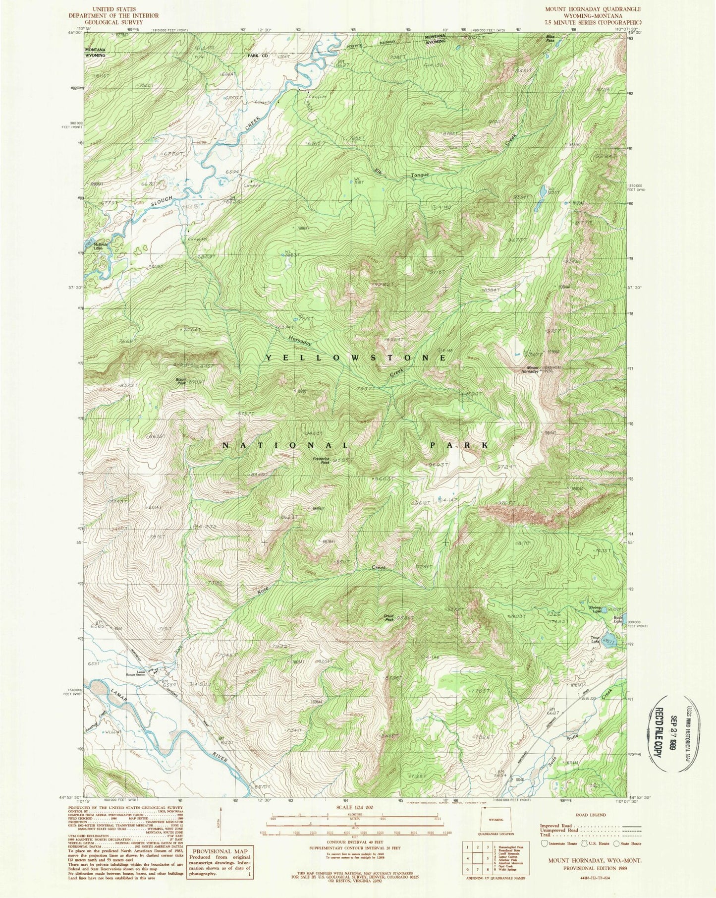
Historical USGS topographic quad map of Mount Hornaday in the state of Wyoming. Typical map scale is 1:24,000, but may vary for certain years, if available. Print size: 24" x 27"
This quadrangle is in the following counties: Park.
The map contains contour lines, roads, rivers, towns, and lakes. Printed on high-quality waterproof paper with UV fade-resistant inks, and shipped rolled.
Contains the following named places: Amethyst Creek, Bison Peak, Bliss Pass, Buck Lake, Buffalo Plateau, Elk Tongue Creek, Mount Hornaday, Lamar Ranger Station, Hornaday Creek, Rose Creek, Rose Creek, Shrimp Lake, Frederick Peak, Soda Butte (historical), Druid Peak, Trout Lake, Soda Butte Canyon, Soda Butte Crater, Soda Butte