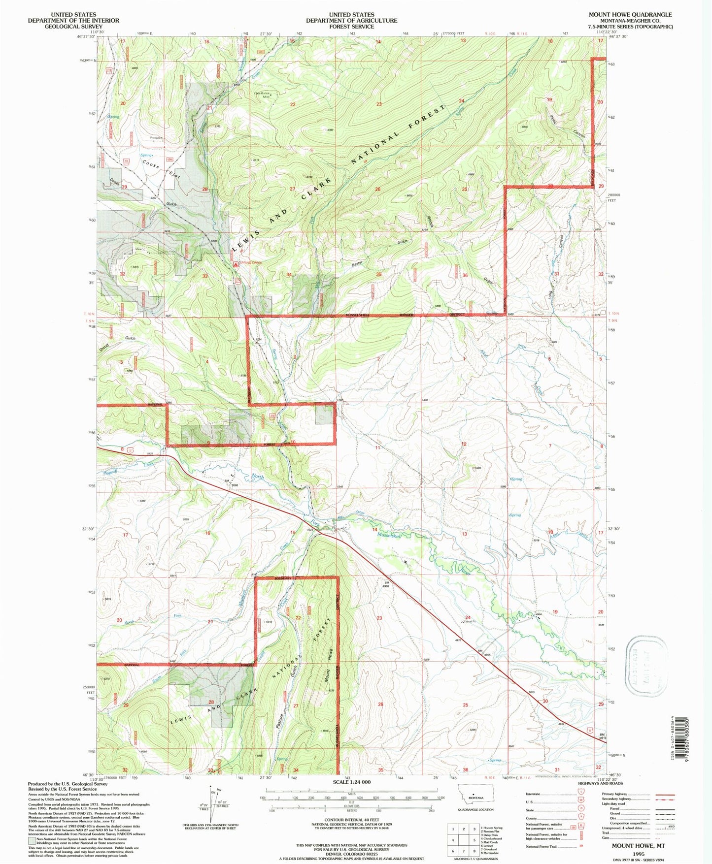
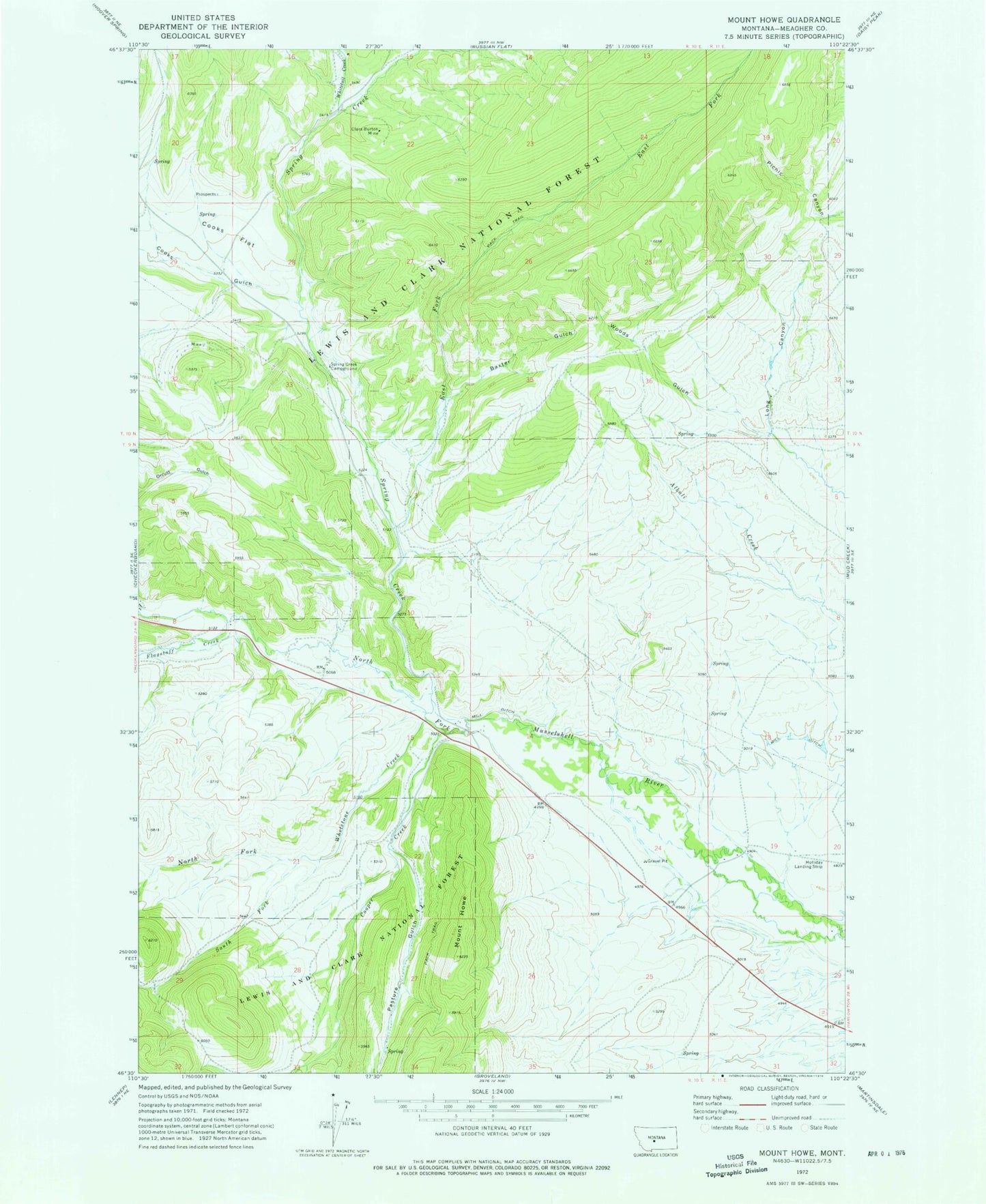
MyTopo
Classic USGS Mount Howe Montana 7.5'x7.5' Topo Map
Couldn't load pickup availability
Historical USGS topographic quad map of Mount Howe in the state of Montana. Map scale may vary for some years, but is generally around 1:24,000. Print size is approximately 24" x 27"
This quadrangle is in the following counties: Meagher.
The map contains contour lines, roads, rivers, towns, and lakes. Printed on high-quality waterproof paper with UV fade-resistant inks, and shipped rolled.
Contains the following named places: Baxter Gulch, BCE Number 3959 Mine, Clara Burton Mine, Cooks Flat, Cooks Gulch, Cooper Creek, East Fork Spring Creek, Flagstaff Creek, Fort Howie, Holliday Landing Strip, Lou Ire Mine, Mill Ditch, Moonlight Mine, Mount Howe, North Fork Whetstone Creek, Pasture Gulch, South Fork Whetstone Creek, Spring Creek, Spring Creek Campground, West Fork Cooper Creek, Whetstone Creek, Whitetail Creek, Woods Gulch