MyTopo
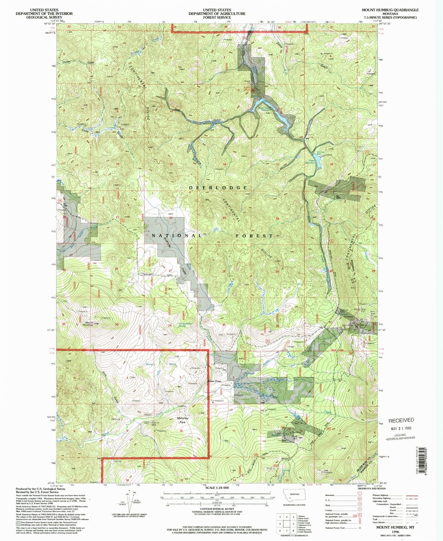
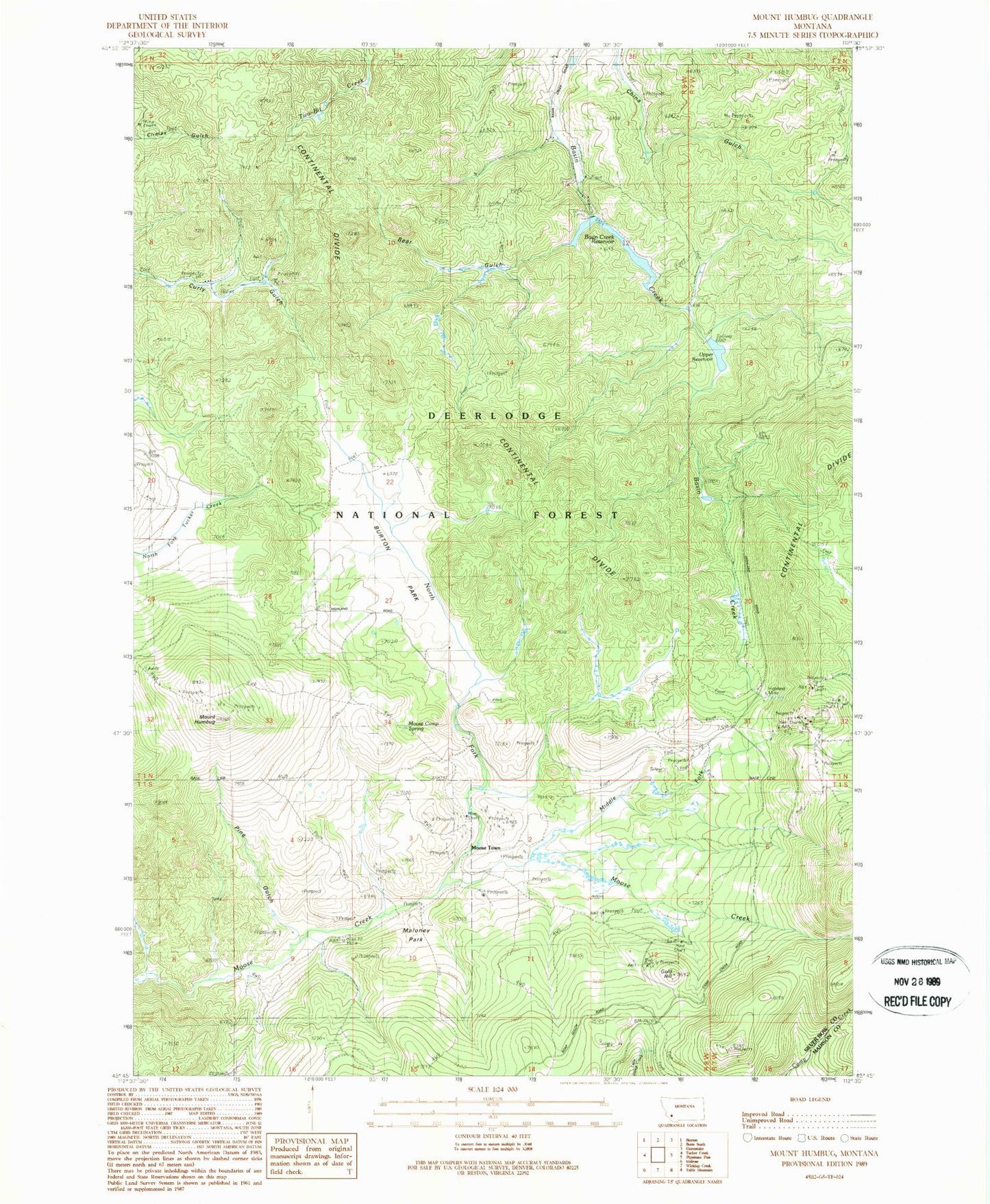
Classic USGS Mount Humbug Montana 7.5'x7.5' Topo Map
Couldn't load pickup availability
Historical USGS topographic quad map of Mount Humbug in the state of Montana. Typical map scale is 1:24,000, but may vary for certain years, if available. Print size: 24" x 27"
This quadrangle is in the following counties: Madison, Silver Bow.
The map contains contour lines, roads, rivers, towns, and lakes. Printed on high-quality waterproof paper with UV fade-resistant inks, and shipped rolled.
Contains the following named places: Basin Creek Park, Basin Creek Reservoir, Bear Gulch, Burton Park, Gold Hill, Highland Mine, Mount Humbug, Maloney Park, Middle Fork Moose Creek, Moose Town, North Fork Moose Creek, Pine Gulch, Upper Reservoir, Decker Flats, Decker Gulch, Moose Camp Spring, Basin Creek Dam Number 1, Basin Creek Dam Number 2, SE NE Section 9 Mine, NW SE Section 21 Mine, W SE Section 9 Mine, Royston (historical), Moose Creek Post Office (historical), Highland City (historical), Gold Hill (historical)