MyTopo
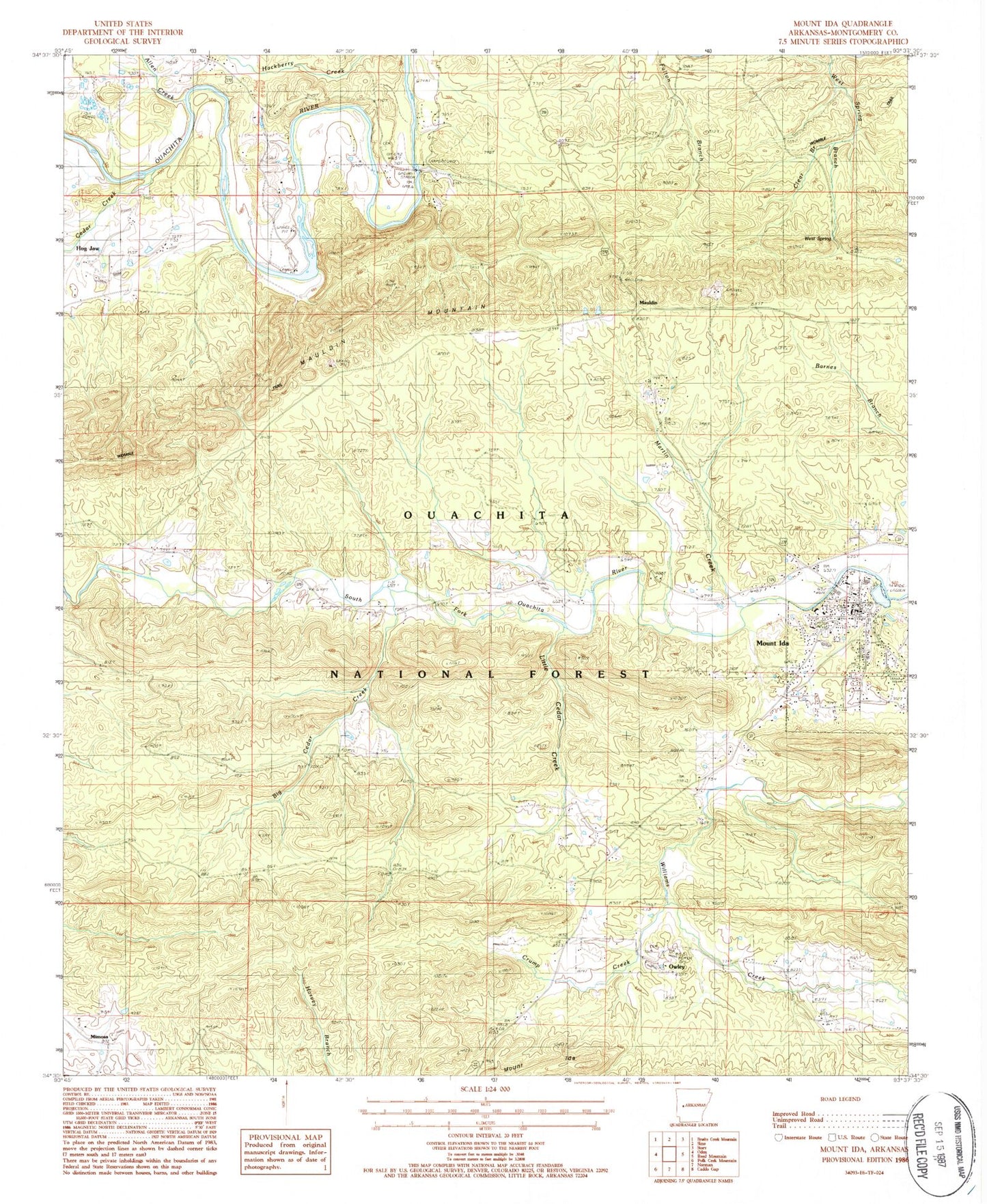
Classic USGS Mount Ida Arkansas 7.5'x7.5' Topo Map
Couldn't load pickup availability
Historical USGS topographic quad map of Mount Ida in the state of Arkansas. Typical map scale is 1:24,000, but may vary for certain years, if available. Print size: 24" x 27"
This quadrangle is in the following counties: Montgomery.
The map contains contour lines, roads, rivers, towns, and lakes. Printed on high-quality waterproof paper with UV fade-resistant inks, and shipped rolled.
Contains the following named places: Amerson Cemetery, Bates Cemetery, Ben Craven Elementary School, Church of Christ, Evening Light Tabernacle, Faith Tabernacle, First Assembly of God Church, Garrett Cemetery, Landmark Missionary Baptist Church, Lone Star School (historical), Mauldin, Mauldin School (historical), Midway Pentecostal Church, Mimosa, Mimosa School (historical), Montgomery County Courthouse, Mount Ida Cemetery, Mount Ida Church of God, Mount Ida First Baptist Church, Mount Ida First United Methodist Church, Mount Ida High School, Mountain Valley School (historical), Mullenix Cemetery, Oak Grove School (historical), Oak Hill Cemetery, Old Salyer Cemetery, Owley, Owley Cemetery, Owley School (historical), Rocky Valley School (historical), Scott Cemetery, Township of South Fork (historical), Montgomery County, Township of Hazel (historical), Allen Creek, Amason Cemetery, Big Cedar Creek, Cedar Creek, Clear Branch, Crump Creek, Mount Ida, Little Cedar Creek, Martin Creek, Mauldin Mountain, Owley Church, West Spring, West Spring Branch, Williams Creek, Mauldin, Rocky Shoals Campground, Mount Ida, Rocky Cemetery, Mount Ida Post Office, Mount Ida Volunteer Fire Department, Montgomery County Sheriff's Office, Southwest Emergency Medical Service Mount Ida, City of Mount Ida