MyTopo
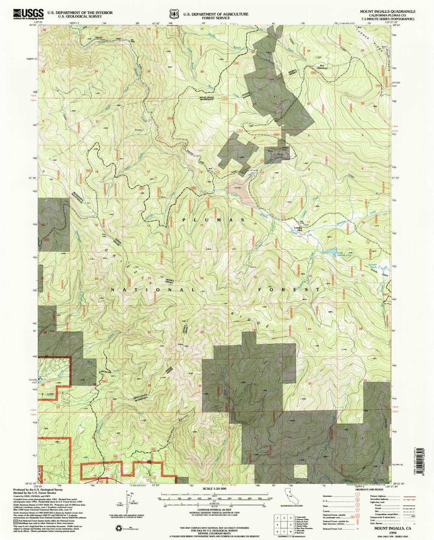
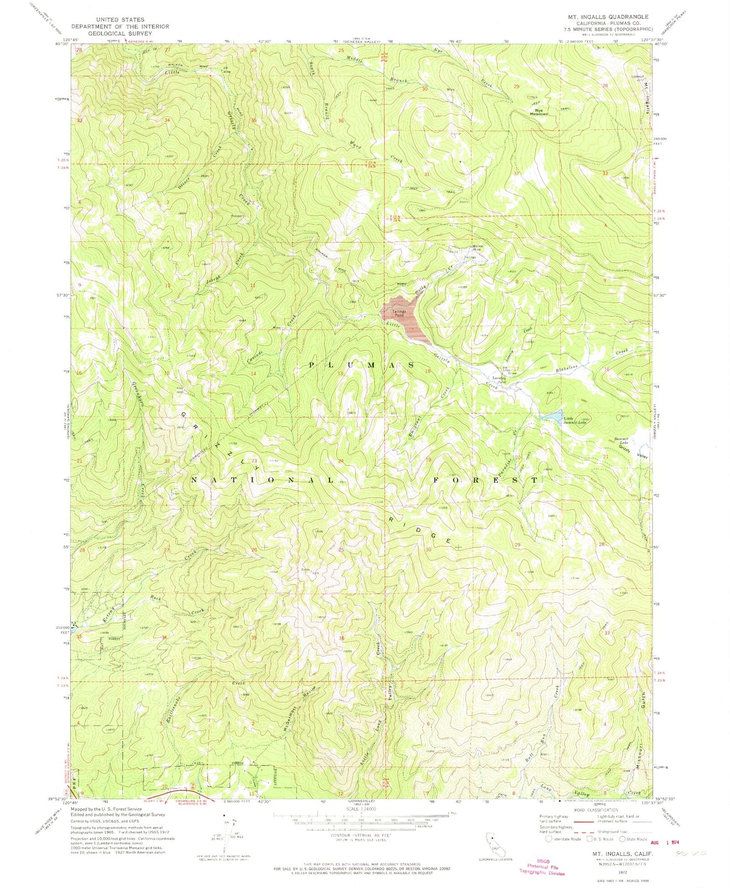
Classic USGS Mount Ingalls California 7.5'x7.5' Topo Map
Couldn't load pickup availability
Historical USGS topographic quad map of Mount Ingalls in the state of California. Map scale may vary for some years, but is generally around 1:24,000. Print size is approximately 24" x 27"
This quadrangle is in the following counties: Plumas.
The map contains contour lines, roads, rivers, towns, and lakes. Printed on high-quality waterproof paper with UV fade-resistant inks, and shipped rolled.
Contains the following named places: Blakeless Creek, Bull Run Creek, Cascade Creek, Dolly Creek, Emigrant Creek, Grizzly Ridge, Joseph Creek, Little Summit Lake, Lovejoy, Lovejoy Creek, McDermott Ravine, Middle Branch Ward Creek, Missouri Gulch, Mount Ingalls, Nye Meadows, Oliver Creek, Paradise Creek, Rock Creek, South Fork Long Valley Creek, Summit Marsh, Turner Ridge, Walker Consolidated Mine, Walker Mine, Walker Mine Compressor, Walker Mine Tailings Dam, Walker Mine Tailings Reservoir, Walkermine