MyTopo
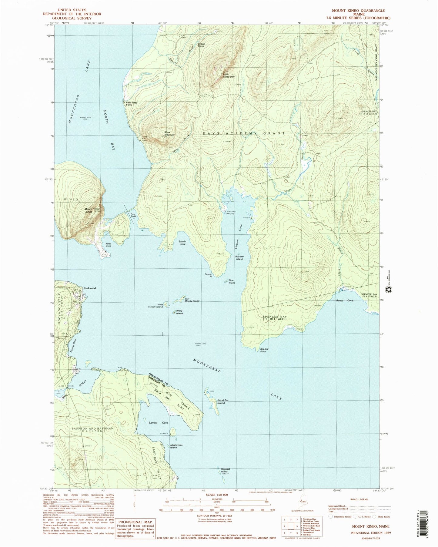
Classic USGS Mount Kineo Maine 7.5'x7.5' Topo Map
Couldn't load pickup availability
Historical USGS topographic quad map of Mount Kineo in the state of Maine. Typical map scale is 1:24,000, but may vary for certain years, if available. Print size: 24" x 27"
This quadrangle is in the following counties: Piscataquis, Somerset.
The map contains contour lines, roads, rivers, towns, and lakes. Printed on high-quality waterproof paper with UV fade-resistant inks, and shipped rolled.
Contains the following named places: Barrows Cove, Beaver Brook, Beaver Ponds, Big Dry Point, Boulder Island, Cowan Brook, Cowan Cove, Cowan Point, Deer Head Farm, East Moody Island, Farm Brook, Frog Pond, Harris Cove, Hogback Island, Kineo Cove, Mount Kineo, Lambs Cove, Little Kineo Mountain, Masterman Island, Pine Island, Rockwood, Ronco Brook, Ronco Cove, Sand Bar Island, Sand Bar Point, Shaw Mountain, West Moody Island, Willis Island, West Outlet Dam, Days Academy Grant Township, Kineo Township, Rockwood Fire and Rescue Department, Sandbar Tract Township