MyTopo
Classic USGS Mount Lago Washington 7.5'x7.5' Topo Map
Couldn't load pickup availability
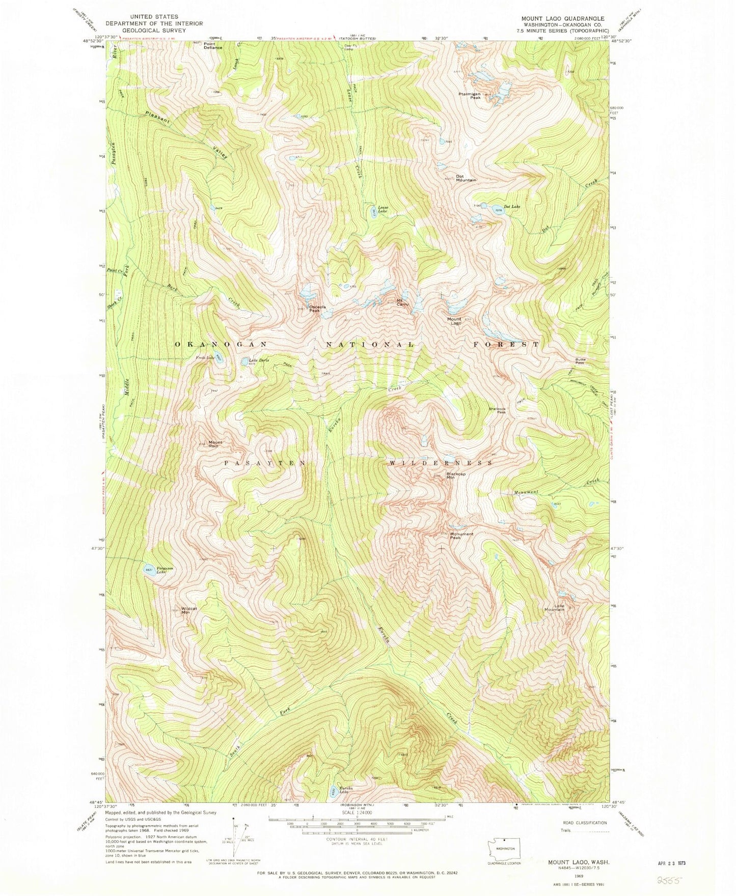
Historical USGS topographic quad map of Mount Lago in the state of Washington. Typical map scale is 1:24,000, but may vary for certain years, if available. Print size: 24" x 27"
This quadrangle is in the following counties: Okanogan.
The map contains contour lines, roads, rivers, towns, and lakes. Printed on high-quality waterproof paper with UV fade-resistant inks, and shipped rolled.
Contains the following named places: Berk Creek, Blackcap Mountain, Butte Pass, Mountain Carru, Deer Fly Camp, Dorchester Creek, Lake Doris, Dot Lakes, Dot Mountain, Eureka Lake, Ferguson Lake, Freds Lake, Mount Lago, Lake Mountain, Lease Lake, Monument Peak, Osceola Peak, Pleasant Valley, Point Creek, Point Defiance, Ptarmigan Peak, Mount Rolo, Shack Creek, Shellrock Pass, South Fork Eureka Creek, Wildcat Mountain