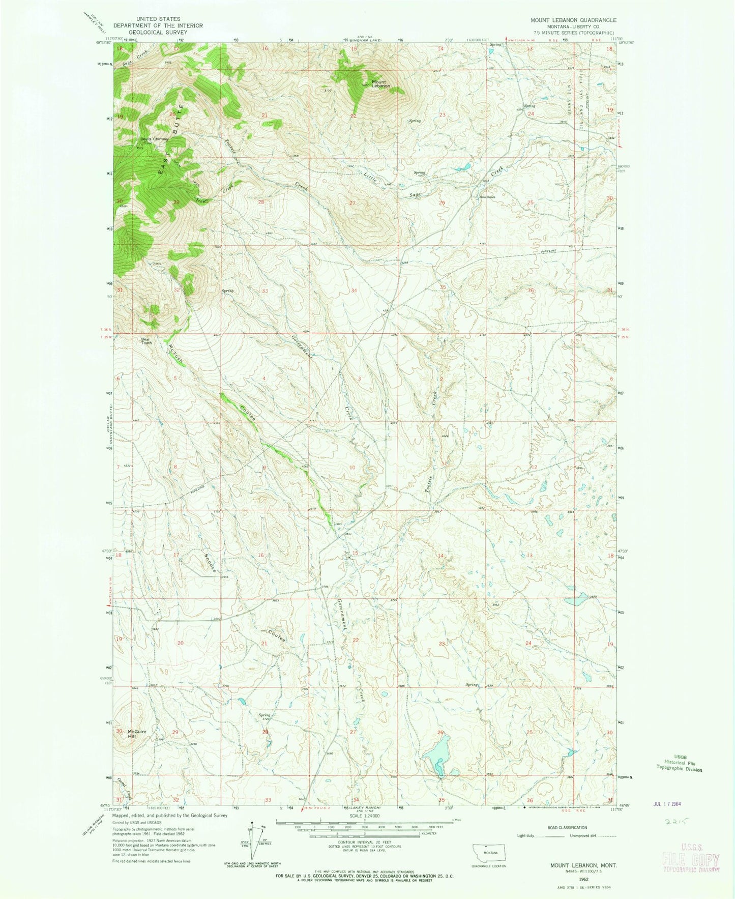
MyTopo
Classic USGS Mount Lebanon Montana 7.5'x7.5' Topo Map
Regular price
$16.95
Regular price
Sale price
$16.95
Unit price
per
Couldn't load pickup availability
Historical USGS topographic quad map of Mount Lebanon in the state of Montana. Map scale may vary for some years, but is generally around 1:24,000. Print size is approximately 24" x 27"
This quadrangle is in the following counties: Liberty.
The map contains contour lines, roads, rivers, towns, and lakes. Printed on high-quality waterproof paper with UV fade-resistant inks, and shipped rolled.
Contains the following named places: 35N05E15CAAC01 Well, 35N05E20BACC01 Well, Bear Tooth, Devils Chimney, East Butte, Iron Creek, McGuire Hill, McTosh Coulee, Meissner Dam, Mount Lebanon, Roke Ranch, Snoose Coulee, Tiber Quarry, Tootsie Creek, Tootsie Creek Number 1 Mine, Tootsie Creek Number 2 Mine