MyTopo
Classic USGS Mount Lena Utah 7.5'x7.5' Topo Map
Couldn't load pickup availability
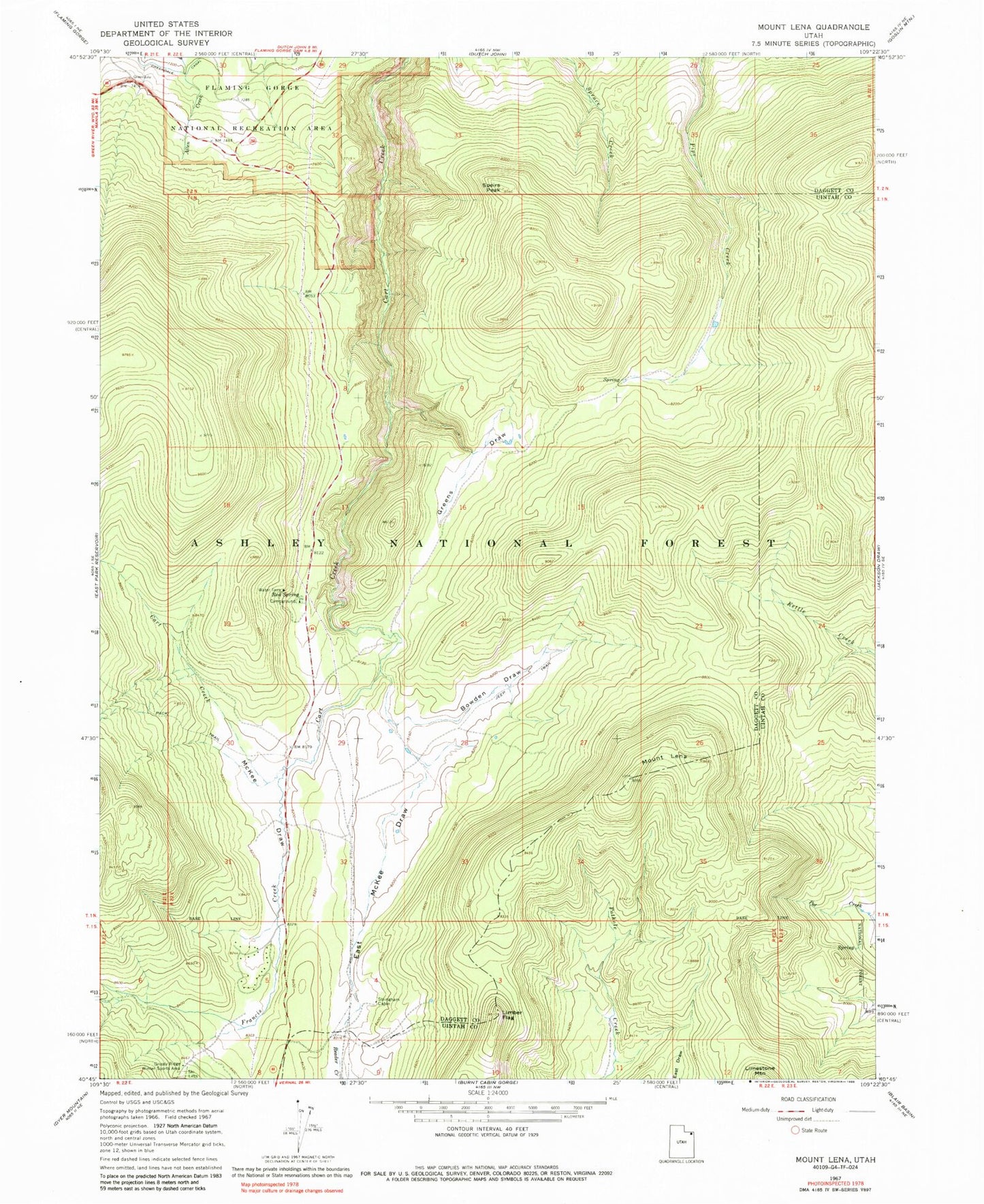
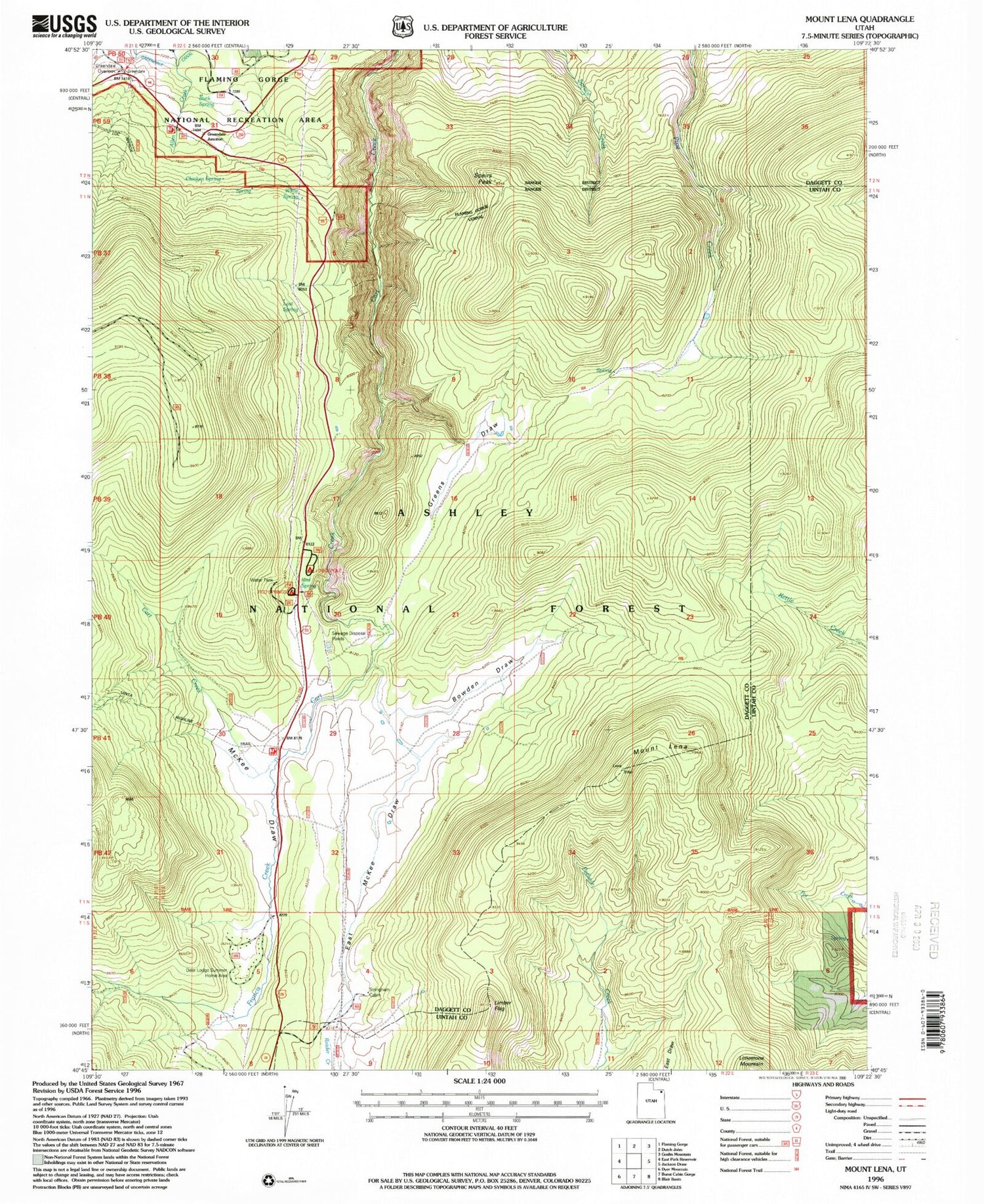
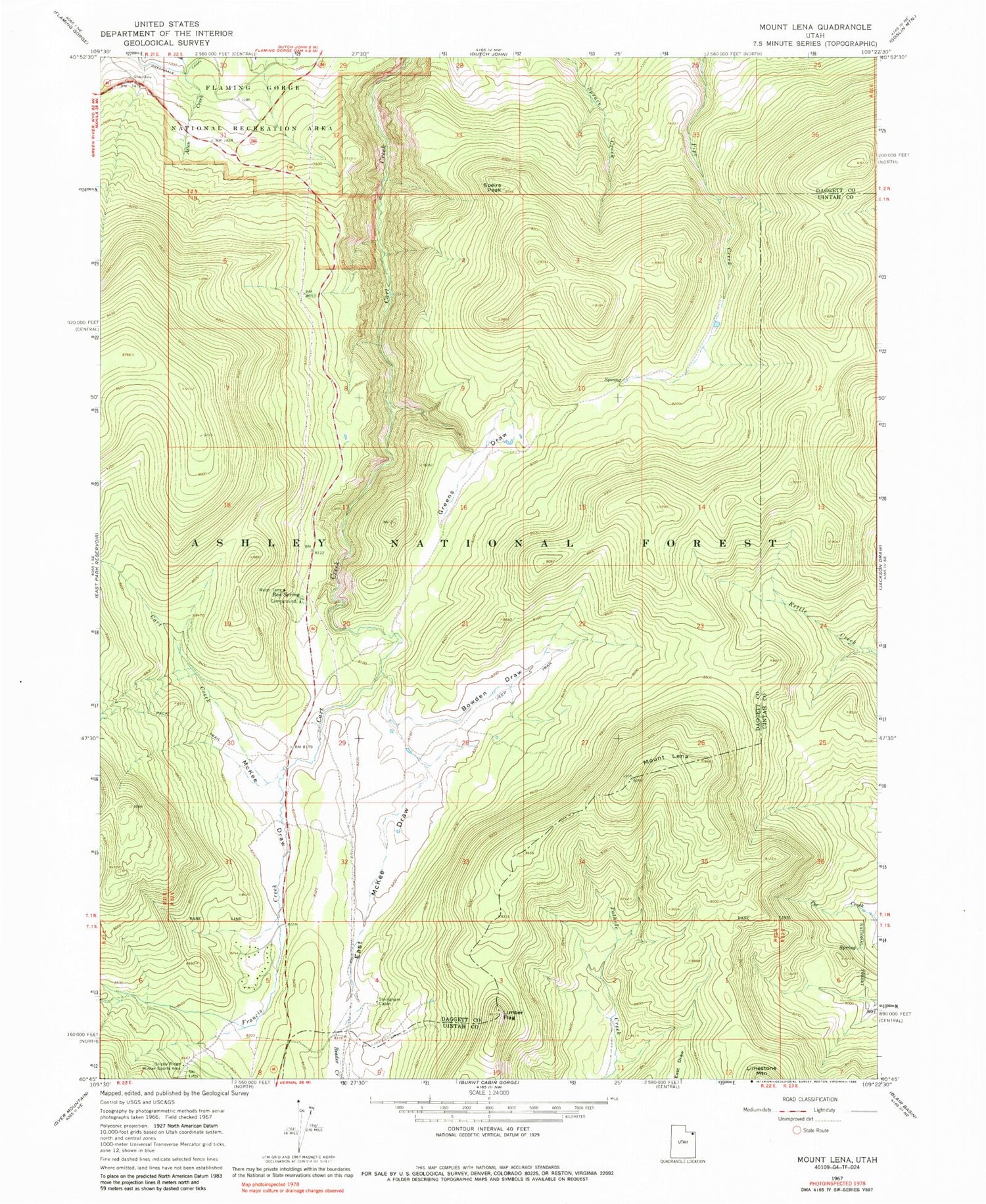
Historical USGS topographic quad map of Mount Lena in the state of Utah. Map scale may vary for some years, but is generally around 1:24,000. Print size is approximately 24" x 27"
This quadrangle is in the following counties: Daggett, Uintah.
The map contains contour lines, roads, rivers, towns, and lakes. Printed on high-quality waterproof paper with UV fade-resistant inks, and shipped rolled.
Contains the following named places: Bowden Draw, Buck Spring, Chicken Spring, Deer Lodge Summer Home Area, East McKee Draw, Francis Creek, Greendale Canal, Greendale Junction, Greens Draw, Greensdale Overlook, Grizzly Ridge Winter Sports Area, Limber Flag, Lodgepole Campground, Lost Spring, McKee Draw, Mount Lena, Red Spring, Red Spring Campground, Speirs Peak, Stringham Cabin, Willie Spring