
MyTopo
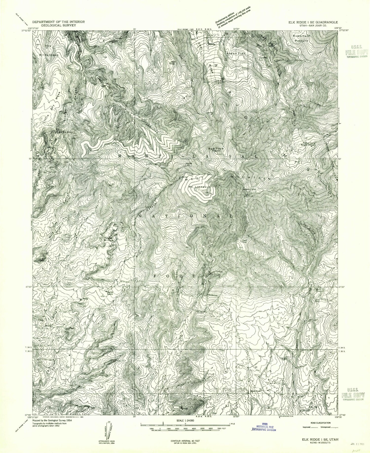
Classic USGS Mount Linnaeus Utah 7.5'x7.5' Topo Map
Couldn't load pickup availability
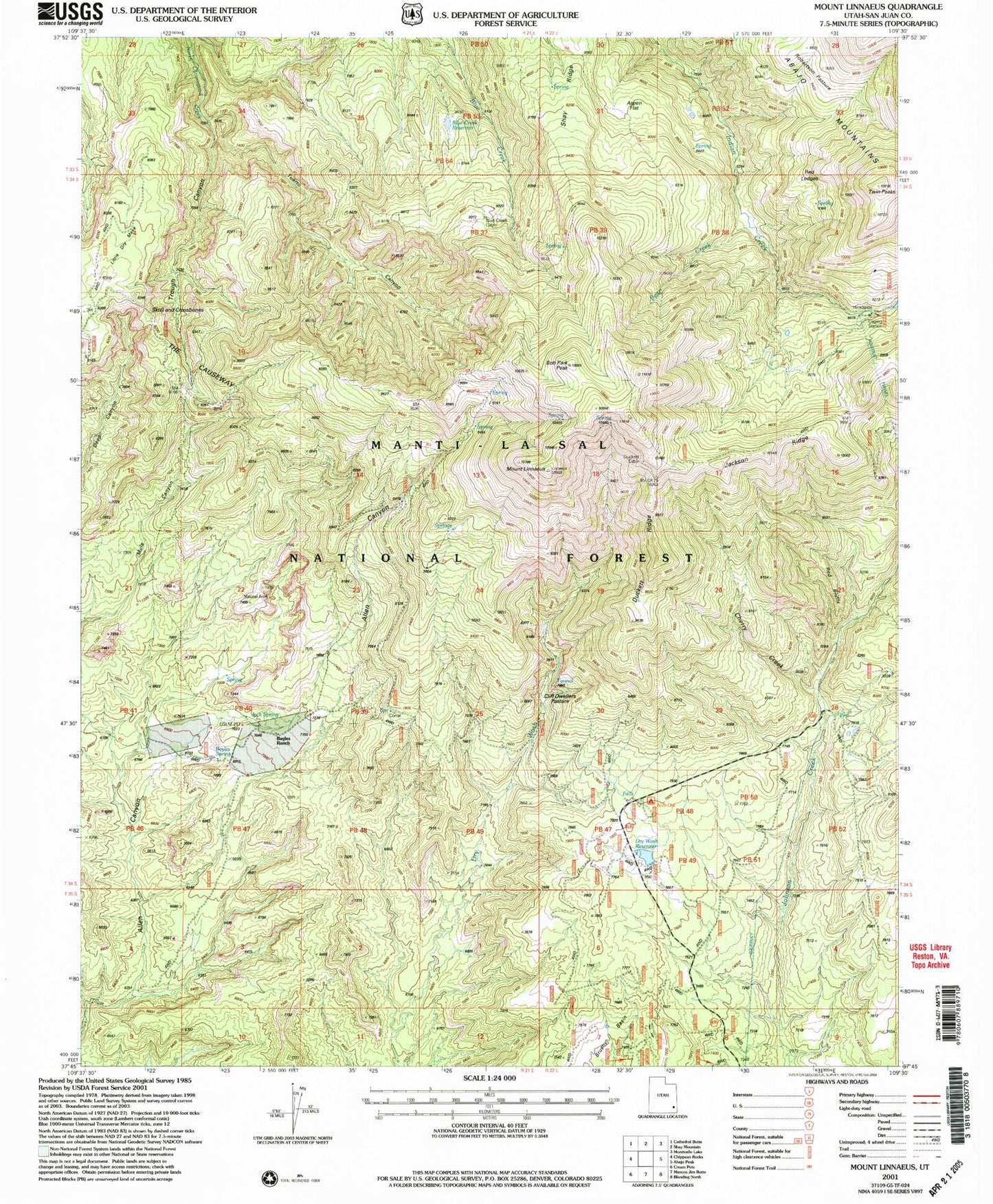
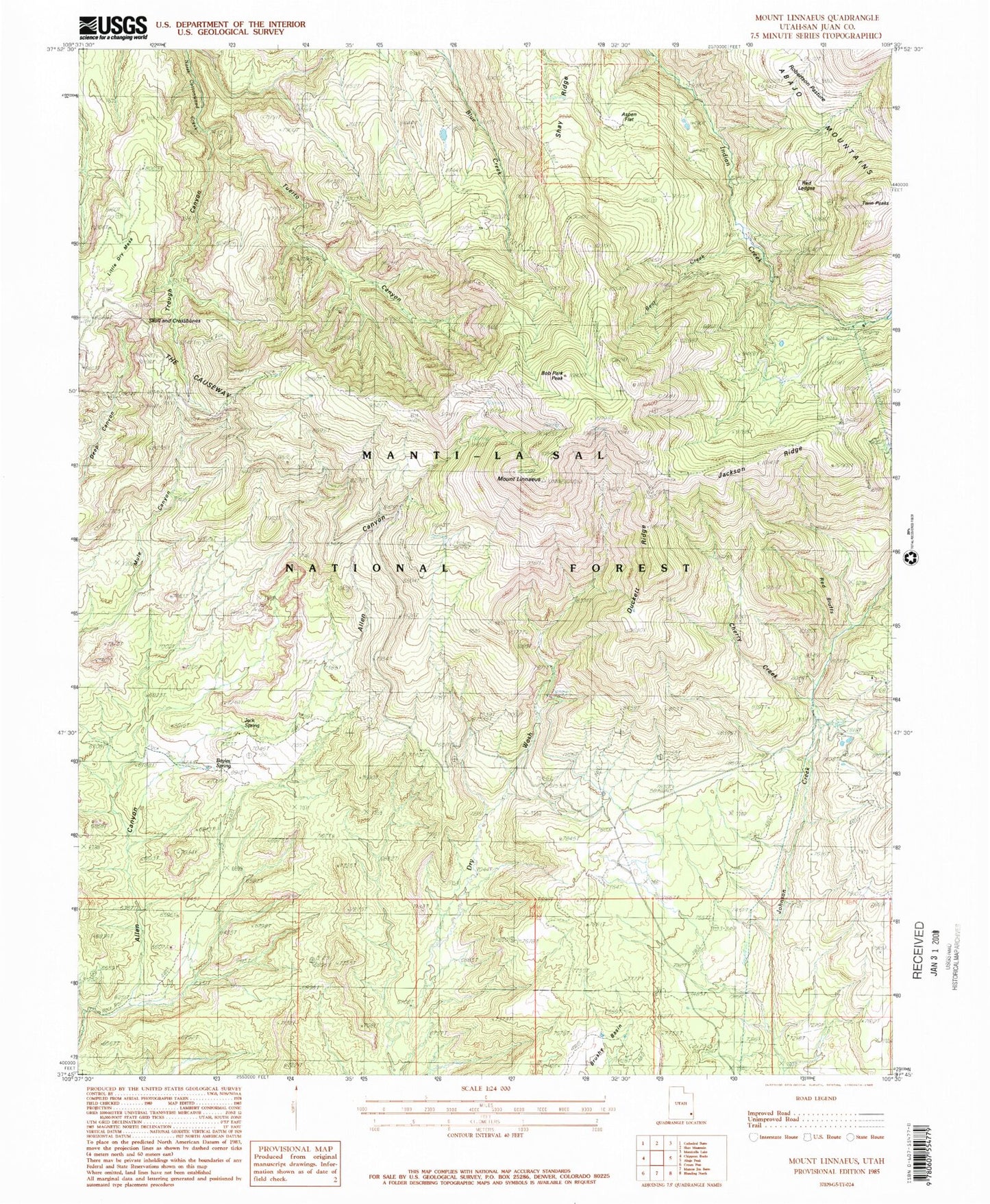
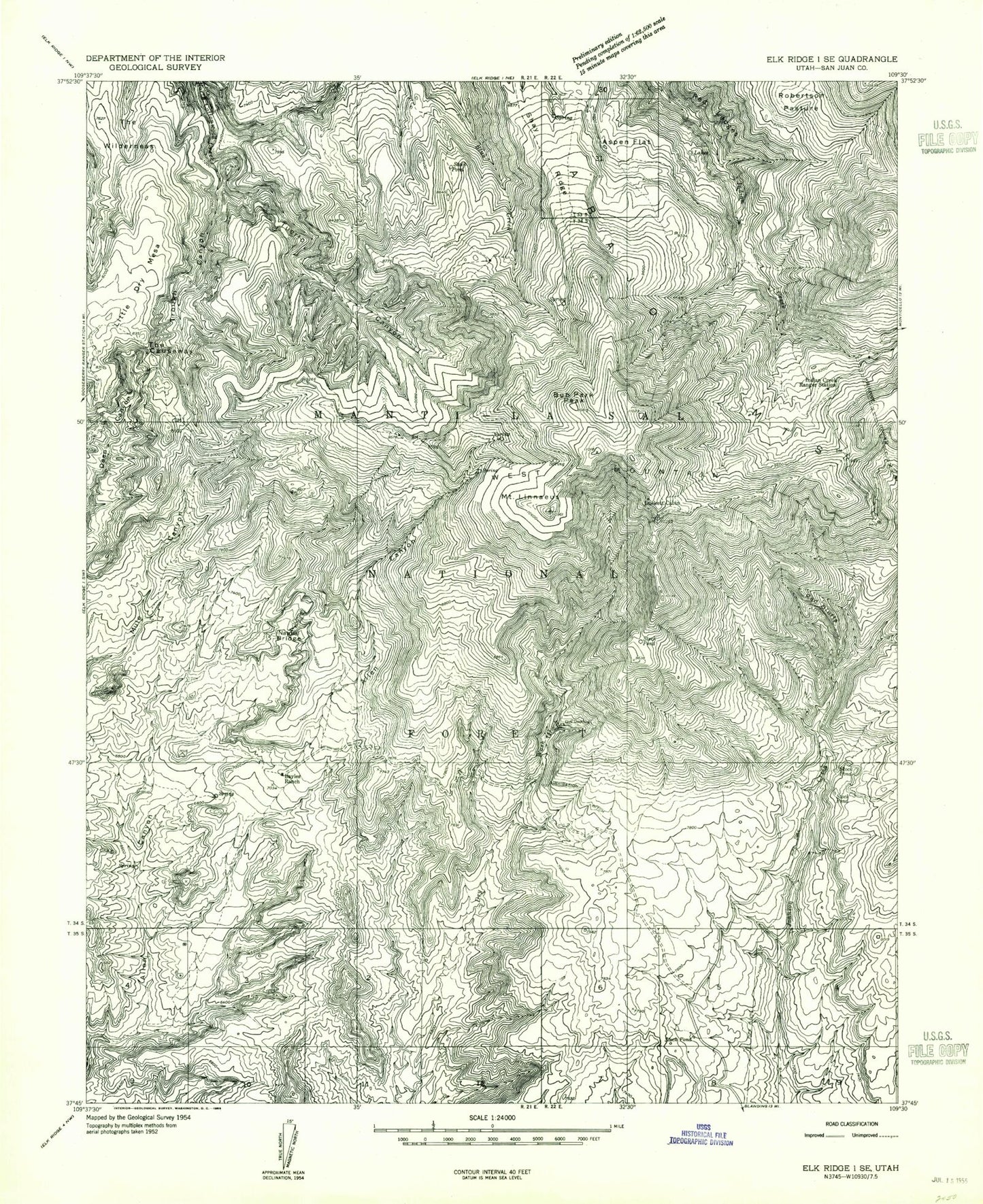
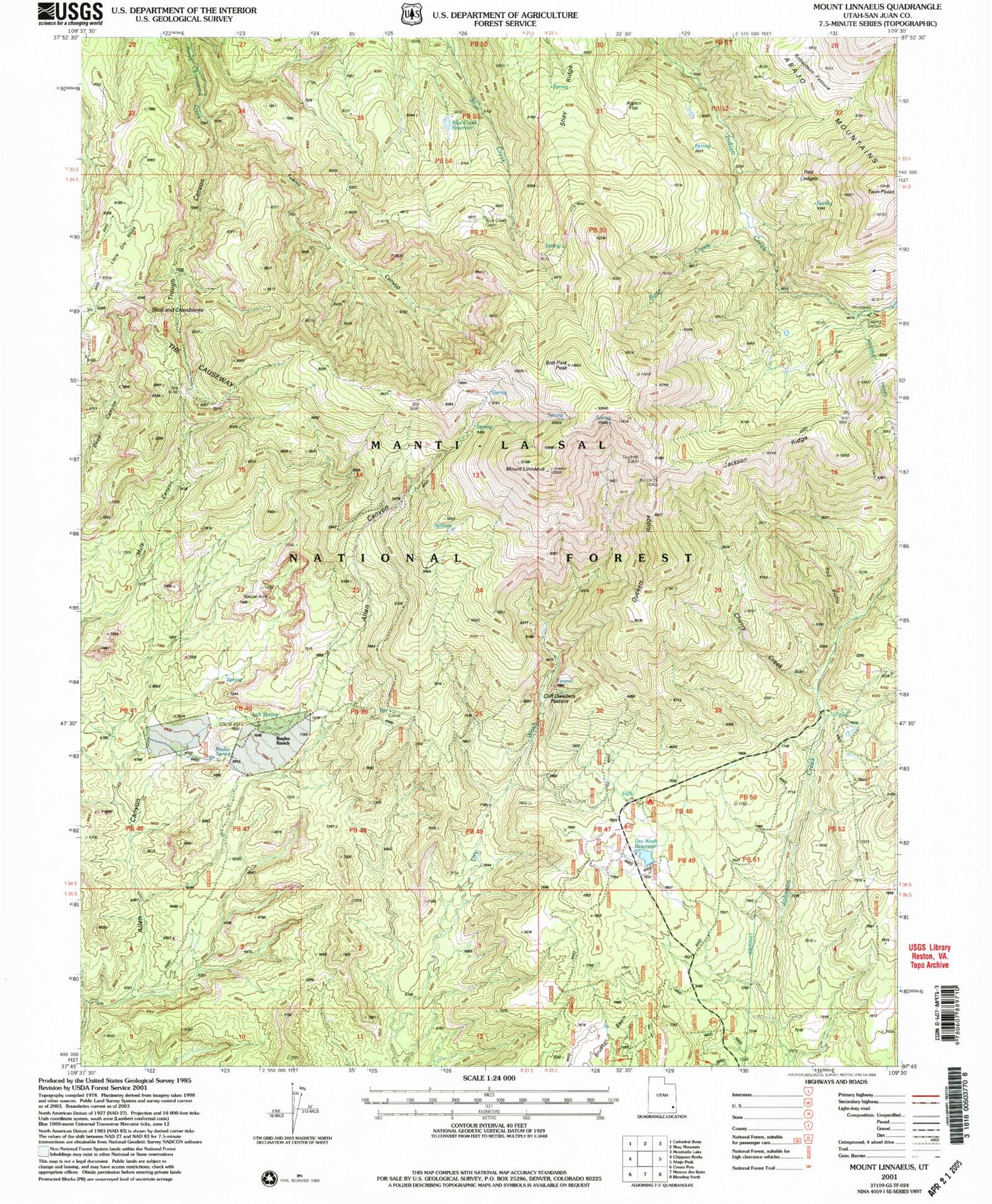
Historical USGS topographic quad map of Mount Linnaeus in the state of Utah. Typical map scale is 1:24,000, but may vary for certain years, if available. Print size: 24" x 27"
This quadrangle is in the following counties: San Juan.
The map contains contour lines, roads, rivers, towns, and lakes. Printed on high-quality waterproof paper with UV fade-resistant inks, and shipped rolled.
Contains the following named places: West Mountain, Abajo Mountains, Aspen Flat, Bayles Ranch, Bob Park Peak, Duckett Cabin, Indian Creek Ranger Station, Mount Linnaeus, Little Dry Mesa, Red Bluffs, Red Ledges, Shay Ridge, The Causeway, Trough Canyon, Tuerto Canyon, Dry Wash Number Two Reservoir, Dry Wash Number Two Dam, Bayles Spring, Blue Creek Reservoir, Cliff Dwellers Pasture, Dry Wash Reservoir, Bear Creek, Bayles Cabin, Red Bluff Campground, Skull and Crossbones Point of Interest, Natural Arch Point of Interest, Blue Creek Cabin, Cherry Creek, Duckett Ridge, Jack Spring, Skull and Crossbones Summit, West Mountain, Abajo Mountains, Aspen Flat, Bayles Ranch, Bob Park Peak, Duckett Cabin, Indian Creek Ranger Station, Mount Linnaeus, Little Dry Mesa, Red Bluffs, Red Ledges, Shay Ridge, The Causeway, Trough Canyon, Tuerto Canyon, Dry Wash Number Two Reservoir, Dry Wash Number Two Dam, Bayles Spring, Blue Creek Reservoir, Cliff Dwellers Pasture, Dry Wash Reservoir, Bear Creek, Bayles Cabin, Red Bluff Campground, Skull and Crossbones Point of Interest, Natural Arch Point of Interest, Blue Creek Cabin, Cherry Creek, Duckett Ridge, Jack Spring, Skull and Crossbones Summit