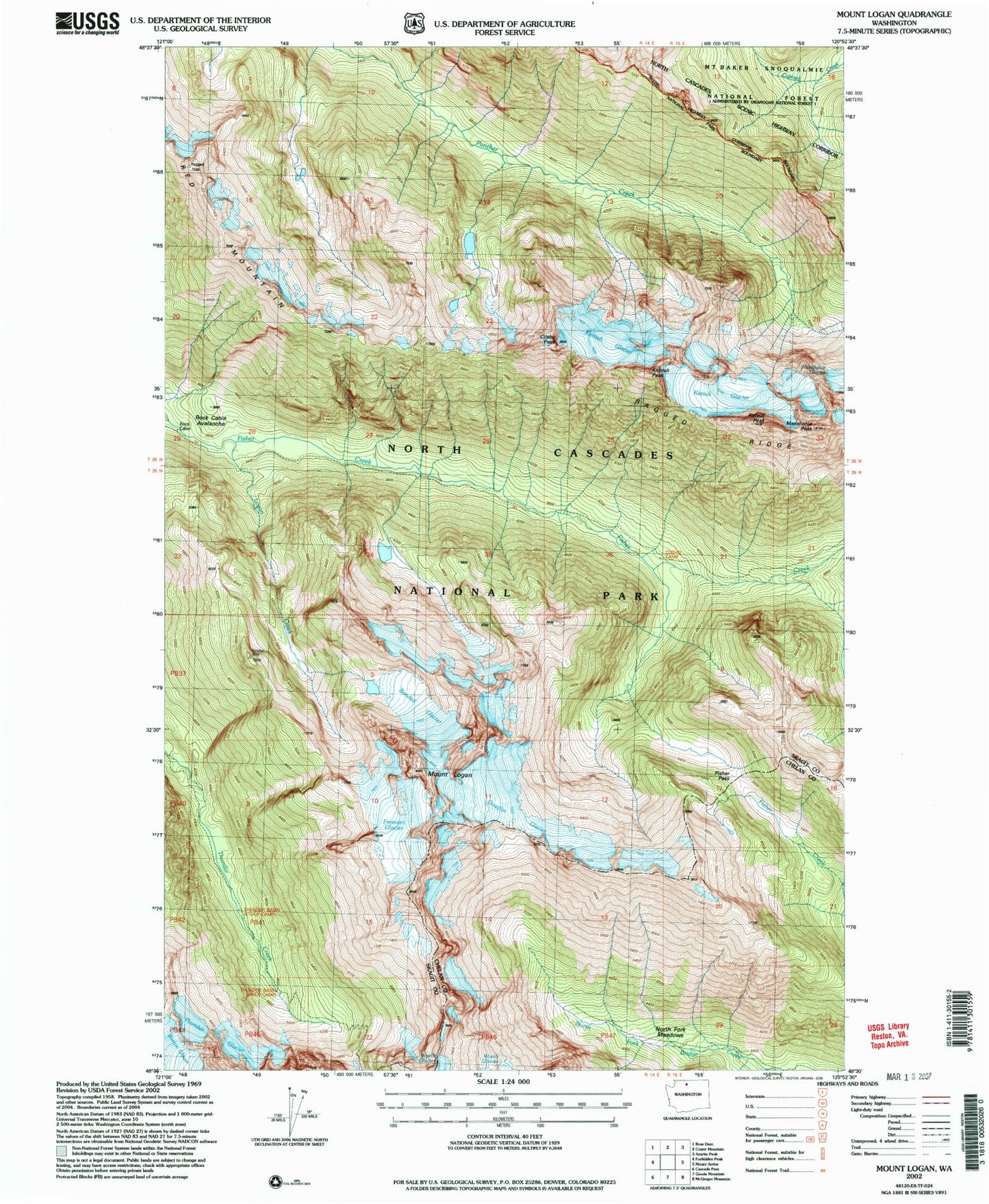
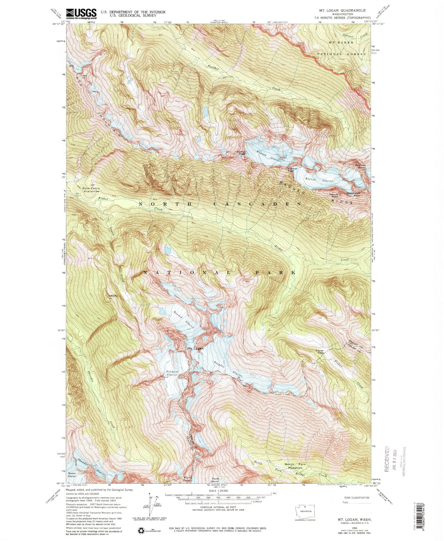
MyTopo
Classic USGS Mount Logan Washington 7.5'x7.5' Topo Map
Regular price
$16.95
Regular price
Sale price
$16.95
Unit price
per
Couldn't load pickup availability
Historical USGS topographic quad map of Mount Logan in the state of Washington. Typical map scale is 1:24,000, but may vary for certain years, if available. Print size: 24" x 27"
This quadrangle is in the following counties: Chelan, Skagit.
The map contains contour lines, roads, rivers, towns, and lakes. Printed on high-quality waterproof paper with UV fade-resistant inks, and shipped rolled.
Contains the following named places: Banded Glacier, Cosho Peak, Douglas Glacier, Fisher Pass, Fremont Glacier, Katsuk Glacier, Katsuk Peak, Kimtah Glacier, Kimtah Peak, Logan Creek, Mount Logan, Mesahchie Peak, Ragged Ridge, Red Mountain, Rock Cabin, Rock Cabin Avalanche, Thunder Glacier