MyTopo
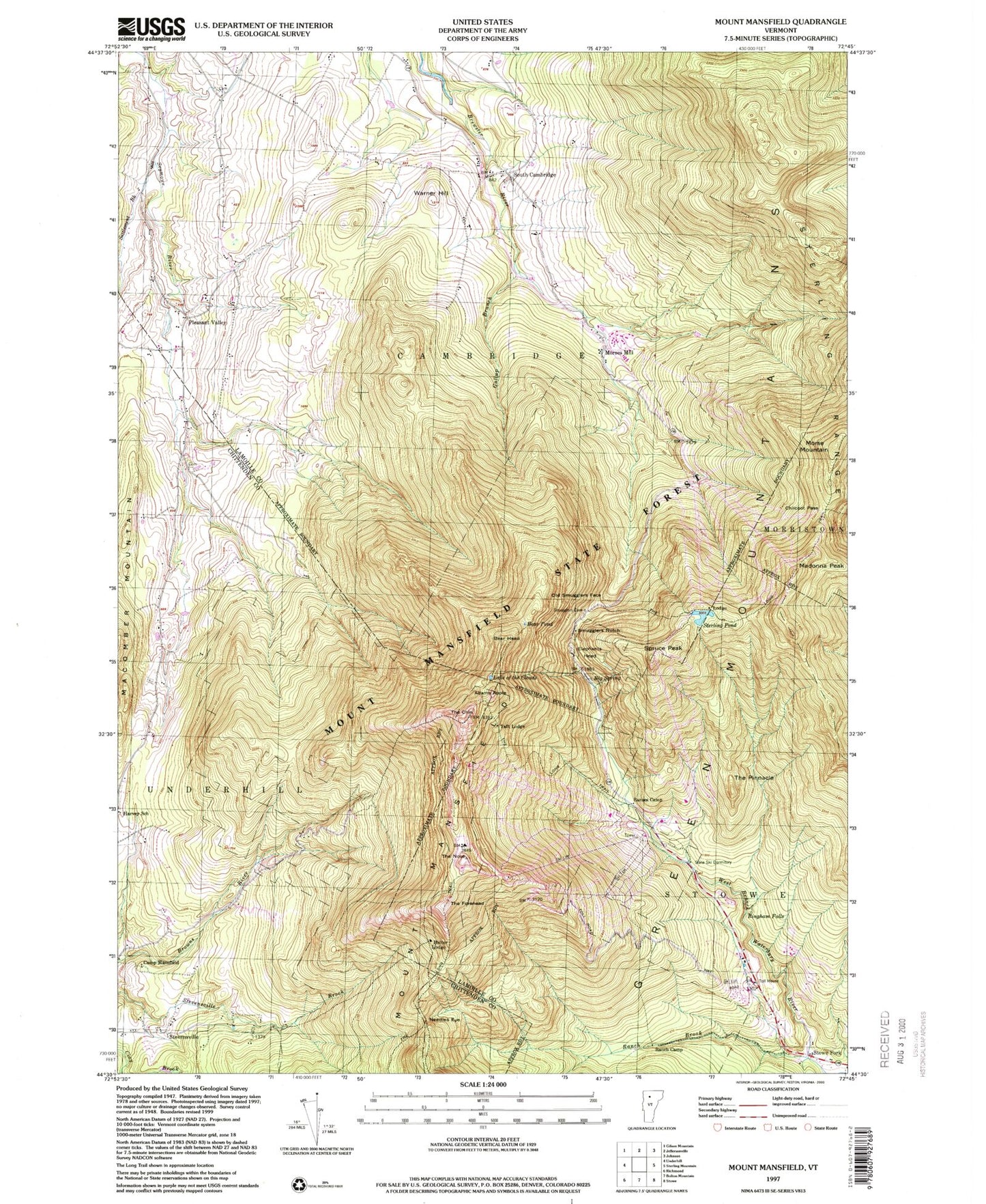
USGS Classic Mount Mansfield Vermont 7.5'x7.5' Topo Map
Couldn't load pickup availability
Historical USGS topographic quad map of Mount Mansfield in the state of Vermont. Scale: 1:24000. Print size: 24" x 27"
This quadrangle is in the following counties: Chittenden, Lamoille.
The map contains contour lines, roads, rivers, towns, lakes, and grids including latitude / longitude and UTM / MGRS. Printed on high-quality waterproof paper with UV fade-resistant inks.
Contains the following named places: Adams Apple, Barnes Camp, Bear Head, Bear Pond, Big Spring, Bingham Falls, Bulter Lodge, Camp Mansfield, Chilcoot Pass, Lake of the Clouds, Elephants Head, Gallup Branch, Halfway House, Harvey School, Macomber Mountain, Madonna Peak, Morse Mountain, Morses Mill, Mount Mansfield Hotel, Mount Mansfield State Forest, Needles Eye, Old Smugglers Face, Pleasant Valley, Ranch Brook, Ranch Camp, Settlement Brook, Smugglers Notch, South Cambridge, Spruce Peak, Sterling Pond, Stevensville, Stowe Fork, Taft Lodge, The Chin, The Forehead, The Long Trail, The Nose, The Pinnacle, Warner Hill, Mount Mansfield, WVPS-FM (Burlington), WEZF-FM (Burlington), WVMX-FM (Stowe), WCAX-TV (Burlington), WETK-TV (Burlington), WVNY-TV (Burlington), Bingham Falls, Haselton Trail, Hopkins Cemetery, Morristown Municipal Forest, Mount Mansfield Ski Area, Mount Mansfield Ski Touring Center, Smugglers Notch Natural Area, South Cambridge Cemetery, Spruce Peak Ski Area, Sugar House Nordic Center, Halfway House, Nose Dive Trail, Pleasant Valley Cemetery, Valley Cemetery, Mount Mansfield Winter Academy, North American Hockey Academy