MyTopo
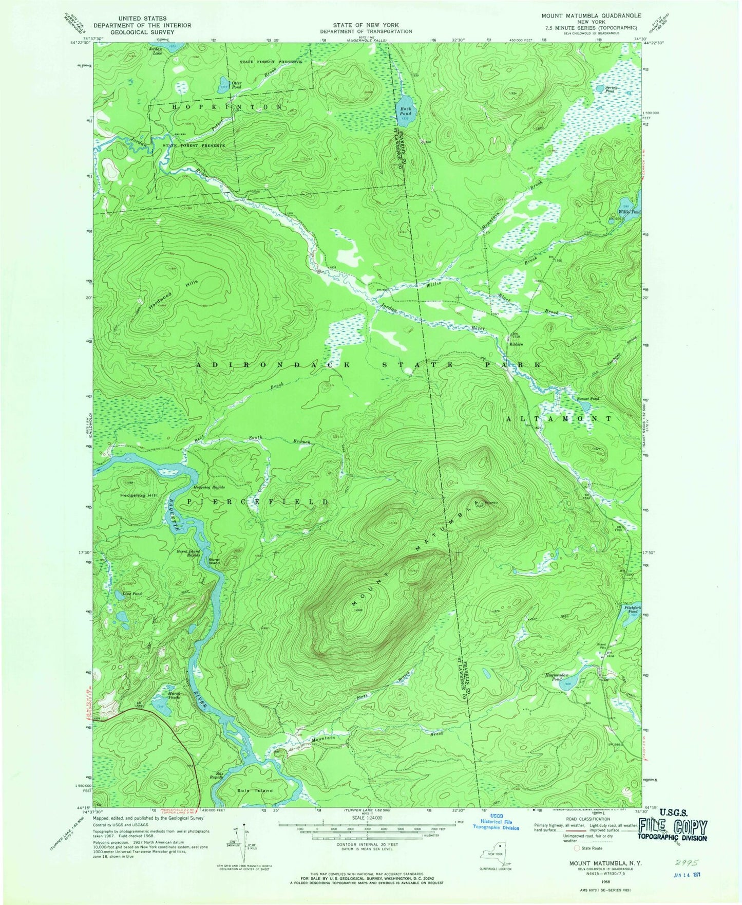
Classic USGS Mount Matumbla New York 7.5'x7.5' Topo Map
Couldn't load pickup availability
Historical USGS topographic quad map of Mount Matumbla in the state of New York. Map scale may vary for some years, but is generally around 1:24,000. Print size is approximately 24" x 27"
This quadrangle is in the following counties: Franklin, St. Lawrence.
The map contains contour lines, roads, rivers, towns, and lakes. Printed on high-quality waterproof paper with UV fade-resistant inks, and shipped rolled.
Contains the following named places: Bear Brook, Black Brook, Burnt Island, Burnt Island Rapids, Hardwood Hills, Haymeadow Pond, Hedgehog Hill, Hedgehog Rapids, Kildare, Line Pond, Marsh Ponds, Mount Matumbla, Mountain Brook, North Branch Mountain Brook, Otter Pond, Pitchfork Pond, Potter Brook, Rock Pond, Sols Island, Sols Rapids, South Branch Bear Brook, Spring Pond, Sunset Pond, Willis Brook, ZIP Code: 12973