MyTopo
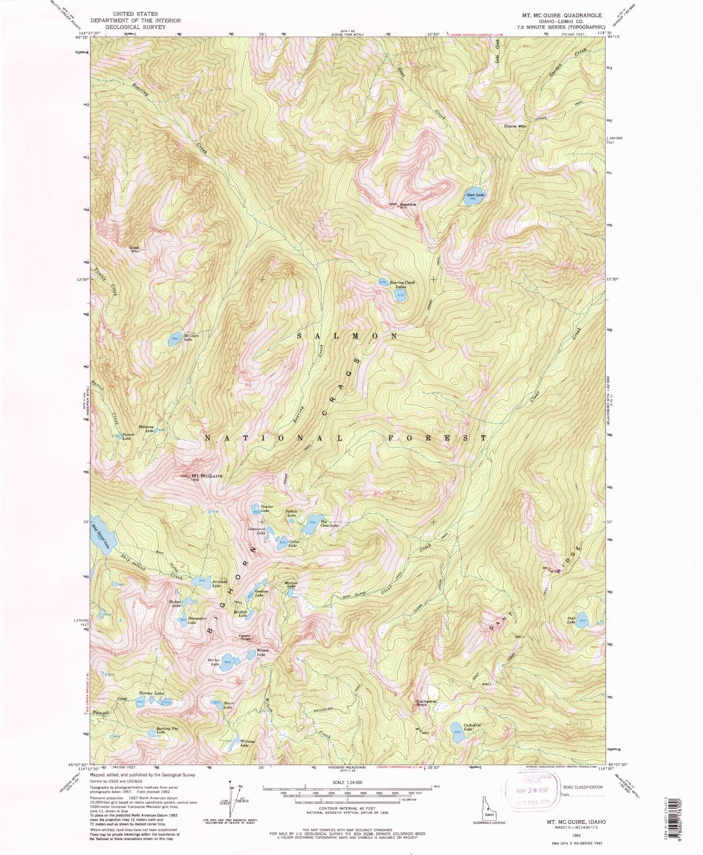
USGS Classic Mount McGuire Idaho 7.5'x7.5' Topo Map
Couldn't load pickup availability
Historical USGS topographic quad map of Mount McGuire in the state of Idaho. Scale: 1:24000. Print size: 24" x 27"
This quadrangle is in the following counties: Lemhi.
The map contains contour lines, roads, rivers, towns, lakes, and grids including latitude / longitude and UTM / MGRS. Printed on high-quality waterproof paper with UV fade-resistant inks.
Contains the following named places: Airplane Lake, Barking Fox Lake, Big Clear Lake, Bighorn Crags, Birdbill Lake, Cathedral Lake, Clear Creek Trail, Crags Trail, Crater Lake, Deer Lake, Dome Mountain, Fishfin Ridge, Gant Ridge Trail, Gentian Lake, Glacier Lake, Goat Lake, Goat Mountain, Gooseneck Lake, Harbor Lake, Heart Lake, Parrott Lake, Pollywog Lake, Pothole Lake, Roaring Creek Lakes, Sheepeater Lake, Ship Island Trail, Shoban Lake, Terrace Lakes, Waterfall Trail, Welcome Lake, Wilson Lake, Yellowjacket Mountains, Cathedral Rock, Gant Ridge, Mount McGuire, Beehive, Fishing Ridge, Mirrow Lake, McGuire Lake