MyTopo
Classic USGS Mount McLoughlin Oregon 7.5'x7.5' Topo Map
Couldn't load pickup availability
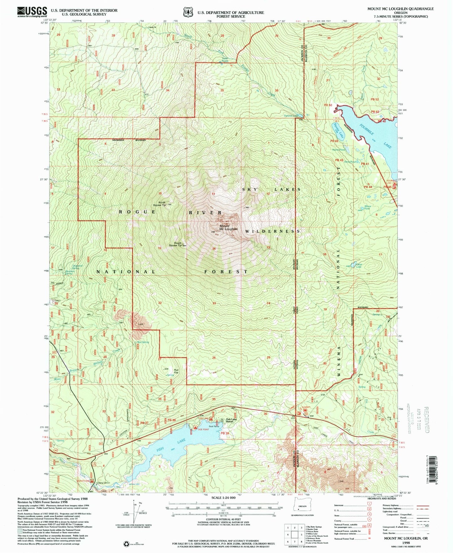
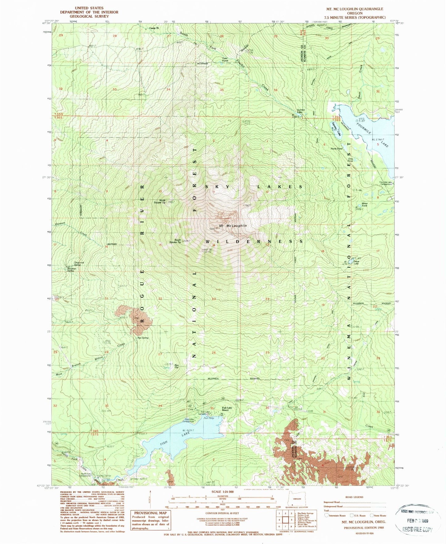
Historical USGS topographic quad map of Mount McLoughlin in the state of Oregon. Typical map scale is 1:24,000, but may vary for certain years, if available. Print size: 24" x 27"
This quadrangle is in the following counties: Jackson, Klamath.
The map contains contour lines, roads, rivers, towns, and lakes. Printed on high-quality waterproof paper with UV fade-resistant inks, and shipped rolled.
Contains the following named places: Blue Rock Trail, Bourbon Spring, Calamity Forest Camp (historical), Camp Seventy-six, Crater Trail, Dogwood Spring, Dry Creek Camp, Fish Lake, Fish Lake Recreation Site, Fish Lake Resort, Freye Lake, Mount McLoughlin, Mirror Pond, Mount McLoughlin Trail, Norris Pond, North Squaw Tip, Orris Pond, Rye Flat, Rye Spring, South Squaw Tip, Squaw Lake, Squaw Tip Trail (historical), Summit Lake, Twin Ponds Camp, Twin Ponds Trail, Fish Lake Dam, Cold Springs, Doe Point, Twin Ponds, North Fork Recreation Site, Fourmile Lake, Swan Creek, Medford Watershed, Doe Point Recreation Site, Summit Sno-Park, Valley of the Rogue Dairy, Fish Lake Resort Marina, High Lakes Pass