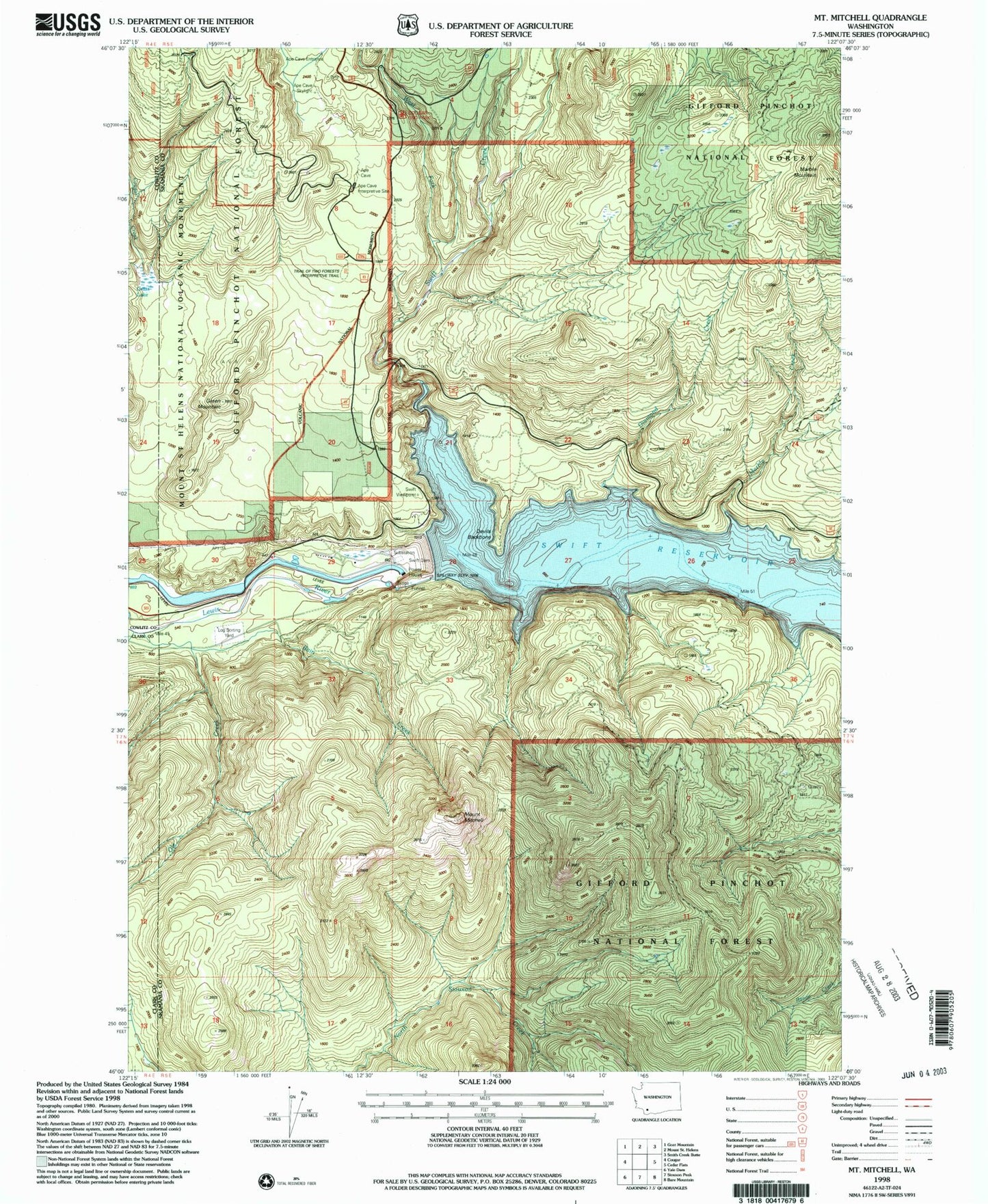
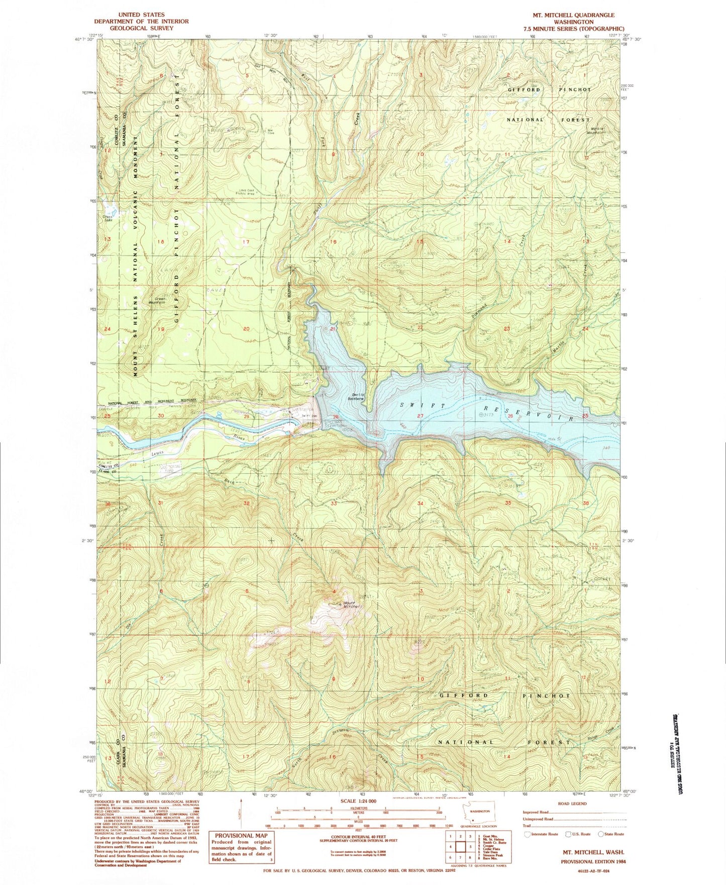
MyTopo
Classic USGS Mount Mitchell Washington 7.5'x7.5' Topo Map
Couldn't load pickup availability
Historical USGS topographic quad map of Mount Mitchell in the state of Washington. Typical map scale is 1:24,000, but may vary for certain years, if available. Print size: 24" x 27"
This quadrangle is in the following counties: Clark, Cowlitz, Skamania.
The map contains contour lines, roads, rivers, towns, and lakes. Printed on high-quality waterproof paper with UV fade-resistant inks, and shipped rolled.
Contains the following named places: Devils Backbone, Diamond Creek, Grass Lake, Marble Creek, Marble Mountain, Mount Mitchell, Ole Creek, Rain Creek, Swift Creek, West Fork Swift Creek, Lava Cast Picnic Area, Green Mountain, Swift Dam Overlook, Swift Viewpoint, Ape Cave Entrance, Ape Cave Skylight, Mount Mitchell Lookout, Cougar Creek, Swift Dam, Swift Number Two Forebay