MyTopo
USGS Classic Mount Moran Wyoming 7.5'x7.5' Topo Map
Couldn't load pickup availability
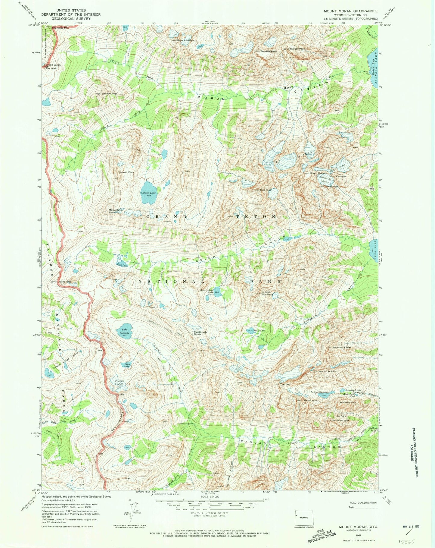
Historical USGS topographic quad map of Mount Moran in the state of Wyoming. Scale: 1:24000. Print size: 24" x 27"
This quadrangle is in the following counties: Teton.
The map contains contour lines, roads, rivers, towns, lakes, and grids including latitude / longitude and UTM / MGRS. Printed on high-quality waterproof paper with UV fade-resistant inks.
Contains the following named places: Hidden Falls, Ramshead Lake, Arrowhead Pool, Bivouac Peak, Cascade Canyon, Cascade Canyon Trail, Cascade Ranger Station, Cirque Lake, Cleaver Peak, Dry Ridge Mountain, East Horn, Falling Ice Glacier, Grizzly Bear Lake, Holly Lake, Ice Point, Lake of the Crags, Lake Solitude Trail, Leigh Canyon, Littles Peak, Maidenform Peak, Mica Lake, Mink Lake, Moran Canyon, Moran Creek, Mount Moran, North Fork Moran Creek, Paintbrush Canyon, Paintbrush Divide, Paintbrush Divide Trail, Petersen Glacier, Ramshield Lake, Raynolds Peak, Rock of Ages, Rockchuck Peak, Mount Saint John, Skillet Glacier, Lake Solitude, South Fork Cascade Canyon, South Fork Moran Creek, Storm Point, Symmetry Spire, The Jaw, The Wigwams, Thor Peak, Traverse Peak, Triple Glaciers, Valhalla Canyon, West Horn, Window Peak, Moran Lake, Mount Woodring, Leigh Creek, Ortenburger Lake (not official)