MyTopo
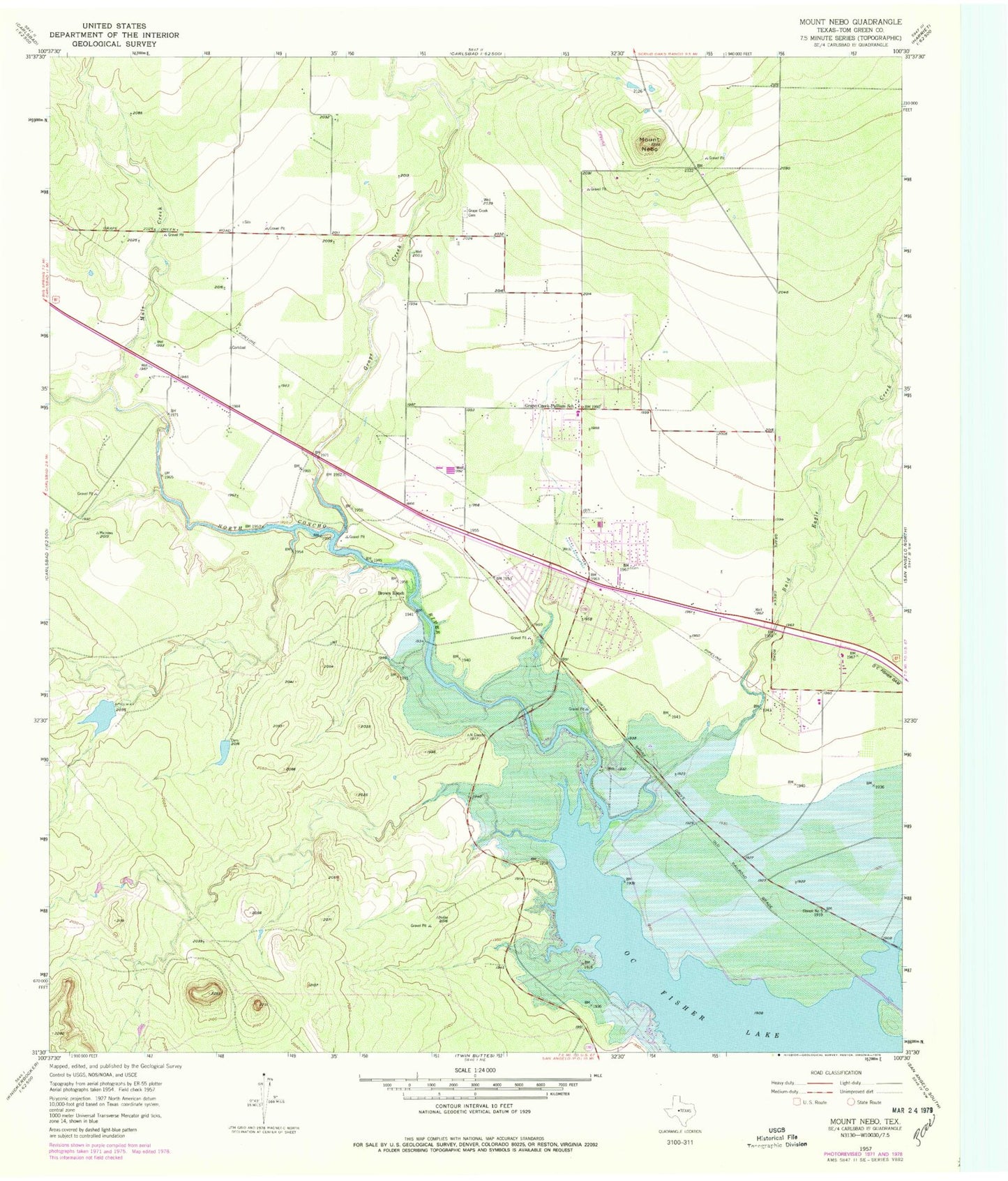
Classic USGS Mount Nebo Texas 7.5'x7.5' Topo Map
Couldn't load pickup availability
Historical USGS topographic quad map of Mount Nebo in the state of Texas. Map scale may vary for some years, but is generally around 1:24,000. Print size is approximately 24" x 27"
This quadrangle is in the following counties: Tom Green.
The map contains contour lines, roads, rivers, towns, and lakes. Printed on high-quality waterproof paper with UV fade-resistant inks, and shipped rolled.
Contains the following named places: Bald Eagle Creek, Brown Ranch, Fairview Accelerated School - Grape Creek, Grape Creek, Grape Creek Cemetery, Grape Creek Census Designated Place, Grape Creek Elementary School, Grape Creek High School, Grape Creek Middle School, Grape Creek Volunteer Fire Department, Grape Creek-Pulliam School, Kenneth Brown Reservoir, Kenneth Brown Reservoir Dam, KIDY-TV (San Angelo), KKLK-FM (San Angelo), Mount Nebo, Mule Creek, San Angelo State Park - North Shore, Trinity Early Childhood - Grape Creek, ZIP Code: 76901