MyTopo
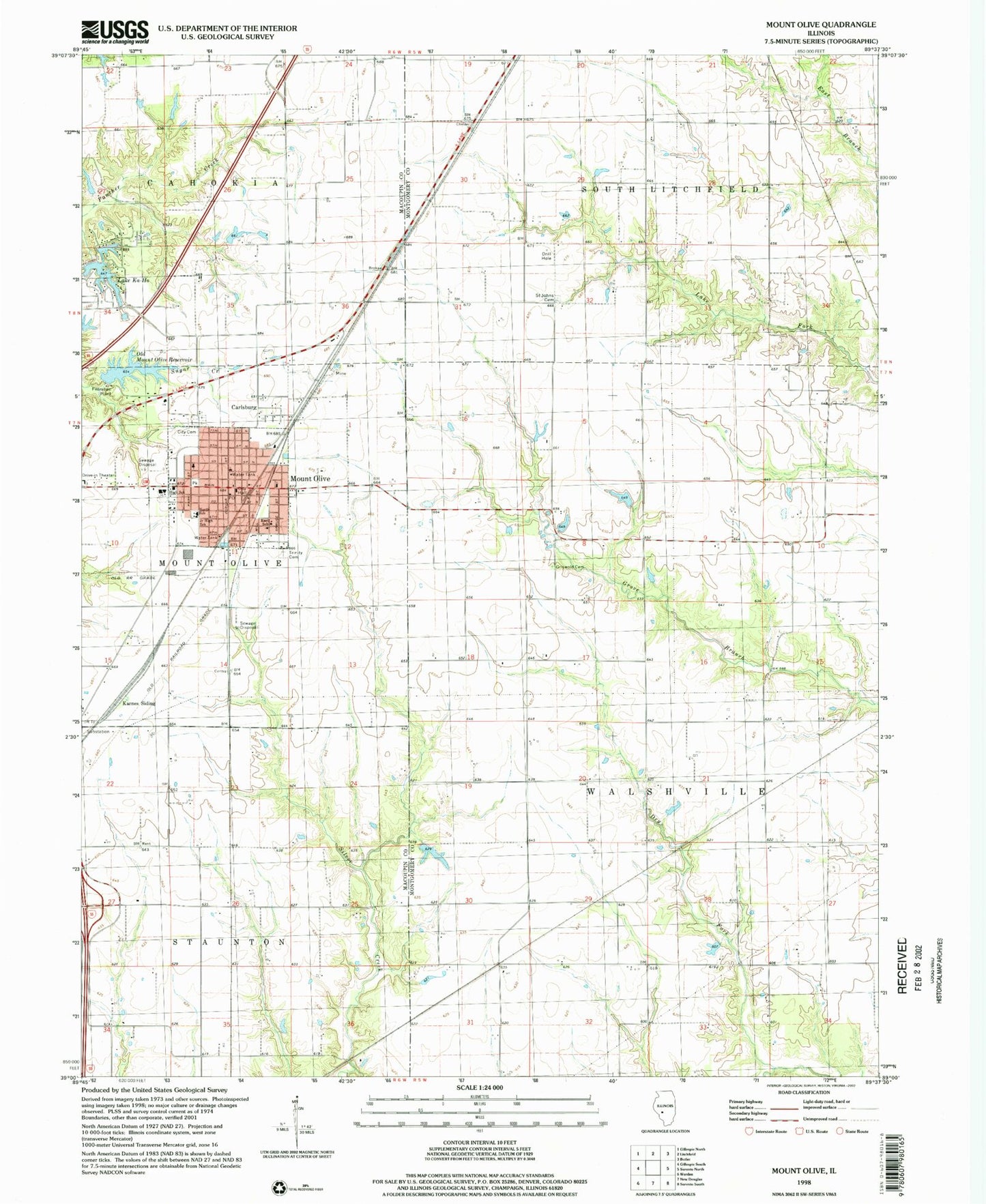
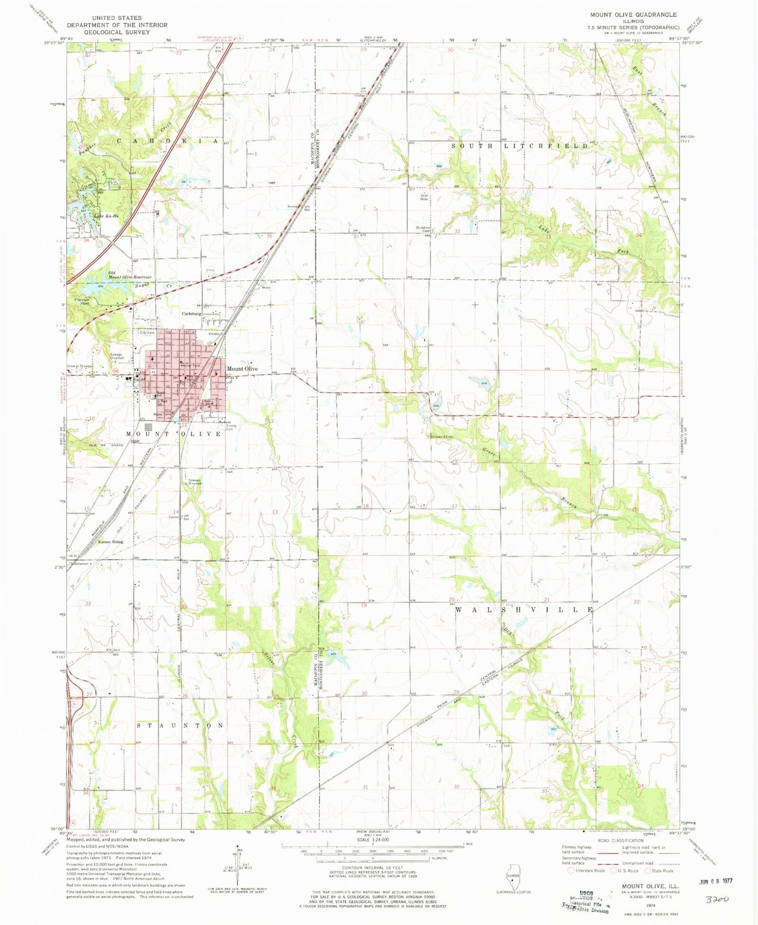
Classic USGS Mount Olive Illinois 7.5'x7.5' Topo Map
Couldn't load pickup availability
Historical USGS topographic quad map of Mount Olive in the state of Illinois. Map scale may vary for some years, but is generally around 1:24,000. Print size is approximately 24" x 27"
This quadrangle is in the following counties: Macoupin, Montgomery.
The map contains contour lines, roads, rivers, towns, and lakes. Printed on high-quality waterproof paper with UV fade-resistant inks, and shipped rolled.
Contains the following named places: Brokaw School, Carlsburg, City of Mount Olive, Davis School, East School, Eichmeyer School, Griswold Cemetery, Heeren Pond, Heeren Pond Dam, Hill School, Holy Trinity Cemetery, Immanuel Lutheran Cemetery, Karnes Siding, Lake Ka-Ho, Lake Ka-Ho Dam Number 1, Lake Ka-Ho Dam Number 2, Mount Olive, Mount Olive Area Ambulance Service, Mount Olive Cemetery, Mount Olive City Hall, Mount Olive Fire Protection District, Mount Olive High School, Mount Olive Police Department, Mount Olive Post Office, New Cavalry Cemetery, Nieman School, North School, Old Mount Olive City Lake Dam, Old Mount Olive Reservoir, Saint Johns Lutheran Cemetery, Silver Creek School, Smith School, Township of Walshville, Union Miners Cemetery, Village of Lake Ka-Ho, ZIP Code: 62069