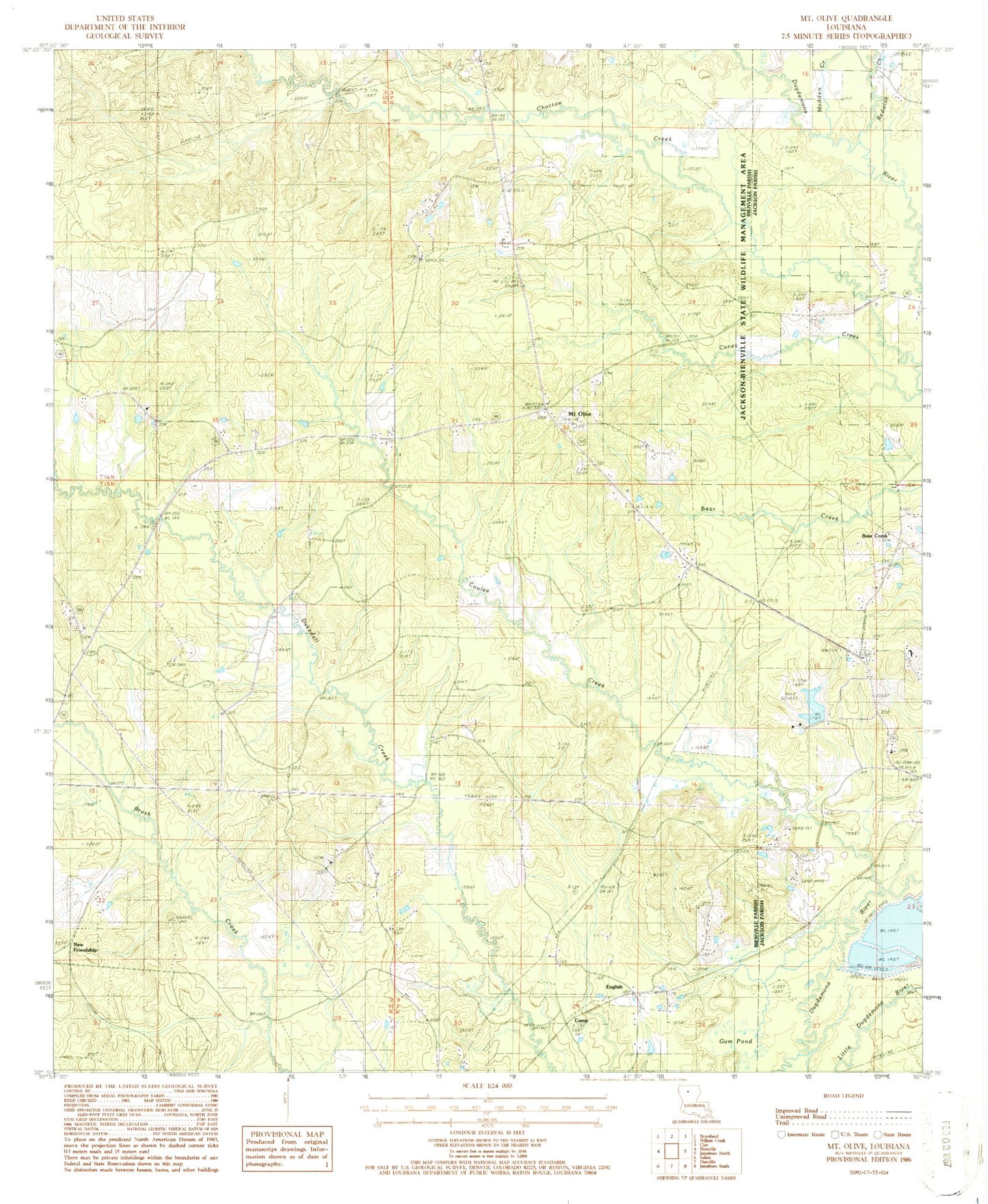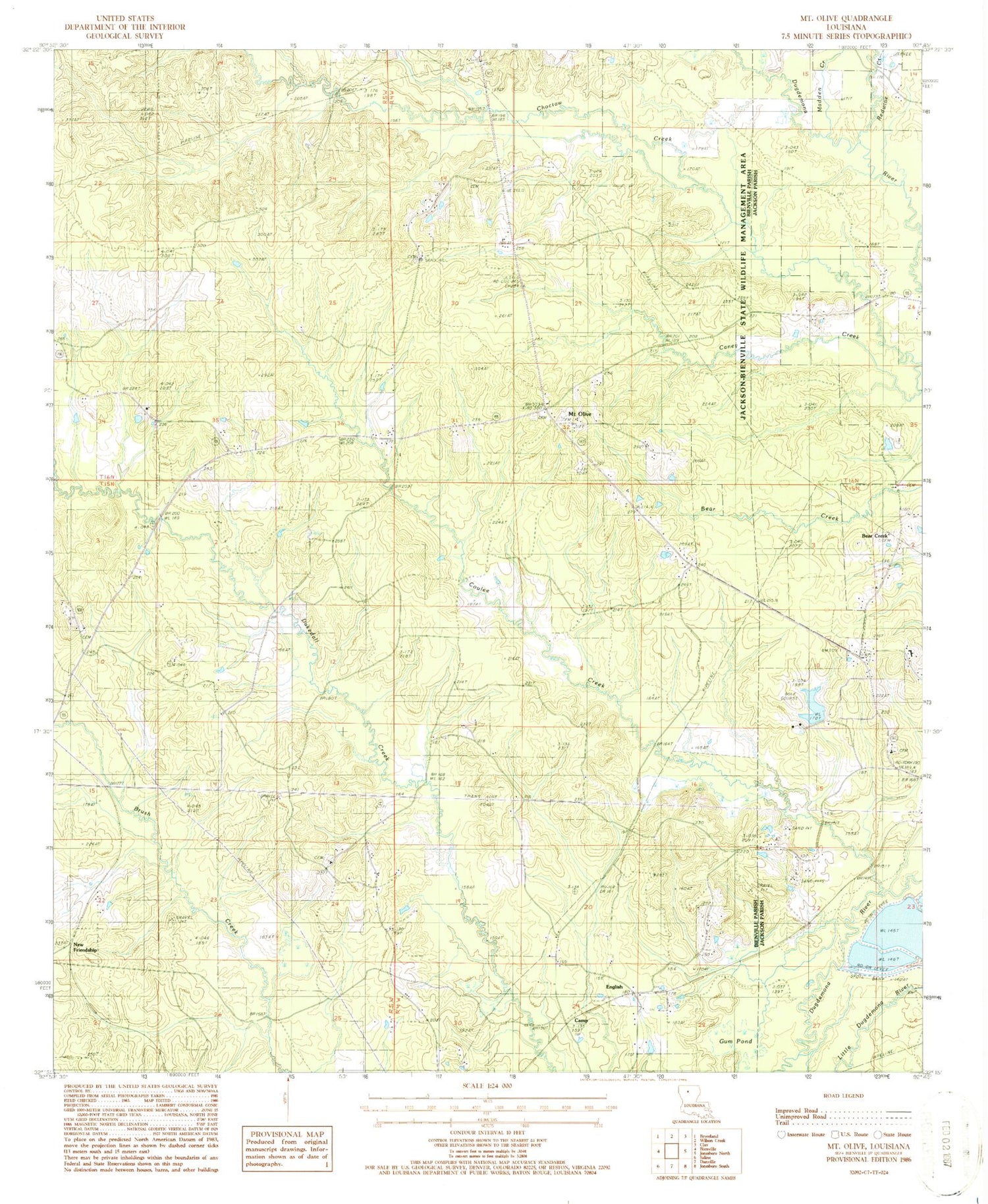
MyTopo
Classic USGS Mount Olive Louisiana 7.5'x7.5' Topo Map
Couldn't load pickup availability
Historical USGS topographic quad map of Mount Olive in the state of Louisiana. Map scale may vary for some years, but is generally around 1:24,000. Print size is approximately 24" x 27"
This quadrangle is in the following counties: Bienville, Jackson.
The map contains contour lines, roads, rivers, towns, and lakes. Printed on high-quality waterproof paper with UV fade-resistant inks, and shipped rolled.
Contains the following named places: Bear Creek, Bienville Parish Fire Protection Ward 7 Station 6 Eastside, Bienville Parish Fire Protection Ward 7 Station 7 Mount Olive, Camp, Caney Creek, Coulee Creek, East Mount Olive Cemetery, English, Gum Pond, Hunt, Lakefield, Madden Creek, Mount Olive, Mount Olive Baptist Church, New Friendship, Pleasant Hill School, Saint Paul School, Sand Hill School, Sweet Home Church, Walnut Ridge Baptist Church, Walnut Ridge Cemetery, West Mount Olive Cemetery