MyTopo
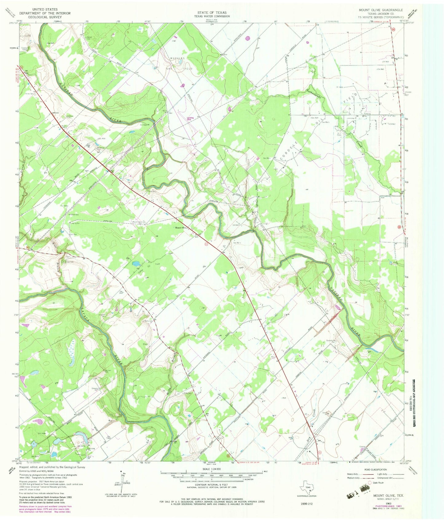
Classic USGS Mount Olive Texas 7.5'x7.5' Topo Map
Couldn't load pickup availability
Historical USGS topographic quad map of Mount Olive in the state of Texas. Map scale may vary for some years, but is generally around 1:24,000. Print size is approximately 24" x 27"
This quadrangle is in the following counties: Jackson.
The map contains contour lines, roads, rivers, towns, and lakes. Printed on high-quality waterproof paper with UV fade-resistant inks, and shipped rolled.
Contains the following named places: Andrews Cemetery, Burnettville Cemetery, Chase Cemetery, Collier Oil Field, Cordele Oil Field, Edna-Cordele Division, Edwards Cemetery, Enon Cemetery, Harrison Cemetery, Hines Cemetery, Kerr Cemetery, KTMR-AM (Edna), Laughter Cemetery, Manly Cemetery, Milby Branch, Milby Cemetery, Mount Olive, Mount Olive Cemetery, Strane Cemetery, Wilkerson Cemetery, ZIP Code: 77957