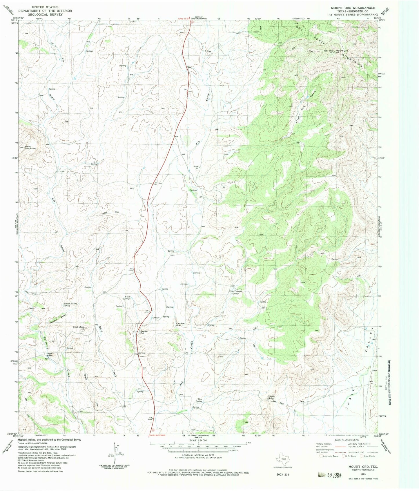
MyTopo
Classic USGS Mount Ord Texas 7.5'x7.5' Topo Map
Regular price
$16.95
Regular price
Sale price
$16.95
Unit price
per
Couldn't load pickup availability
Historical USGS topographic quad map of Mount Ord in the state of Texas. Map scale may vary for some years, but is generally around 1:24,000. Print size is approximately 24" x 27"
This quadrangle is in the following counties: Brewster.
The map contains contour lines, roads, rivers, towns, and lakes. Printed on high-quality waterproof paper with UV fade-resistant inks, and shipped rolled.
Contains the following named places: Bird Creek, Cathedral Mountain, Clark Springs, Eagle Peak, East Spring, Fiftytwo Spring, Hidden Valley, Hidden Valley Spring, L-H Draw, L-H Spring, Mount Ord, Mount Ord Basin, Nine Troughs Spring, Open Mine Hill, Panther Hole, United States Border Patrol Checkpoint