MyTopo
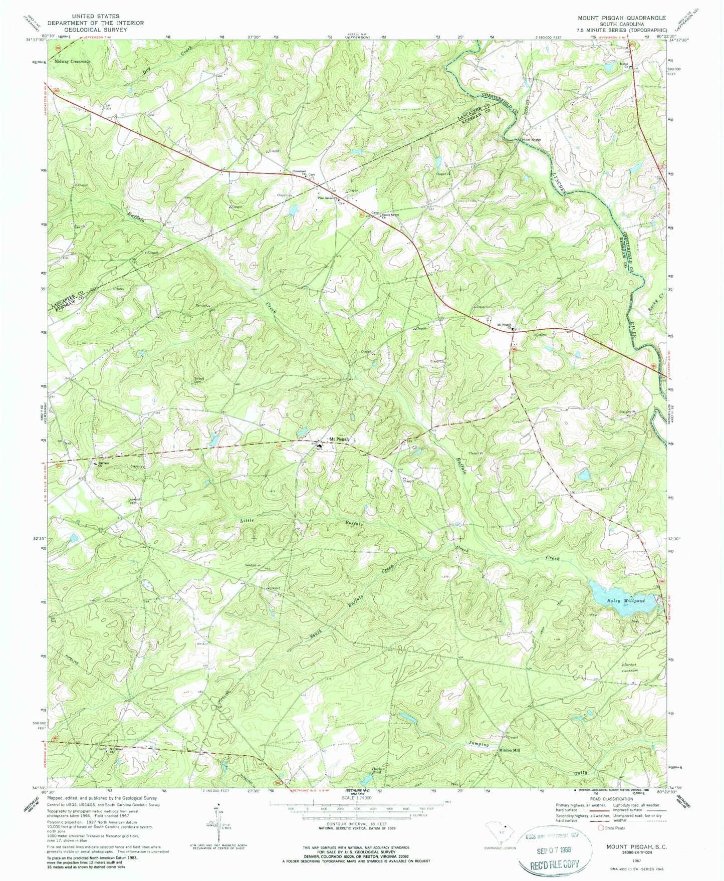
Classic USGS Mount Pisgah South Carolina 7.5'x7.5' Topo Map
Couldn't load pickup availability
Historical USGS topographic quad map of Mount Pisgah in the state of South Carolina. Map scale may vary for some years, but is generally around 1:24,000. Print size is approximately 24" x 27"
This quadrangle is in the following counties: Chesterfield, Kershaw, Lancaster.
The map contains contour lines, roads, rivers, towns, and lakes. Printed on high-quality waterproof paper with UV fade-resistant inks, and shipped rolled.
Contains the following named places: Bermuda High Gliderport, Bethel Church, Bethel Church Cemetery, Blakneys Bridge, Buffalo Church, Buffalo Lookout Tower, Buffalo School, Crossroad Church, Dew Fresh Pond Number One, Dew Fresh Pond Number One Dam D-2509, Dew Fresh Pond Number Two, Dew Fresh Pond Number Two Dam D-2511, Flat Creek School, Fork Creek, Fran Bridge, Gates Ford School, Harrisons Ford, Horton Pond, Kershaw County Fire Station Buffalo Mount Pisgah Station, Little Buffalo Creek, McLeods Mill, Miller Bridge, Minton Mill, Mount Oliver Church, Mount Pisgah, Mount Pisgah Buffalo Rescue Squad, Mount Pisgah Church, Mount Pisgah Division, Mount Pisgah Elementary School, Pine Grove Church, Pisgah School, Raley Millpond, Raleys Mill, Rocky Creek, Sandy Grove Church, Sidney Horton Pond Dam D-1074, South Buffalo Creek, South Carolina Noname 28001 D-2510 Dam, Stroud Cemetery, Ubanks Pond, Ubanks Pond Dam D-2512, William Holly Pond, William Holly Pond Dam D-1073