MyTopo
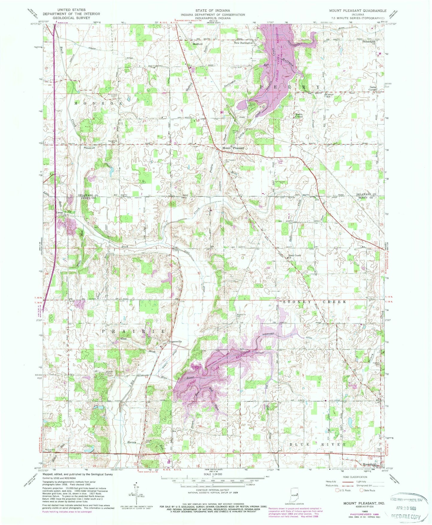
Classic USGS Mount Pleasant Indiana 7.5'x7.5' Topo Map
Couldn't load pickup availability
Historical USGS topographic quad map of Mount Pleasant in the state of Indiana. Map scale may vary for some years, but is generally around 1:24,000. Print size is approximately 24" x 27"
This quadrangle is in the following counties: Delaware, Henry.
The map contains contour lines, roads, rivers, towns, and lakes. Printed on high-quality waterproof paper with UV fade-resistant inks, and shipped rolled.
Contains the following named places: Brave Run, Brown Run, Buck Creek Church, Burlington Run, Cemetery Run, Center School, Chief Run, Clift Ditch, Cunningham Ditch, Fairview Cemetery, Felton Cemetery, Felton Creek, Gates Corner, Gibson Ditch, Harris Chapel, Harvey Cemetery, Harvey Run, Hodson Cemetery, Huffman Creek, Kirklin Farms, Lebanon Cemetery, Little Buck Creek, Luray, Luray Pit, Macedonia Cemetery, Macedonia Creek, Medford, Moon Brook, Mount Pleasant, Mount Pleasant Cemetery, Mount Summit Cemetery, New Burlington, Philadelphia Church, Prairie Creek Reservoir, Red Brook, Rogersville, Rogersville Cemetery, Sheetz Ditch, Starkey's Airport, Stone Branch, Summit Lake Reservoir, Sweringen Ditch, Township of Perry, Township of Prairie, Township of Stoney Creek, WERK-AM (Muncie), ZIP Code: 47360