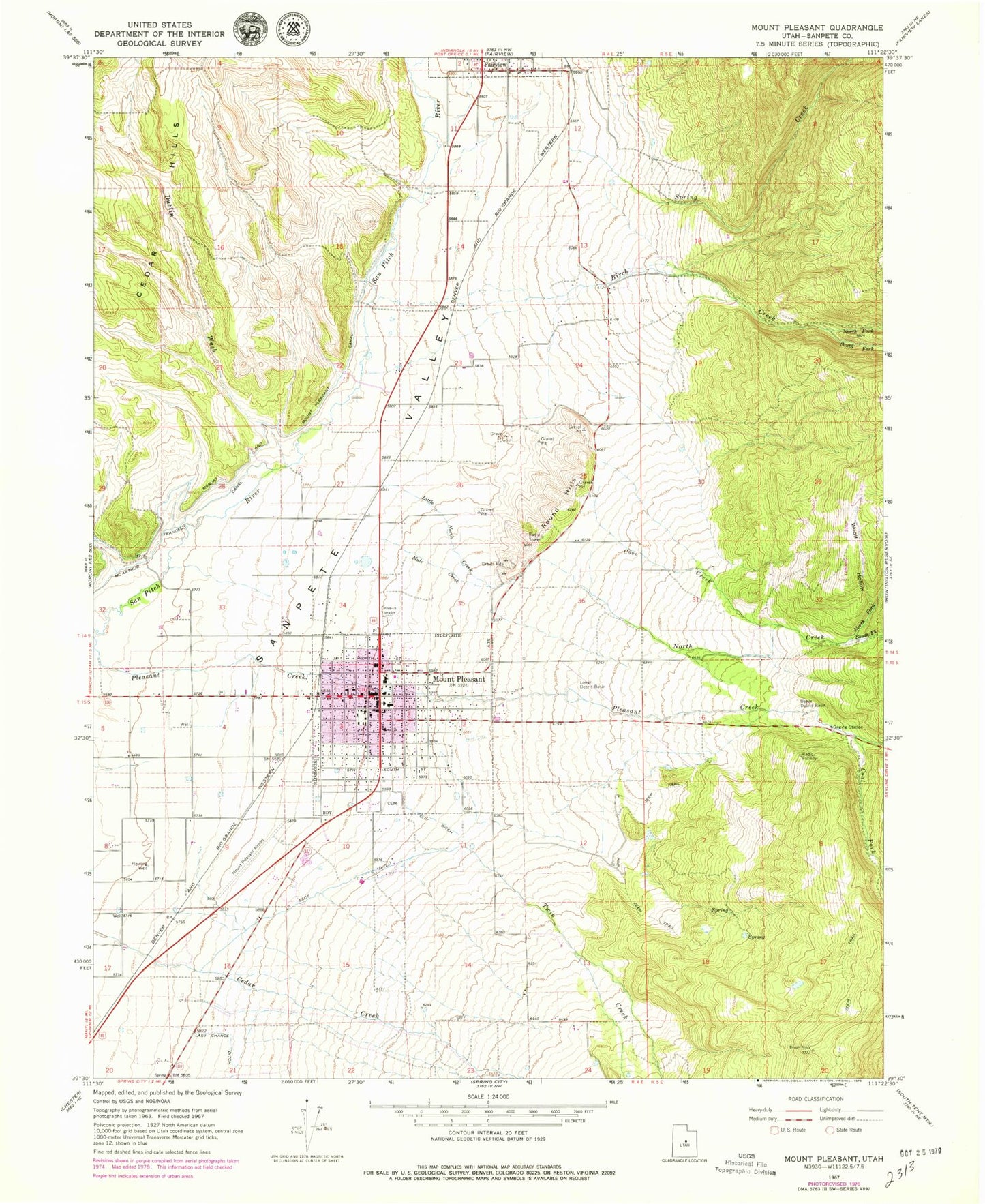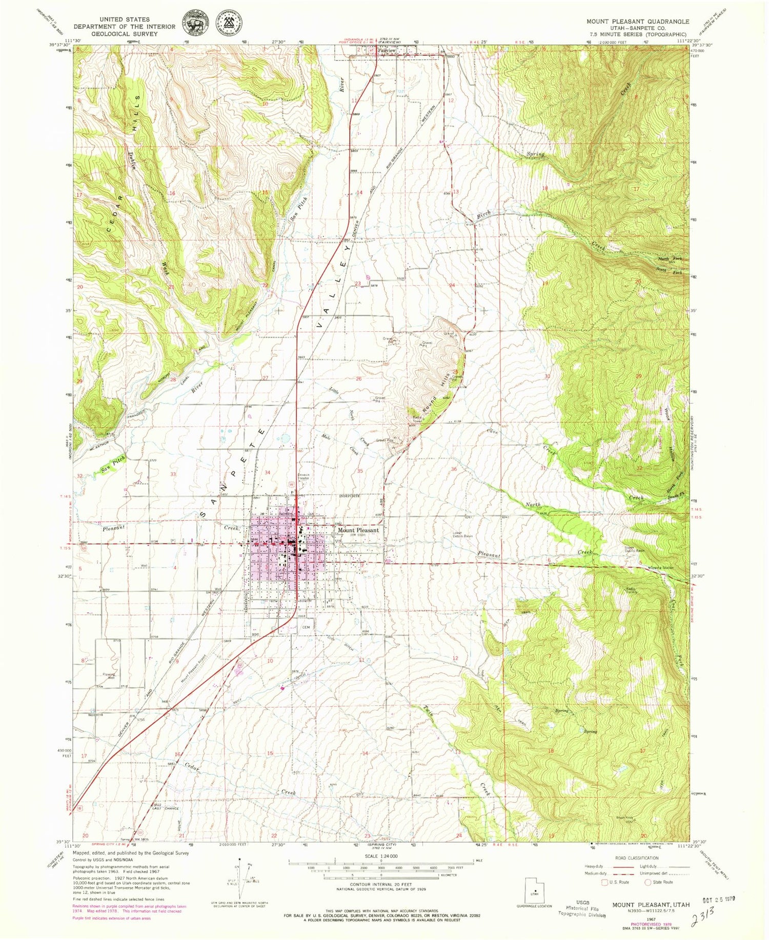
MyTopo
Classic USGS Mount Pleasant Utah 7.5'x7.5' Topo Map
Couldn't load pickup availability
Historical USGS topographic quad map of Mount Pleasant in the state of Utah. Map scale may vary for some years, but is generally around 1:24,000. Print size is approximately 24" x 27"
This quadrangle is in the following counties: Sanpete.
The map contains contour lines, roads, rivers, towns, and lakes. Printed on high-quality waterproof paper with UV fade-resistant inks, and shipped rolled.
Contains the following named places: A J Camper Park, Basin Drive-In, Birch Creek, City Ditch, City of Mount Pleasant, Coal Fork, Cottonwood Creek, Cove Creek, Dublin Wash, First Southern Baptist Church, KMTP-FM (Mt Pleasant), Little North Creek, Lower Debris Basin, Lower Mount Pleasant Powerplant, McArthur Frandsen Canal, Moroni and Mount Pleasant Canal, Mount Pleasant, Mount Pleasant Airport, Mount Pleasant Ambulance Association, Mount Pleasant City Cemetery, Mount Pleasant Elementary School, Mount Pleasant First Presbyterian Church, Mount Pleasant Police Department, Mount Pleasant Post Office, Mount Pleasant Volunteer Fire Department, Mount Pleasant-Moroni Division, Mule Creek, North Creek, North Fork Birch Creek, North Fork North Creek, North Sanpete High School, Quaking Hollow Creek, Round Hills, Sanpete Valley Hospital, Sanpete Valley Hospital Heliport, Sect Ditch, South Fork Birch Creek, South Fork North Creek, Spring Creek, The Church of Jesus Christ of Latter Day Saints, Twin Creek, Upper Debris Basin, Woolf Hollow, ZIP Code: 84647