MyTopo
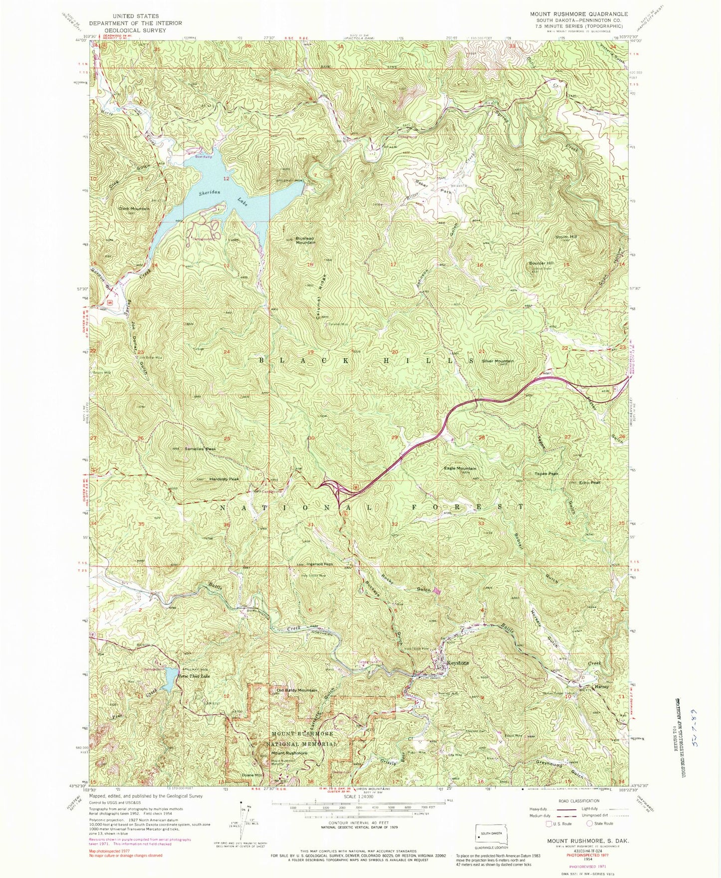
Classic USGS Mount Rushmore South Dakota 7.5'x7.5' Topo Map
Couldn't load pickup availability
Historical USGS topographic quad map of Mount Rushmore in the state of South Dakota. Typical map scale is 1:24,000, but may vary for certain years, if available. Print size: 24" x 27"
This quadrangle is in the following counties: Pennington.
The map contains contour lines, roads, rivers, towns, and lakes. Printed on high-quality waterproof paper with UV fade-resistant inks, and shipped rolled.
Contains the following named places: Baker Park, Bitter Creek, Bluelead Mountain, Bobtail Gulch, Boulder Hill, Buckeye Gulch, Calumet Mine, Calumet Ridge, Clark Mountain, Clog Gulch, Coon Hollow, Doane Mountain, Dutch Creek, Eagle Mountain, Echo Peak, Edison Mine, Gordon Gulch, Grizzly Bear Creek, Hardesty Peak, Harney, Harney Ranger Station, Holy Smoke Mine, Holy Terror Mine, Horse Creek, Horse Thief Lake, Horsely Gulch, Hugo Mine, Ingersoll Peak, Joe Dollar Gulch, Joe Dollar Mine, Johnson Gulch, Keystone, Mountain View Cemetery, Lafferty Gulch, Mount Rushmore Memorial, Mount Rushmore National Memorial, Old Baldy Mountain, Peerless Mine, Pine Creek, Rocky Gulch, Samelias Peak, Silver Mountain, Storm Hill, Tepee Gulch, Tepee Peak, Rushmore Airport (historical), Sheridan Lake Dam, Southside Campground, Willow Creek - Rushmore Trail, North Cove Campground, Spring Creek Picnic Area, South Beach Campground, Northside Campground, Flume Trail, Horse Thief Lake Trail, Elkhorn Picnic Area, Horse Thief Lake Campground, Lucky Cuss Mine (historical), Old Smelter (historical), Rosedale (historical), Pine Camp (historical), Oblivion (historical), Sheridan (historical), Frenchtown (historical), Camp Fifteen (historical), Burnt Ranch, Bismark-Ida Florence Group Mine, Nathaniel Pope Mine, Egyptian Group Mine, Bullion Mine, Columbia Mine, Lucky Boy Mine, Gold Hill Lode Mine, Sitting Bull Mine, Juniper Mine, Watson Mine, Big Hit Mine, Legal Tender Mine, Plate Mica Prospect Mine, King Mica Mine, Henry Tin Mine, Dan Patch Mine, Confidence Mine, Big Shot Mine, Ingersoll Mine, Hardesty Homestead Mine, Samelias Mine, Giras Claim Mine, Edna Hazel Mine, Golden Slipper Mine, Forrest City Mine, Halcyon Mine, Dakota Calmet Mine, Keystone Mine, Grand Island Group Mine, Elta Mine, Mount Rushmore, Sheridan Lake, Horse Thief Lake Dam, Town of Keystone, Unorganized Territory of Mount Rushmore, Rushmore Shadows Resort, Mount Rushmore KOA, Keystone Volunteer Fire Department, Keystone Ambulance Service, Keystone Post Office, Keystone Town Library, Keystone City Hall, National Presidential Wax Museum, Keystone Police Department, Miner's Gateway Tunnel


