MyTopo
Classic USGS Mount Si Washington 7.5'x7.5' Topo Map
Couldn't load pickup availability
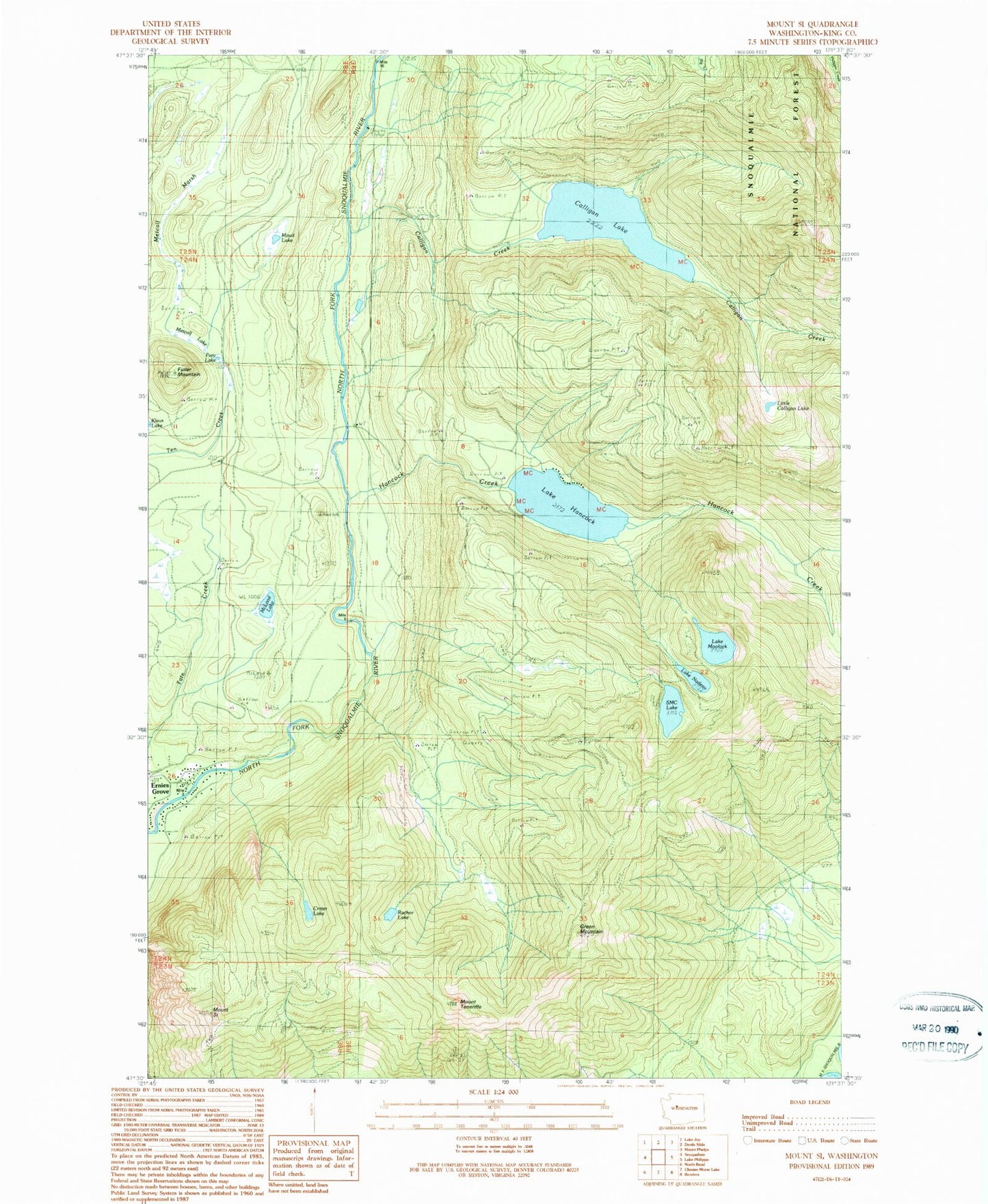
Historical USGS topographic quad map of Mount Si in the state of Washington. Typical map scale is 1:24,000, but may vary for certain years, if available. Print size: 24" x 27"
This quadrangle is in the following counties: King.
The map contains contour lines, roads, rivers, towns, and lakes. Printed on high-quality waterproof paper with UV fade-resistant inks, and shipped rolled.
Contains the following named places: Calligan Creek, Calligan Lake, Crater Lake, Ernies Grove, Fuller Mountain, Fury Lake, Green Mountain, Hancock Creek, Lake Hancock, Little Calligan Lake, Maud Lake, McLeod Lake, Metcalf Lake, Metcalf Marsh, Lake Moolock, Lake Nadeau, Rachor Lake, SMC Lake, Mount Si, Spur 10 Gate, Mount Teneriffe, Upper Snoqualmie Valley Division (historical)