MyTopo
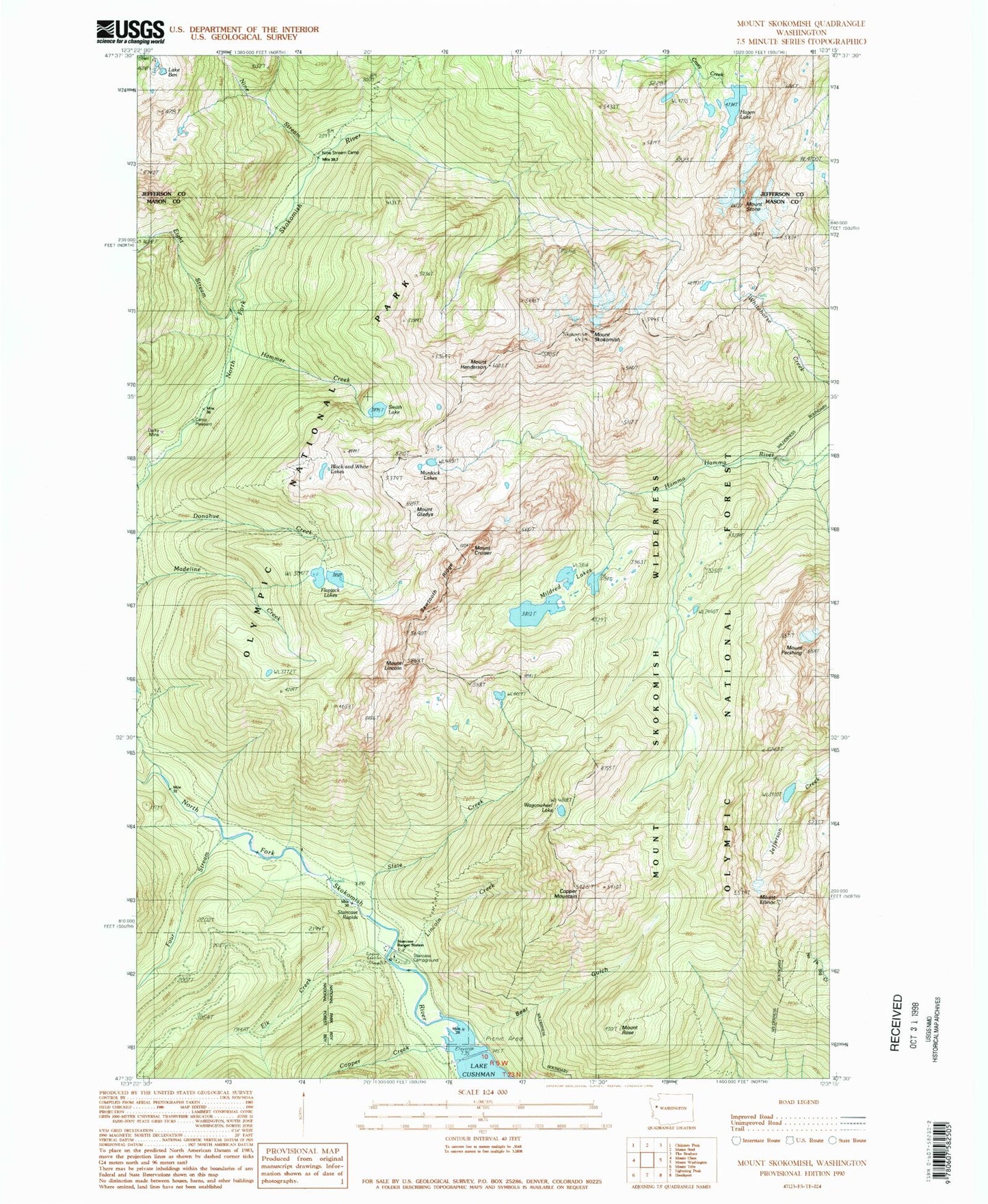
Classic USGS Mount Skokomish Washington 7.5'x7.5' Topo Map
Couldn't load pickup availability
Historical USGS topographic quad map of Mount Skokomish in the state of Washington. Typical map scale is 1:24,000, but may vary for certain years, if available. Print size: 24" x 27"
This quadrangle is in the following counties: Jefferson, Mason.
The map contains contour lines, roads, rivers, towns, and lakes. Printed on high-quality waterproof paper with UV fade-resistant inks, and shipped rolled.
Contains the following named places: Bear Gulch, Bear Gulch Camp (historical), Lake Ben, Black and White Lakes, Camp Pleasant, Copper Creek, Copper Mountain, Mount Cruiser, Darky Mine (historical), Eight Stream, Elk Creek, Mount Ellinor, Flapjack Lakes, Four Stream, Mount Gladys, Hagen Lake, Hammer Cabin (historical), Hammer Creek, Mount Henderson, Lincoln Creek, Staircase Ranger Station, Mount Lincoln, Mildred Lakes, Murdock Lakes, Nine Stream, Nine Stream Camp, Mount Pershing, Mount Rose, Sawtooth Ridge, Mount Skokomish, Slate Creek, Smith Lake, Staircase Rapids, Mount Stone, Wagonwheel Lake, Staircase Campground, Staircase Ranger Station, Mount Skokomish Wilderness, Staircase Campground, Staircase, Lake of the Angels