MyTopo
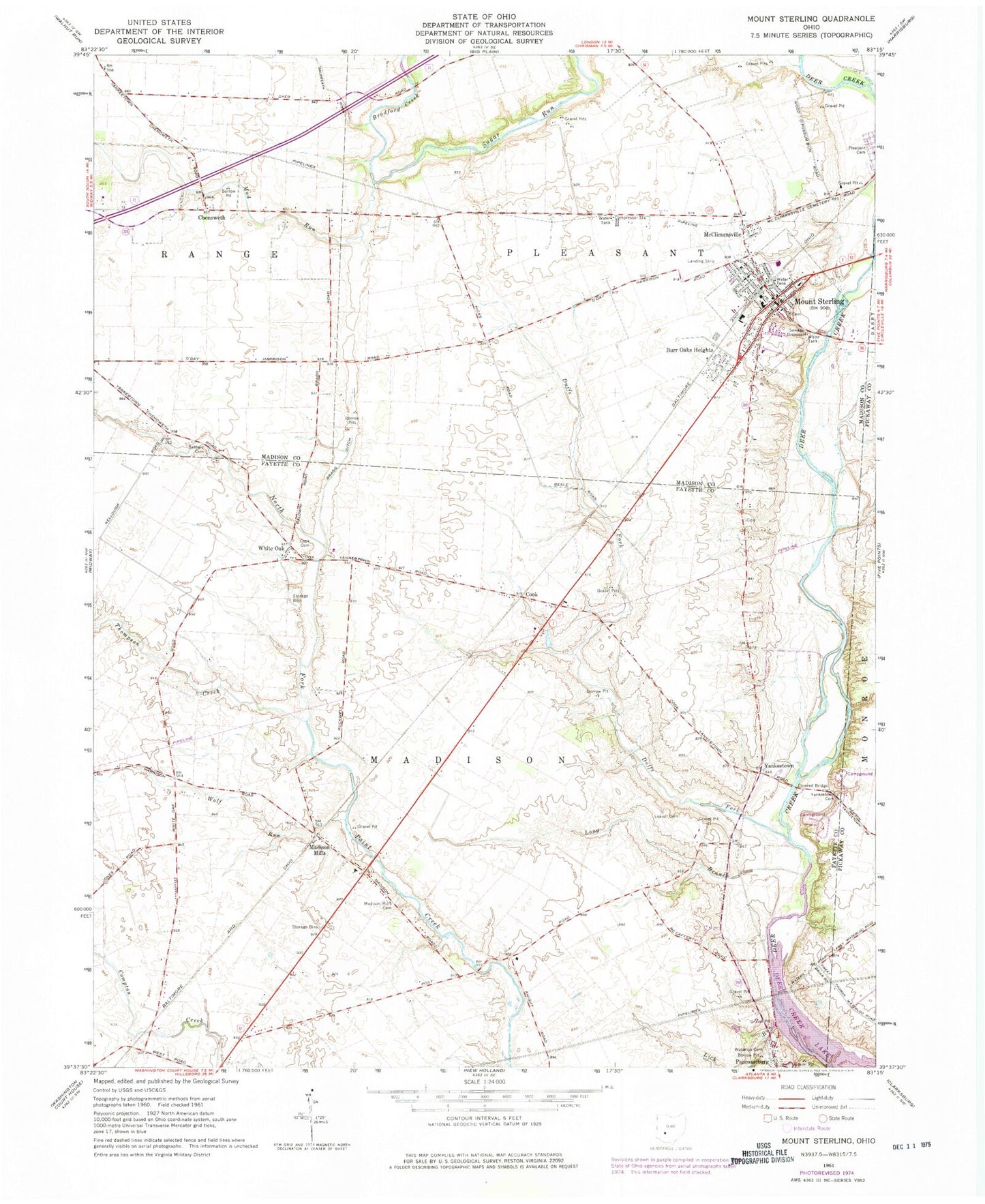
Classic USGS Mount Sterling Ohio 7.5'x7.5' Topo Map
Couldn't load pickup availability
Historical USGS topographic quad map of Mount Sterling in the state of Ohio. Map scale may vary for some years, but is generally around 1:24,000. Print size is approximately 24" x 27"
This quadrangle is in the following counties: Fayette, Madison, Pickaway.
The map contains contour lines, roads, rivers, towns, and lakes. Printed on high-quality waterproof paper with UV fade-resistant inks, and shipped rolled.
Contains the following named places: Baldwin Cemetery, Bostwick-Loofbourrow Cemetery, Bradford Creek, Bragg Ditch, Burr Oaks Heights, Chenoweth, Chenoweth Post Office, Cook, Cook Cemetery, Cook Post Office, Duffs Fork, Galbreath Ditch, Leavell Cemetery, Lick Run, Long Branch, Madison Mills, Madison Mills Cemetery, Madison Mills Elementary School, Madison Mills Post Office, Madison Mills United Methodist Church, McClimansville, Methodist Cemetery, Mount Sterling, Mount Sterling Elementary School, Mount Sterling Historic District, Mount Sterling Post Office, Mount Sterling United Methodist Church, Mud Run, Pleasant Cemetery, Plumwood Mobile Home Park, Sterling Joint Ambulance District, Thompson Creek, Township of Madison, Township of Pleasant, Tri - County Joint Fire District Station 491, Village of Mount Sterling, Waterloo Cemetery, White Oak, White Oak Post Office, Wolf Run, Yankeetown, Yankeetown Cemetery, ZIP Code: 43143