MyTopo
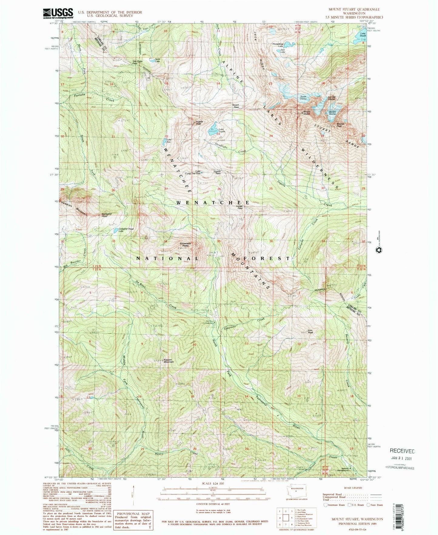
Classic USGS Mount Stuart Washington 7.5'x7.5' Topo Map
Couldn't load pickup availability
Historical USGS topographic quad map of Mount Stuart in the state of Washington. Typical map scale is 1:24,000, but may vary for certain years, if available. Print size: 24" x 27"
This quadrangle is in the following counties: Chelan, Kittitas.
The map contains contour lines, roads, rivers, towns, and lakes. Printed on high-quality waterproof paper with UV fade-resistant inks, and shipped rolled.
Contains the following named places: Lake Ann, Bean Creek, Beverly Campground, Lake Camp Fire Girls, DeRoux Creek, DeRoux Forest Camp, Eldorado Creek, Esmeralda Peaks, Gallaher Head, Gallaher Head Lake, Horseshoe Lake, Lake Ingalls, Ingalls Peak, Iron Peak, Jack Lake, Jack Ridge, Johnson Creek, Jolly Creek, Koppen Mountain, Medra Creek, North Fork Fortune Creek, Spirit Lake, Stuart Pass, Lake Stuart, Mount Stuart, Turnpike Creek, Van Epps Creek, Van Epps Pass, Longs Pass, Ingalls Pass, Sherpa Glacier, Ice Cliff Glacier, Stuart Glacier, De Roux Campground, De Roux Trail Head, Esmeralda Trail Head, Skookum Mine, Sherpa Peak