MyTopo
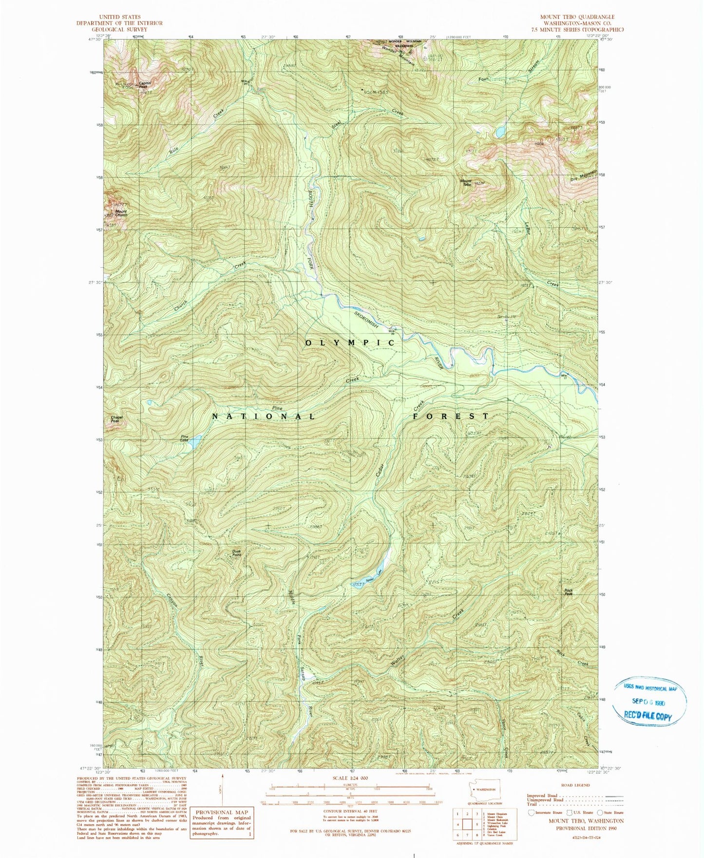
Classic USGS Mount Tebo Washington 7.5'x7.5' Topo Map
Couldn't load pickup availability
Historical USGS topographic quad map of Mount Tebo in the state of Washington. Map scale may vary for some years, but is generally around 1:24,000. Print size is approximately 24" x 27"
This quadrangle is in the following counties: Mason.
The map contains contour lines, roads, rivers, towns, and lakes. Printed on high-quality waterproof paper with UV fade-resistant inks, and shipped rolled.
Contains the following named places: Camp Comfort Shelter, Camp Harps Shelter, Canyon River Shelter, Capitol Peak, Cedar Creek, Chapel Peak, Church Creek, Church Creek Shelter, Dry Mountain, Dusk Point, Mount Church, Mount Tebo, Neby Shelter, Olympic National Forest, Pine Creek, Pine Lake, Rock Peak, Rule Creek, Spider Lake, Spider Lake Shelter, Steel Creek, Walter Creek, Wonder Mountain, ZIP Code: 98548