
MyTopo
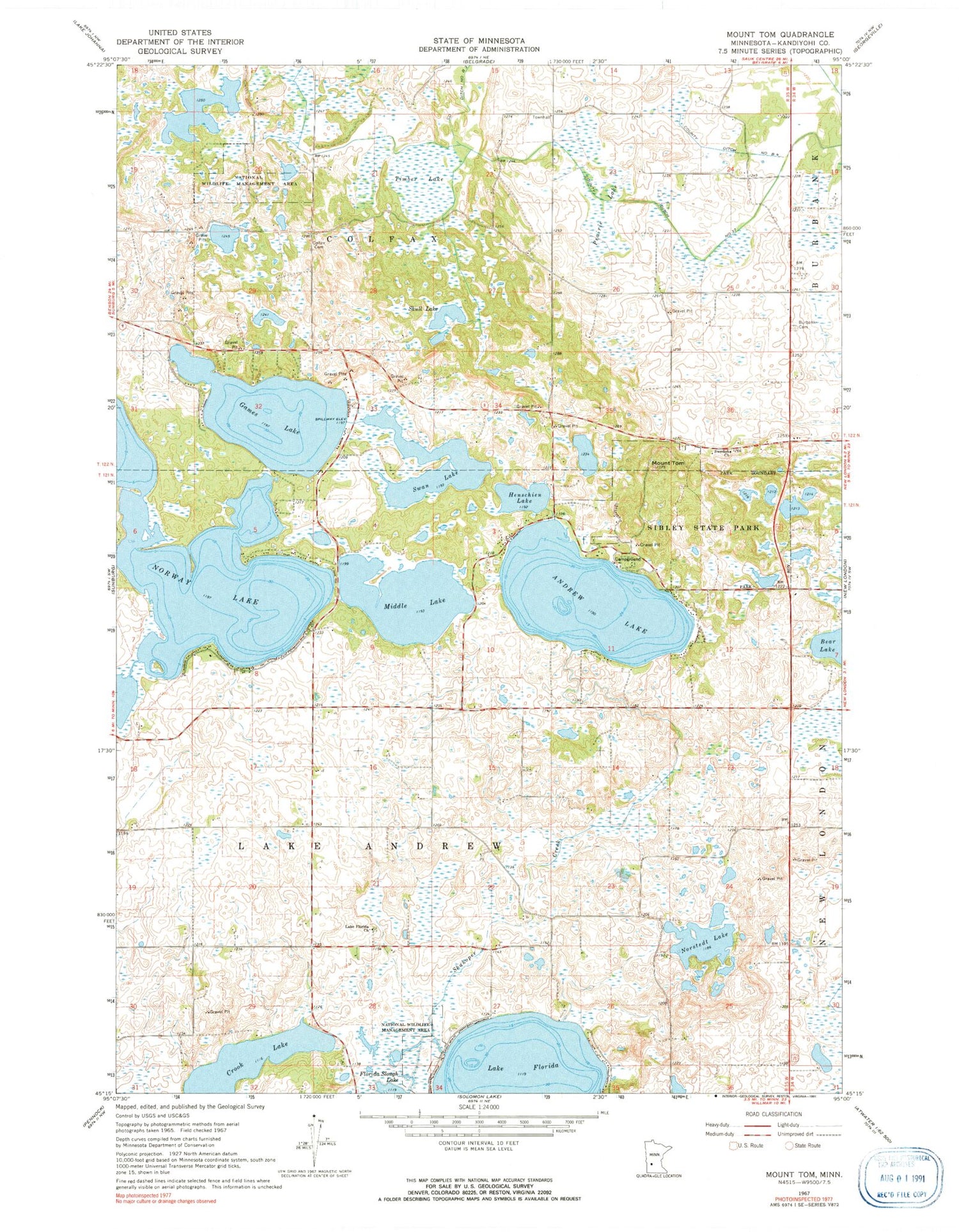
Classic USGS Mount Tom Minnesota 7.5'x7.5' Topo Map
Couldn't load pickup availability
Historical USGS topographic quad map of Mount Tom in the state of Minnesota. Map scale may vary for some years, but is generally around 1:24,000. Print size is approximately 24" x 27"
This quadrangle is in the following counties: Kandiyohi.
The map contains contour lines, roads, rivers, towns, and lakes. Printed on high-quality waterproof paper with UV fade-resistant inks, and shipped rolled.
Contains the following named places: Andrew Lake, Broberg-Lundborg State Monument, Burbank Cemetery, Colfax Cemetery, County Ditch Number B Four, County Ditch Number B Three, County Ditch Number Thirtyseven, Crook Lake, Games Lake, Henschien Lake, Lake Andrew Cemetery, Lake Florida, Lake Florida Cemetery, Lake Florida Church, Middle Lake, Mount Tom, Norstedt Lake, Norway Lake, Prairie Lake, Sibley State Park, Skull Lake, Swan Lake, Swedish Church, Timber Lake, Township of Colfax, Township of Lake Andrew


