
MyTopo
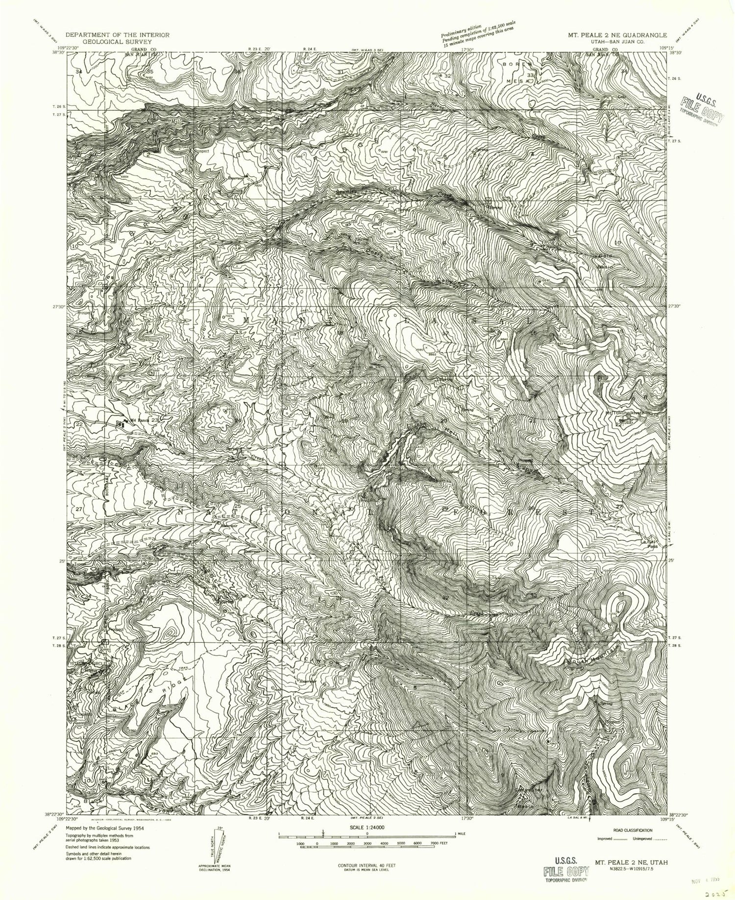
Classic USGS Mount Tukuhnikivatz Utah 7.5'x7.5' Topo Map
Couldn't load pickup availability
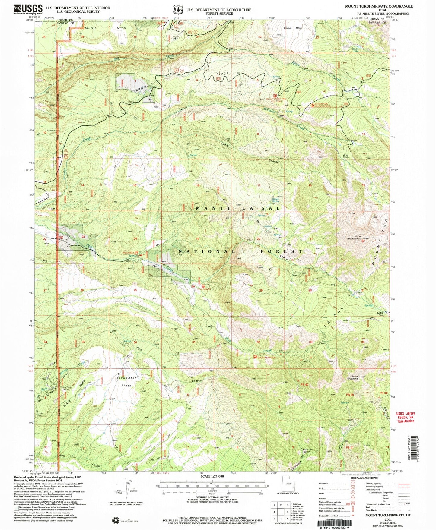
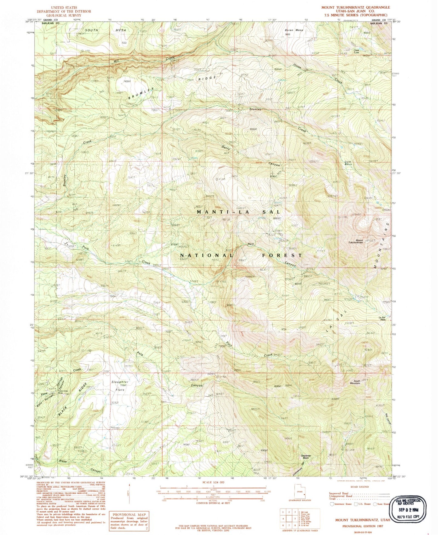
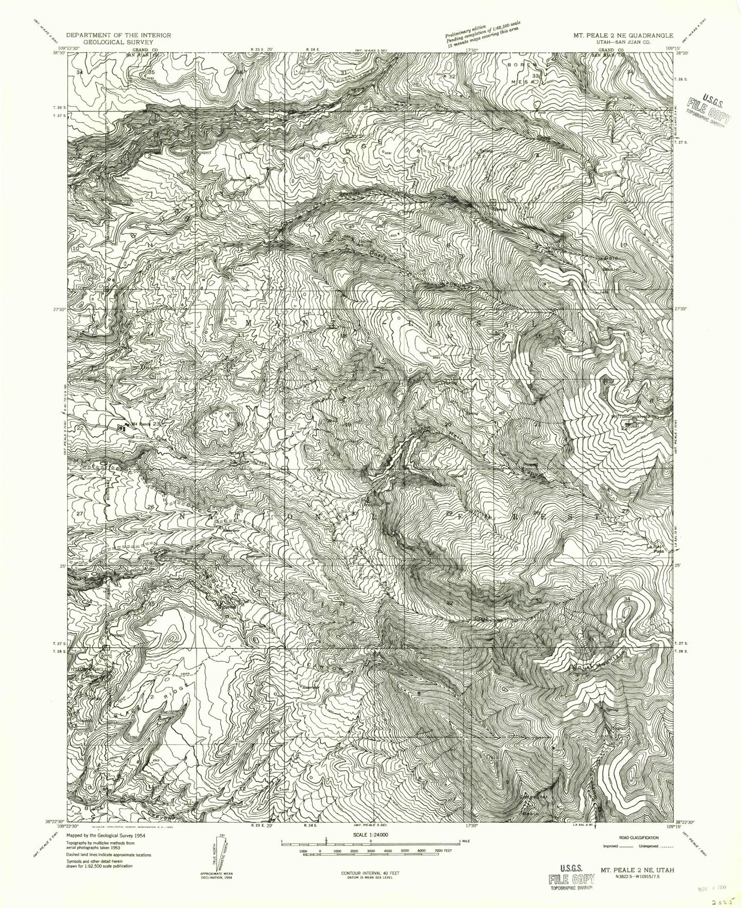
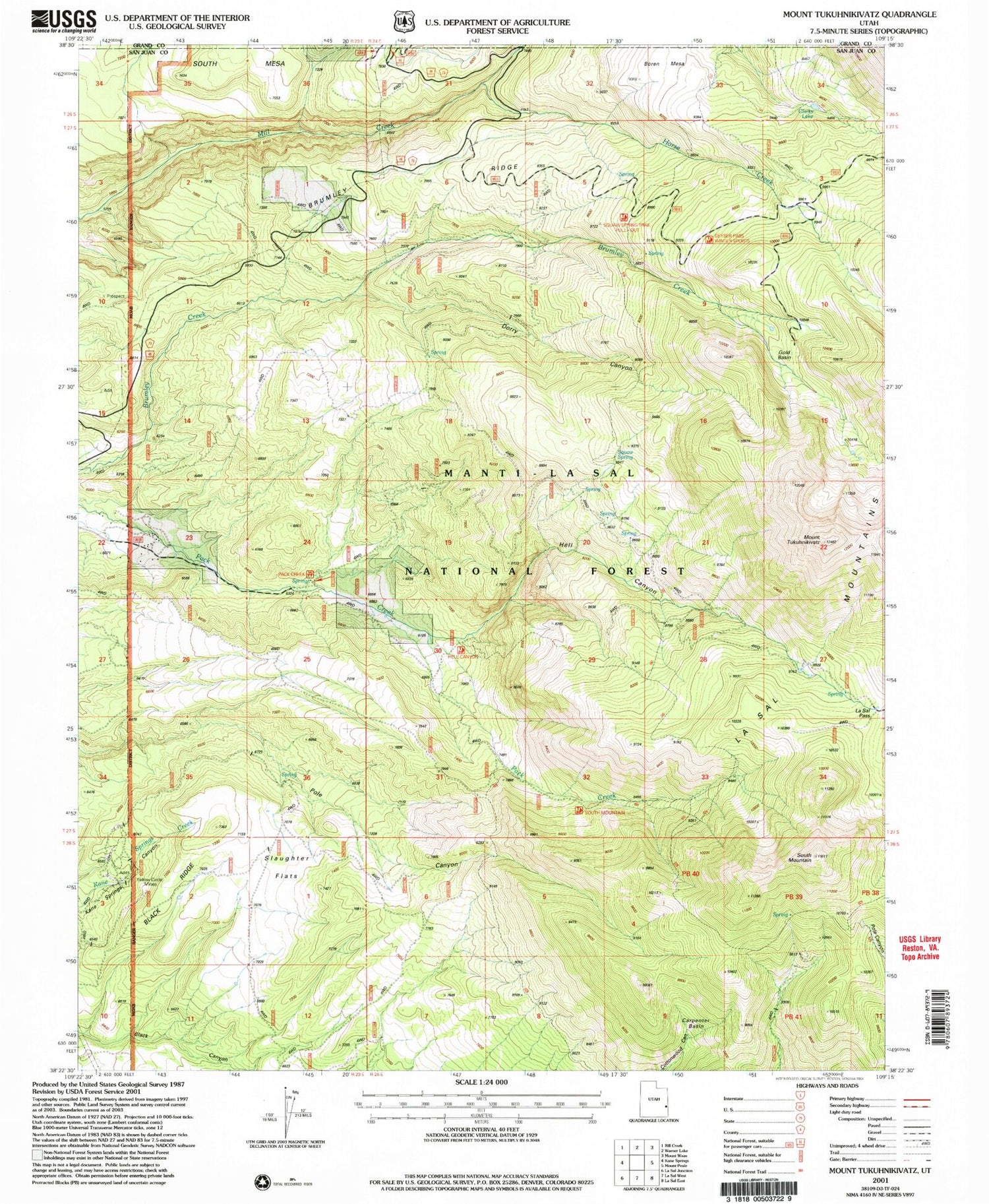
Historical USGS topographic quad map of Mount Tukuhnikivatz in the state of Utah. Typical map scale is 1:24,000, but may vary for certain years, if available. Print size: 24" x 27"
This quadrangle is in the following counties: Grand, San Juan.
The map contains contour lines, roads, rivers, towns, and lakes. Printed on high-quality waterproof paper with UV fade-resistant inks, and shipped rolled.
Contains the following named places: Black Ridge, Boren Mesa, Brumley Ridge, Carpenter Basin, Dorry Canyon, Gold Basin, Hell Canyon, Horse Creek, La Sal Mountains, La Sal Pass, M4 Ranch, South Mountain, Yellow Circle Mines, Pack Creek Picnic Area, Chess Ridge Mine, Squaw Spring, Gold Basin Tower, LaSal Pass Mine, Mill Creek Bridge, Slaughter Spring, LaSal Mountain Loop Road Auto Tour, Mount Tukuhnikivatz, Clark Lake, Slaughter Flats, San Juan Fire Department - Pack Creek Station, Black Ridge, Boren Mesa, Brumley Ridge, Carpenter Basin, Dorry Canyon, Gold Basin, Hell Canyon, Horse Creek, La Sal Mountains, La Sal Pass, M4 Ranch, South Mountain, Yellow Circle Mines, Pack Creek Picnic Area, Chess Ridge Mine, Squaw Spring, Gold Basin Tower, LaSal Pass Mine, Mill Creek Bridge, Slaughter Spring, LaSal Mountain Loop Road Auto Tour, Mount Tukuhnikivatz, Clark Lake, Slaughter Flats, San Juan Fire Department - Pack Creek Station