MyTopo
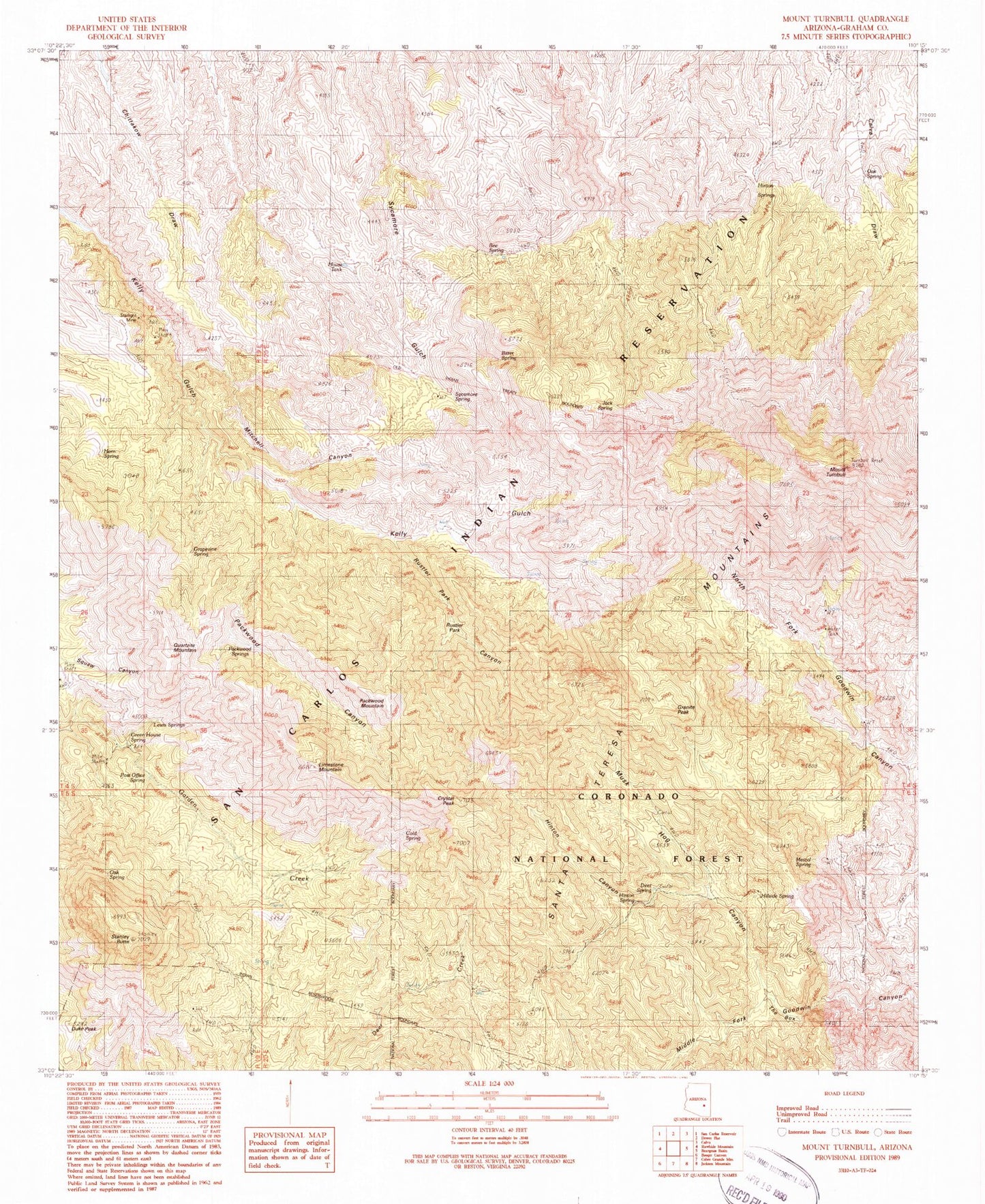
Classic USGS Mount Turnbull Arizona 7.5'x7.5' Topo Map
Couldn't load pickup availability
Historical USGS topographic quad map of Mount Turnbull in the state of Arizona. Map scale may vary for some years, but is generally around 1:24,000. Print size is approximately 24" x 27"
This quadrangle is in the following counties: Graham.
The map contains contour lines, roads, rivers, towns, and lakes. Printed on high-quality waterproof paper with UV fade-resistant inks, and shipped rolled.
Contains the following named places: Bee Spring, Bitter Spring, Cold Spring, Crystal Peak, Deer Spring, Duke Peak, Ellison Cabin Two hundred eighty three Trail, Ellison Place, Goat Ranch Spring, Granite Peak, Grapevine Spring, Green House Spring, Hillside Spring, Hinton Canyon, Hinton Spring, Hinton Springs, Horn Spring, House Ranch, House Tank, Jack Spring, Kelly Canyon, Lewis Spring, Limestone Mountain, Maple Spring, Mescal Spring, Mitchell Cabin Spring, Mitchell Canyon, Mount Turnbull, Musk Hog Canyon, Musk Hog Canyon Spring, Oak Spring, Packwood Canyon, Packwood Mountain, Packwood Springs, Post Office Spring, Quartzite Mountain, Rustler Park, Rustler Park Canyon, Safford Ranger District, Santa Teresa Mountains, Stanley Butte, Starlight Mine, Sycamore Spring, The Box, Upper Goat Camp Spring, Upper Kelly Spring, Weaver Ranch