MyTopo
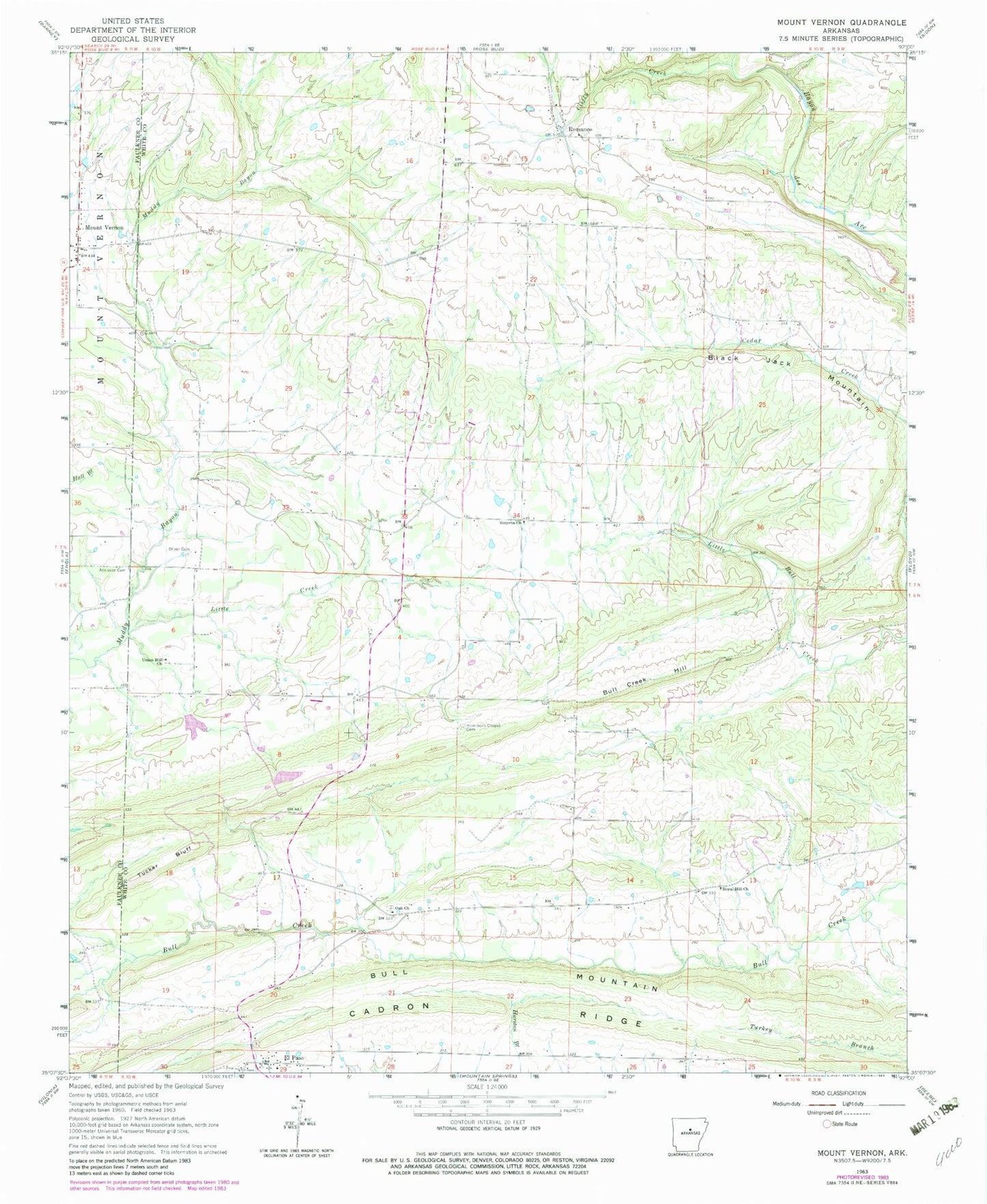
Classic USGS Mount Vernon Arkansas 7.5'x7.5' Topo Map
Couldn't load pickup availability
Historical USGS topographic quad map of Mount Vernon in the state of Arkansas. Map scale may vary for some years, but is generally around 1:24,000. Print size is approximately 24" x 27"
This quadrangle is in the following counties: Faulkner, White.
The map contains contour lines, roads, rivers, towns, and lakes. Printed on high-quality waterproof paper with UV fade-resistant inks, and shipped rolled.
Contains the following named places: Adkisson Cemetery, Black Jack Mountain, Blasingame Cemetery, Bull Creek Hill, Bull Mountain, Clifty Creek, El Paso, Faith Missionary Baptist Church, First Baptist Church of El Paso, Floyd Volunteer Fire Department Station 2, Hammondsville, Hammons Chapel Cemetery, Little Creek, Mount Vernon, Mount Vernon Post Office, Mount Vernon Volunteer Fire Department, Oak Church of Christ, Oliver Cemetery, Powell Branch, Romance, Romance Post Office, Royal Hill Baptist Church, Smyrna Baptist Church, Town of Mount Vernon, Township of Cleveland, Township of Jefferson, Township of Marshall, Tucker Bluff, Union Hill Church, ZIP Codes: 72045, 72136