MyTopo
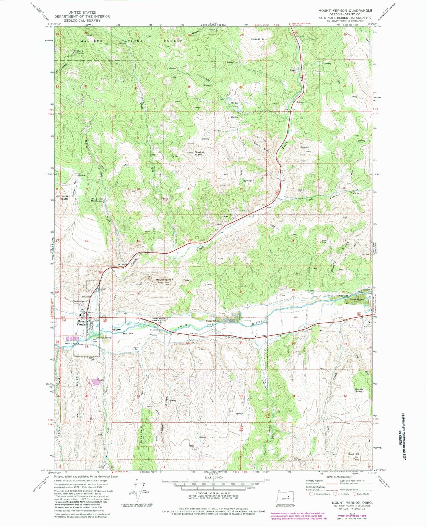
Classic USGS Mount Vernon Oregon 7.5'x7.5' Topo Map
Couldn't load pickup availability
Historical USGS topographic quad map of Mount Vernon in the state of Oregon. Map scale may vary for some years, but is generally around 1:24,000. Print size is approximately 24" x 27"
This quadrangle is in the following counties: Grant.
The map contains contour lines, roads, rivers, towns, and lakes. Printed on high-quality waterproof paper with UV fade-resistant inks, and shipped rolled.
Contains the following named places: Angel Gulch, Bald Hill, Beech Creek, Benson Ranch, City of Mount Vernon, Clark Spring, Clyde Holliday State Park, Daniels Spring, East Fork Luce Creek, Enterprise Ditch, Fall Creek, Fletcher Cemetery, Fletcher Ranch, Gibson Gulch, Gibson Hill, Gordon Butte, Gordon Creek, Gordon Lakes, Grant, Grant County, Grant Post Office, Graveyard Gulch, Grouse Creek, Grouse Mountain, Harper Creek, Herburger Pond, Hines Log Pond, Hodson Creek, Huss Creek, Ingle Cemetery, Ingle Creek, John Day Sanitary Landfill, Laycock Creek, Laycock Long Ditch, Lee Gulch, Little Beech Creek, Luce Creek, Luce-Belshaw School, Mount Vernon, Mount Vernon City Hall, Mount Vernon Fire Department, Mount Vernon Hot Springs, Mount Vernon Hot Springs Resort, Mount Vernon Middle School, Mount Vernon Post Office, Mount Vernon Public Works Department Office, Mount Vernon Sewage Treatment Lagoons, Oliver Ranch, Panama Ditch, Quartz Gulch, Silvers Mine, Warm Springs Creek, White Butte, Wymer Flat