MyTopo
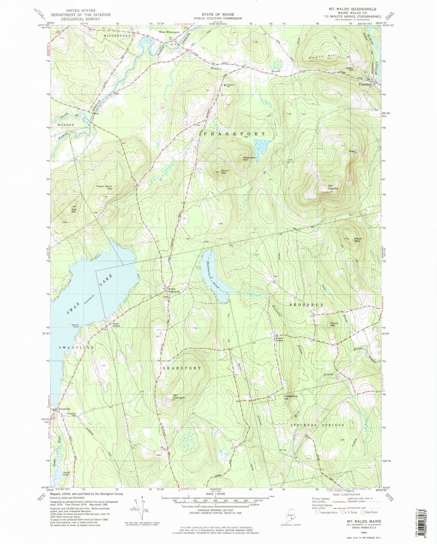
Classic USGS Mount Waldo Maine 7.5'x7.5' Topo Map
Couldn't load pickup availability
Historical USGS topographic quad map of Mount Waldo in the state of Maine. Typical map scale is 1:24,000, but may vary for certain years, if available. Print size: 24" x 27"
This quadrangle is in the following counties: Waldo.
The map contains contour lines, roads, rivers, towns, and lakes. Printed on high-quality waterproof paper with UV fade-resistant inks, and shipped rolled.
Contains the following named places: Brown Corner, Clark School, Delaware Mountain, Downs Hill, Dutch Mountain, Mount Ephraim, Frankfort, Halfmoon Pond, Halfmoon Stream, Hedgehog Hill, Hedgehog Mountain, Lane Brook, Lane School, Littlefield Brook, Mack Mountain, Main Stream, Meadow Brook, Nickerson Cemetery, North Branch Marsh Stream, North Searsport, Oak Hill, Smith Hill, Smith Pond, Spruce Point, Swan Lake, Swanville, Town Farm Hill, Mount Waldo, West Winterport Church, Wiswell Cemetery, Dodge Corner, West Winterport, Frankfort Elementary School, WBFB-FM (Ellsworth), Town of Frankfort, Swan Lake Dam, West Winterport Dam, Searsport North Fire Station, West Frankfort Fire Station First Responders, Lane Cemetery, Lowe Cemetery, Merithew Cemetery, Evergreen Cemetery