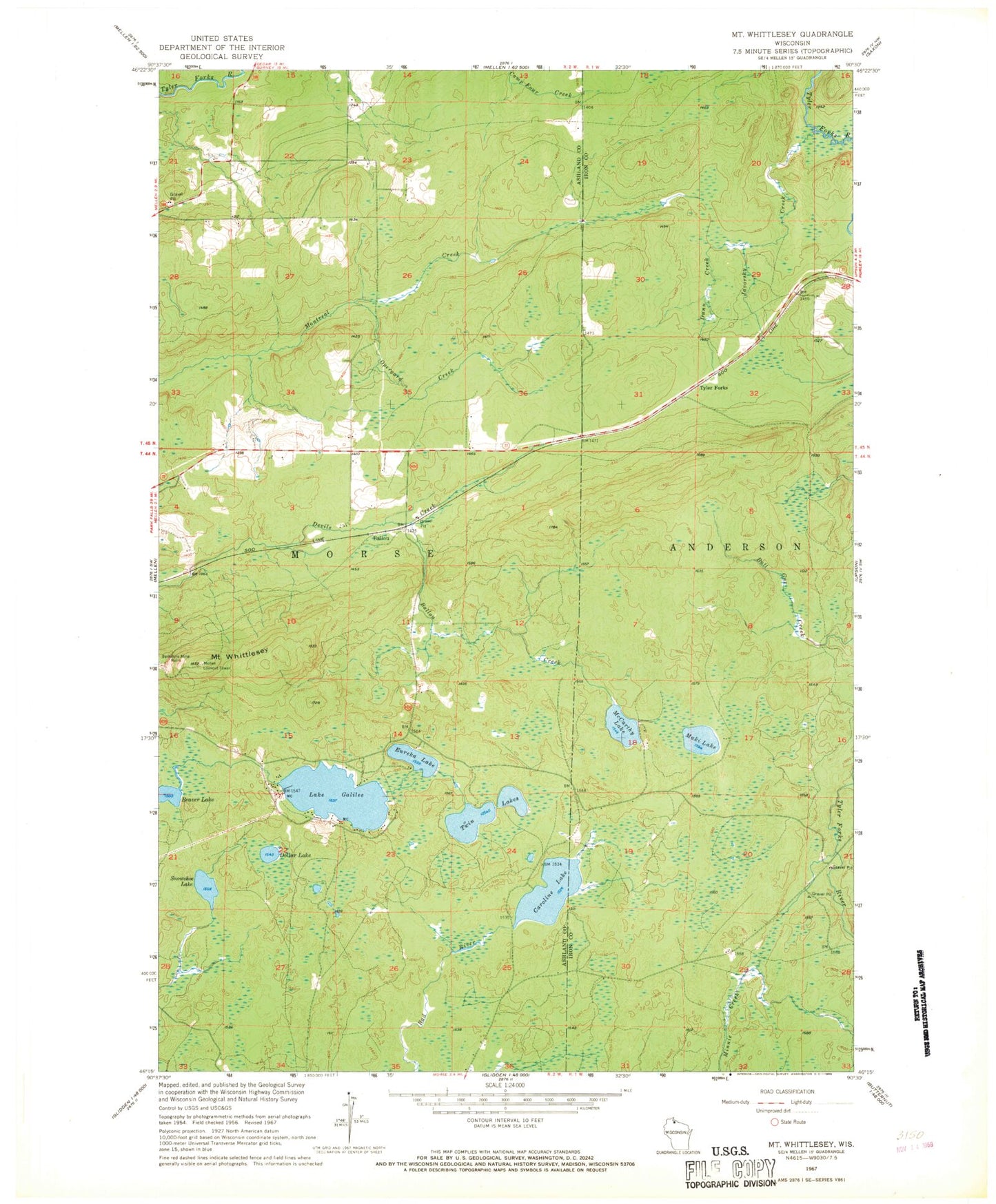
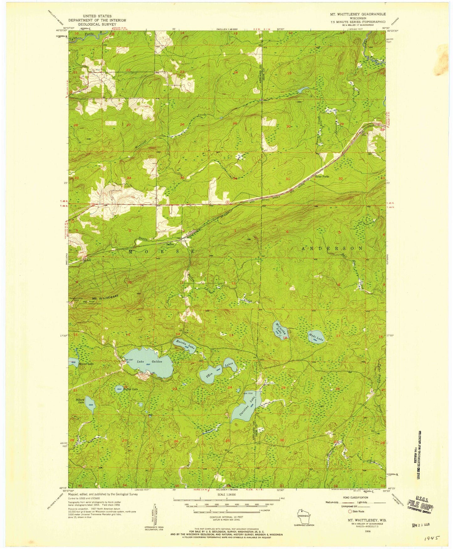
MyTopo
Classic USGS Mount Whittlesey Wisconsin 7.5'x7.5' Topo Map
Couldn't load pickup availability
Historical USGS topographic quad map of Mount Whittlesey in the state of Wisconsin. Map scale may vary for some years, but is generally around 1:24,000. Print size is approximately 24" x 27"
This quadrangle is in the following counties: Ashland, Iron.
The map contains contour lines, roads, rivers, towns, and lakes. Printed on high-quality waterproof paper with UV fade-resistant inks, and shipped rolled.
Contains the following named places: Ballou, Ballou Creek, Beaver Lake, Caroline Lake, Caroline Lake State Natural Area, Dollar Lake, Dunn Creek, Eureka Lake, Javorsky Creek, Lake Galilee, Maki Lake, McCarthy Lake, Mellen Lookout Tower, Mount Whittlesey, O'Dovero Farms, Opergard Creek, Snowshoe Lake, Twin Lakes, Tyler Forks