MyTopo
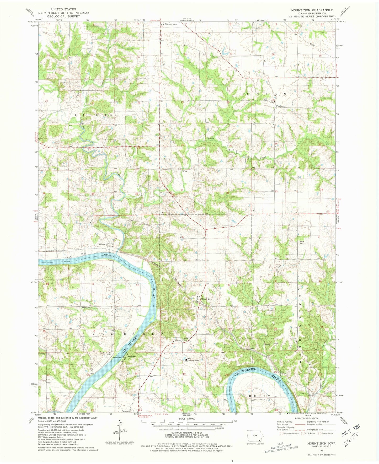
Classic USGS Mount Zion Iowa 7.5'x7.5' Topo Map
Couldn't load pickup availability
Historical USGS topographic quad map of Mount Zion in the state of Iowa. Map scale may vary for some years, but is generally around 1:24,000. Print size is approximately 24" x 27"
This quadrangle is in the following counties: Van Buren.
The map contains contour lines, roads, rivers, towns, and lakes. Printed on high-quality waterproof paper with UV fade-resistant inks, and shipped rolled.
Contains the following named places: Anson Cemetery, Austin County Park, County Farm Cemetery, Forbes Cemetery, Gilbert Cemetery, Kilbourn, Kilbourn Post Office, Kilbourne Cemetery, Leech Cemetery, Lick Creek, Little Creek, Little Lick Creek, Miller Chapel Cemetery, Mount Zion, Mount Zion Church, Mount Zion Post Office, Parkerville Cemetery, Parksville, Railroad Grave, Rider Cemetery, Rock Creek, Rogers Cemetery, Tedrow Cemetery, Topping Cemetery, Township of Union, Township of Van Buren, Union Post Office, Van Buren County, Van Buren County Home, Wilson Cemetery, Winchester, Winchester Cemetery, Winchester Post Office, ZIP Code: 52535