MyTopo
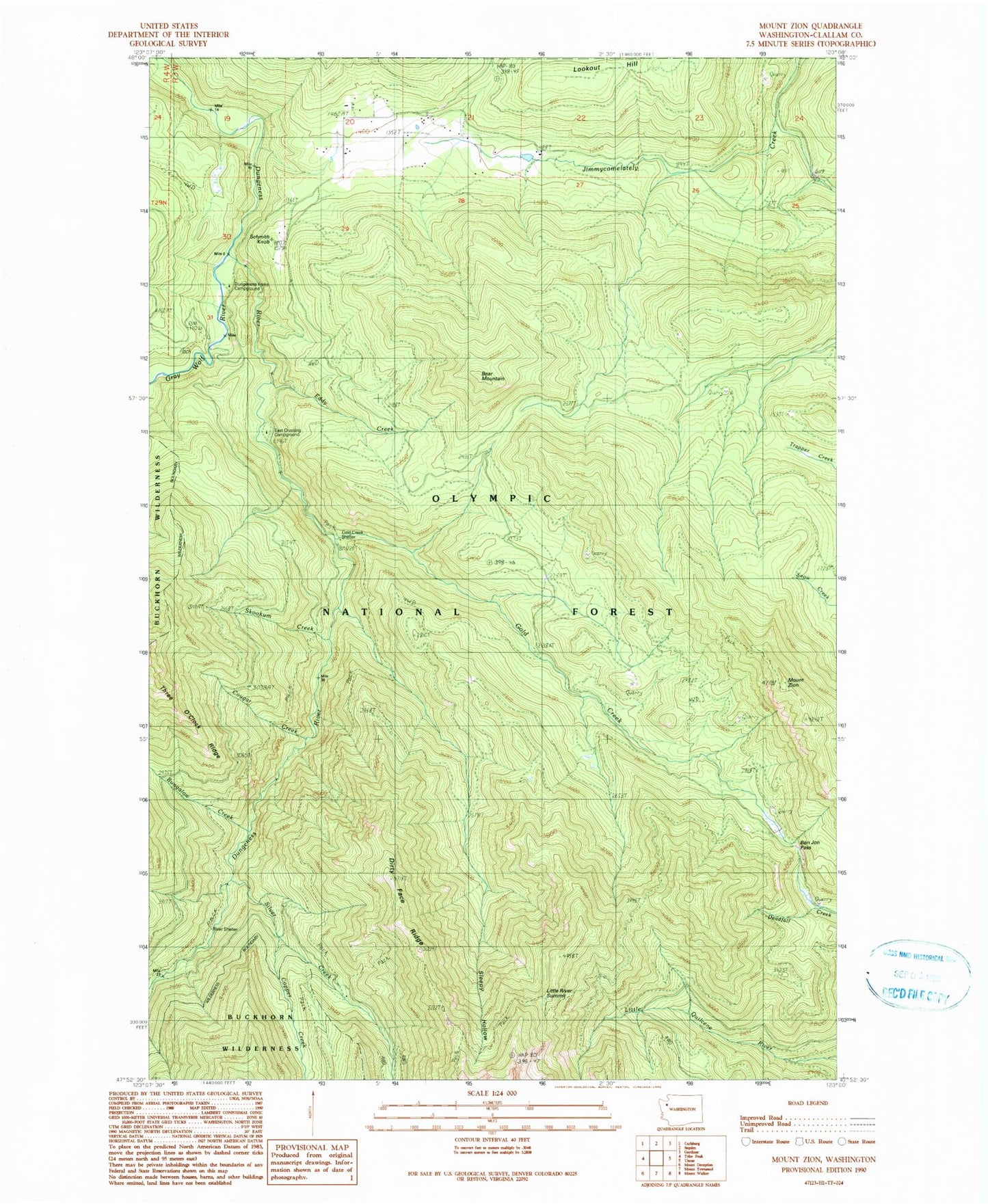
Classic USGS Mount Zion Washington 7.5'x7.5' Topo Map
Couldn't load pickup availability
Historical USGS topographic quad map of Mount Zion in the state of Washington. Typical map scale is 1:24,000, but may vary for certain years, if available. Print size: 24" x 27"
This quadrangle is in the following counties: Clallam.
The map contains contour lines, roads, rivers, towns, and lakes. Printed on high-quality waterproof paper with UV fade-resistant inks, and shipped rolled.
Contains the following named places: Bear Mountain, Bear Mountain Trail (historical), Bon Jon Pass, Bungalow Creek, Clink Trail (historical), Colonel Shelter (historical), Copper Creek, Cougar Creek, Dirty Face Ridge, Dirty Face Trail (historical), Dungeness Forks Campground, Eddy Creek, Gold Creek, Gold Creek Shelter, Gorge Campground, Gray Wolf River, Last Water Camp (historical), Little Quilcene Trail (historical), Little River Summit, Louella Guard Station (historical), River Campground, Schmith Knob, Silver Creek, Skookum Creek, Sleepy Hollow, Tubal Cain Mine Trail, Mount Zion, Silver Creek Shelter, Mount Zion Lookout, Elwick Dam, East Crossing Campground