MyTopo
Classic USGS Mount Zircon Maine 7.5'x7.5' Topo Map
Couldn't load pickup availability
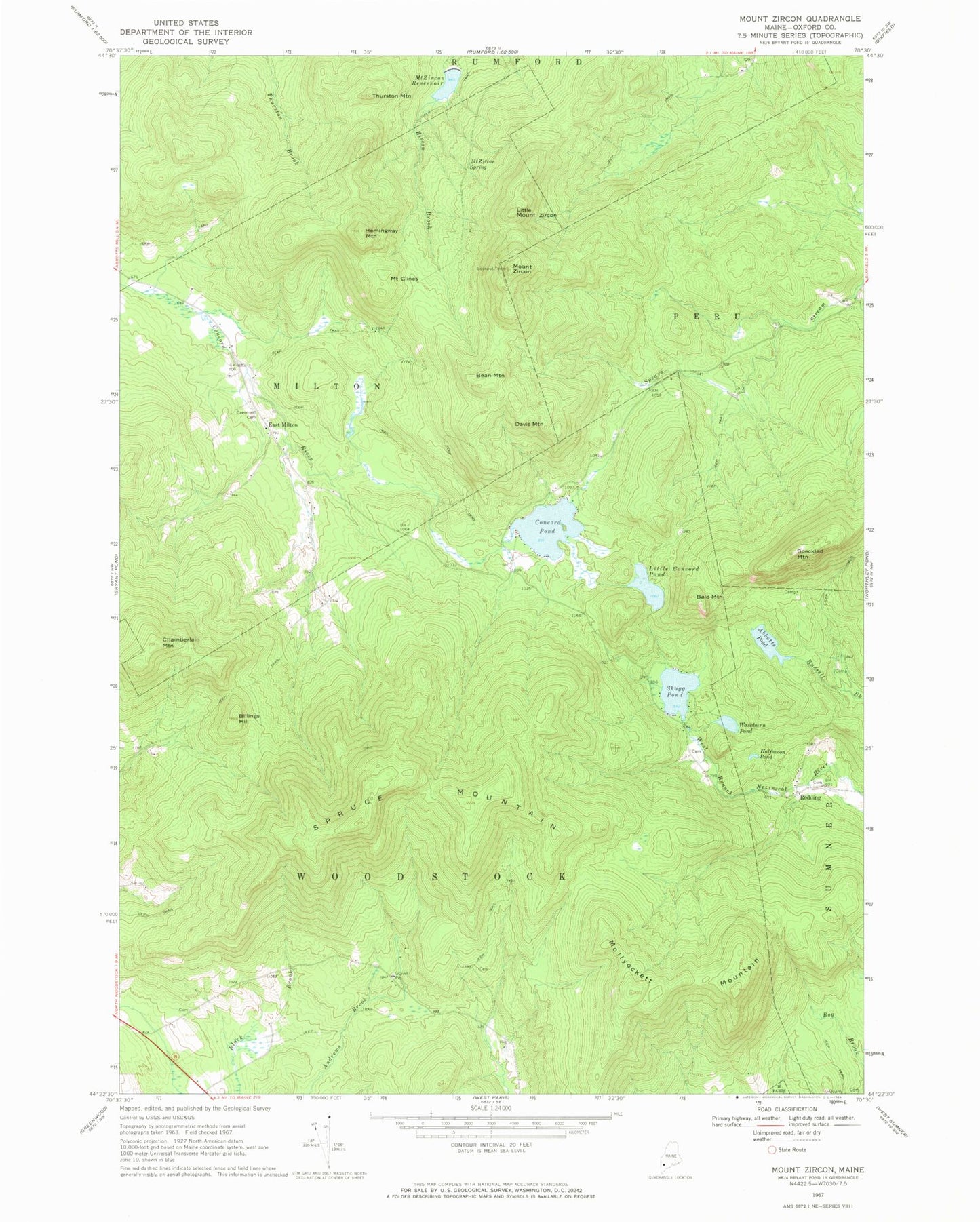
Historical USGS topographic quad map of Mount Zircon in the state of Maine. Typical map scale is 1:24,000, but may vary for certain years, if available. Print size: 24" x 27"
This quadrangle is in the following counties: Oxford.
The map contains contour lines, roads, rivers, towns, and lakes. Printed on high-quality waterproof paper with UV fade-resistant inks, and shipped rolled.
Contains the following named places: Abbotts Pond, Bald Mountain, Bean Mountain, Billings Hill, Chamberlain Mountain, Concord Pond, Davis Mountain, Mount Glines, Greenleaf Cemetery, Halfmoon Pond, Hemingway Mountain, Little Concord Pond, Little Mount Zircon, Mollyockett Mountain, Mount Zircon Reservoir, Mount Zircon Spring, Redding, Shagg Pond, Speckled Mountain, Spruce Mountain, Thurston Mountain, Washburn Pond, Mount Zircon, East Milton, Township of Milton, Town of Woodstock, Mount Zircon Reservoir Dam, Unorganized Territory of Milton, Redding Cemetery, Robbins Cemetery, Davis Cemetery