MyTopo
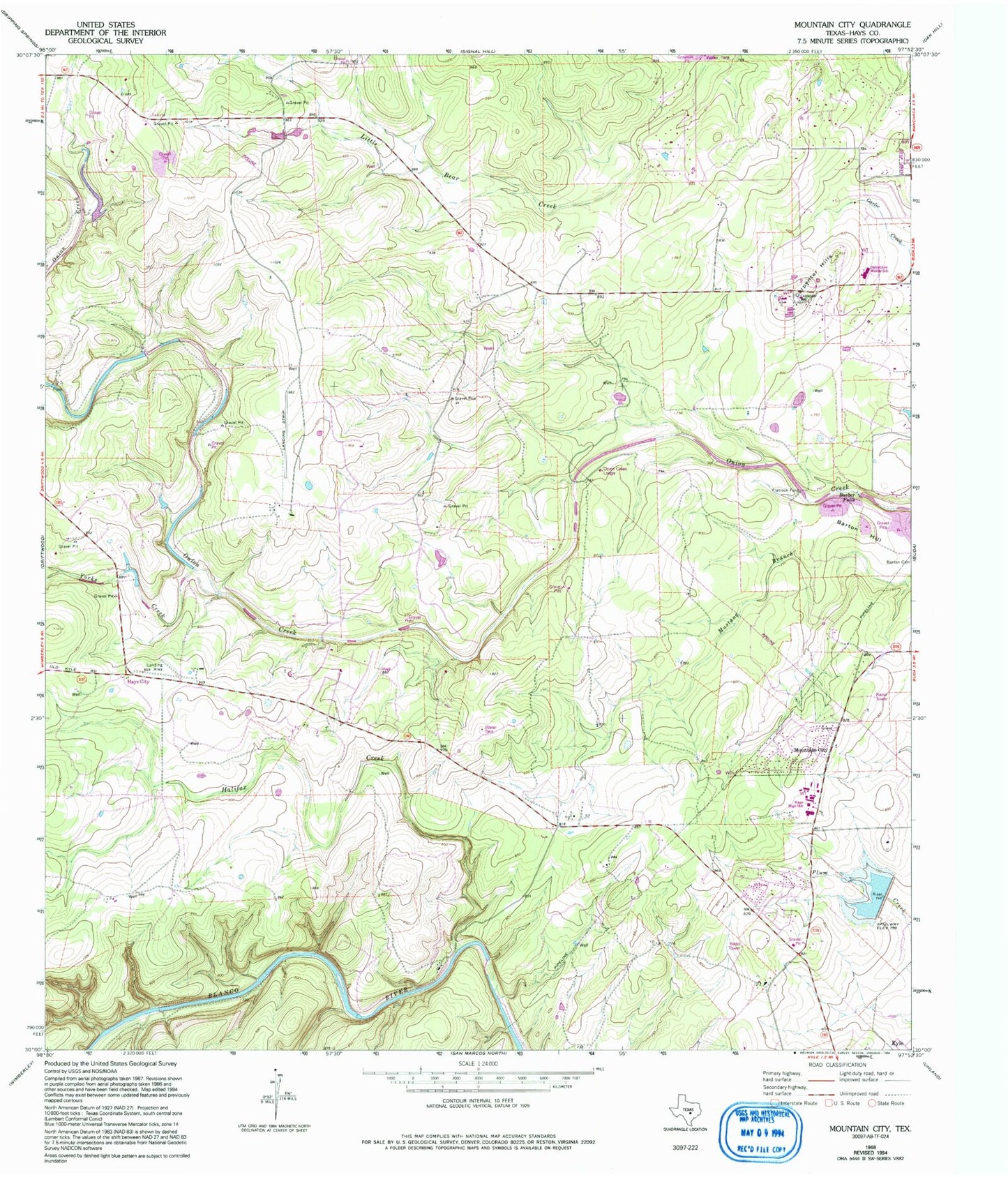
Classic USGS Mountain City Texas 7.5'x7.5' Topo Map
Couldn't load pickup availability
Historical USGS topographic quad map of Mountain City in the state of Texas. Map scale may vary for some years, but is generally around 1:24,000. Print size is approximately 24" x 27"
This quadrangle is in the following counties: Hays.
The map contains contour lines, roads, rivers, towns, and lakes. Printed on high-quality waterproof paper with UV fade-resistant inks, and shipped rolled.
Contains the following named places: Barber Falls, Barton Hill, Bob Shelton Stadium, Brown Ranch Dam, Carpenter Hills, City of Mountain City, Dahlstrom Intermediate School, Farris Ranch, Flatrock Ford, Gregg Ranch, Halifax Creek, Halifax Ranch, Hays Alternative Impact Center, Hays City, Hays County Sheriff 's Department Kyle Sub - Station, Hays County Sheriff's Office Driftwood Substation, Hoskins Ranch, KATG-FM (Luling), KEYI-FM (San Marcos), Kuykendall Ranch, Kyle-Buda Division, Lutranger Lake, Lutranger Lake Dam, Michaelis Ranch, Mountain City, Mountain City Town Hall, Onion Creek Lodge, Phillips Ranch, Rattlesnake Lake, Ruby Ranch, Rutherford Ranch, Rutherford Ranch Airport, Soil Conservation Service Site 1 Dam, Soil Conservation Service Site 1 Reservoir, Yorks Creek