MyTopo
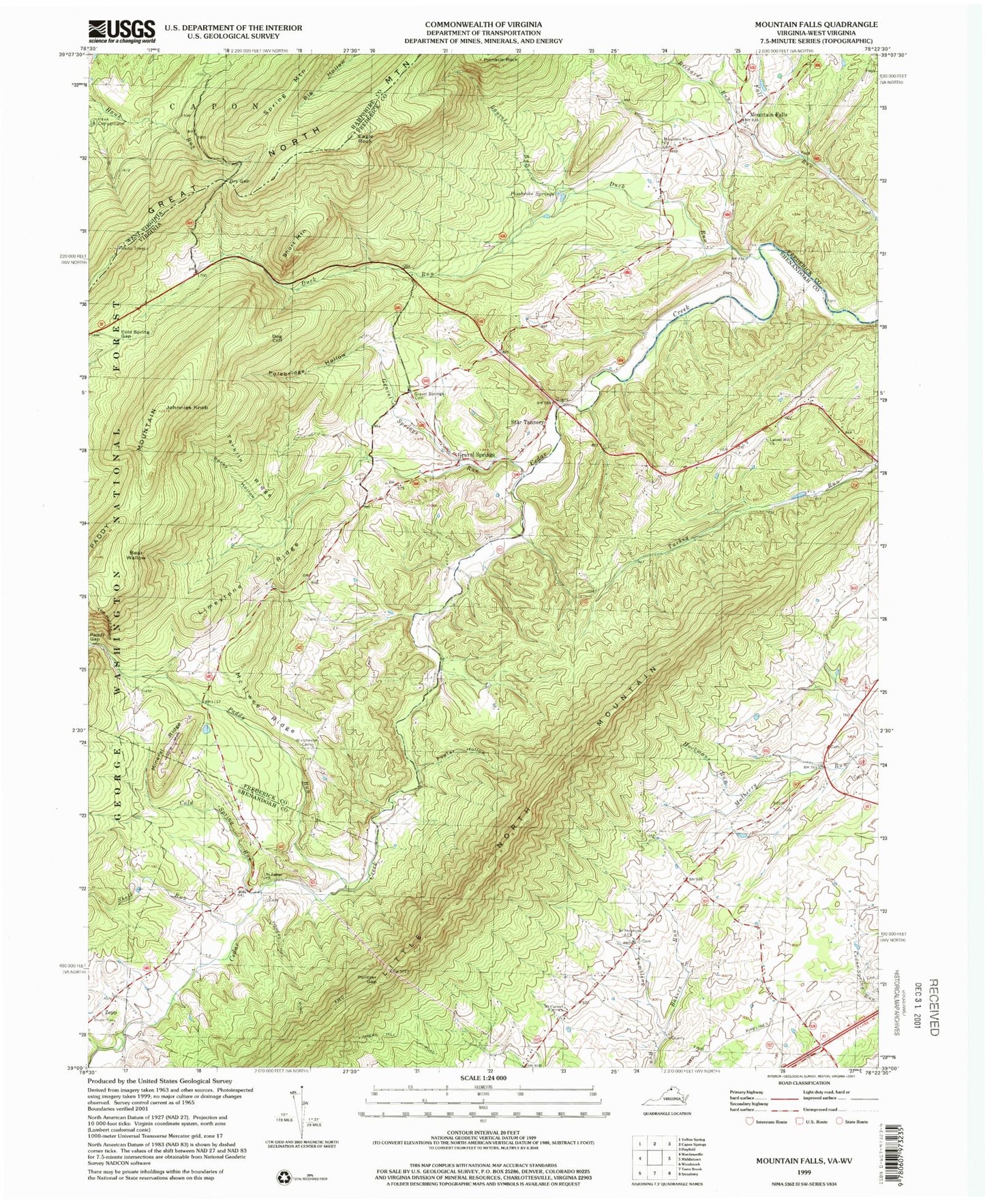
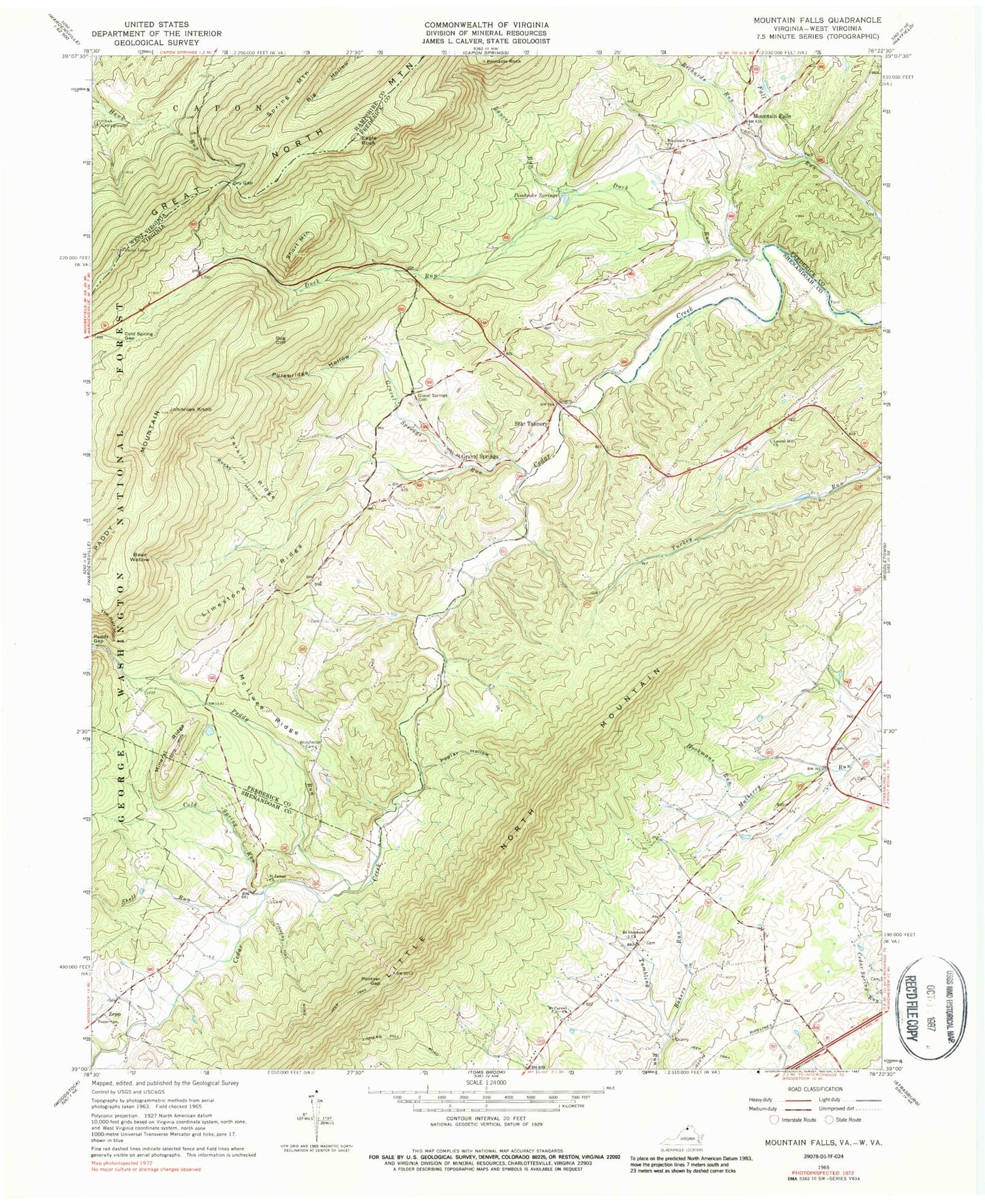
Classic USGS Mountain Falls Virginia 7.5'x7.5' Topo Map
Couldn't load pickup availability
Historical USGS topographic quad map of Mountain Falls in the states of Virginia, West Virginia. Map scale may vary for some years, but is generally around 1:24,000. Print size is approximately 24" x 27"
This quadrangle is in the following counties: Frederick, Hampshire, Shenandoah.
The map contains contour lines, roads, rivers, towns, and lakes. Printed on high-quality waterproof paper with UV fade-resistant inks, and shipped rolled.
Contains the following named places: Bakers Run, Bear Wallow, Cold Spring Gap, Cold Spring Run, Dog Cliff, Dry Gap, Duck Run, Eagle Rock, Fairmont School, Gravel Springs, Gravel Springs Cemetery, Gravel Springs Run, Hawk Campground, Hockmans Run, Johnnies Knob, Laurel Hill Cemetery, Laurel Hill Church, Laurel Run, Limestone Ridge, Little North Mountain, McIiwee Ridge, Mineral Ridge, Mount Carmel Cemetery, Mount Carmel Church, Mountain Falls, Mountain View Church, Mulberry Run Airport, Paddy Gap, Paddy Run, Pembroke Springs, Pinnacle Rock, Polebridge Hollow, Pontzer Gap, Poplar Hollow, Richards Run, Rocky Hollow, Saint James Cemetery, Saint James Church, Saint Stephens Cemetery, Saint Stephens Church, Seven Vistas Dam, Seven Vistas Lake, Shell Run, Short Mountain, Spring Mountain, Star Tannery, Star Tannery Post Office, Star Tannery Volunteer Fire and Rescue Station 17, Star Tannery Volunteer Fire Department, Tarkiln Ridge, The Half Moon, Topnot School, Waverly School, WESI-FM (Strasburg), Winchester Camp, Zepp, ZIP Codes: 22641, 22657