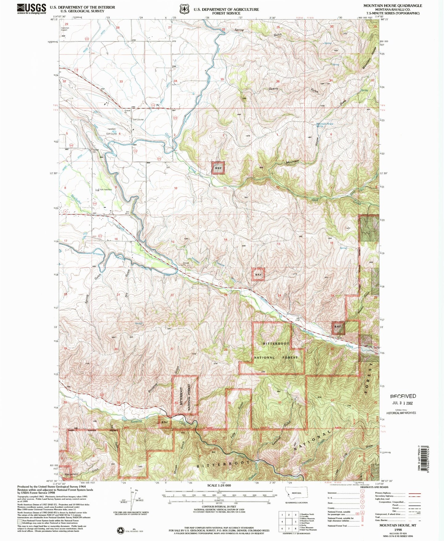
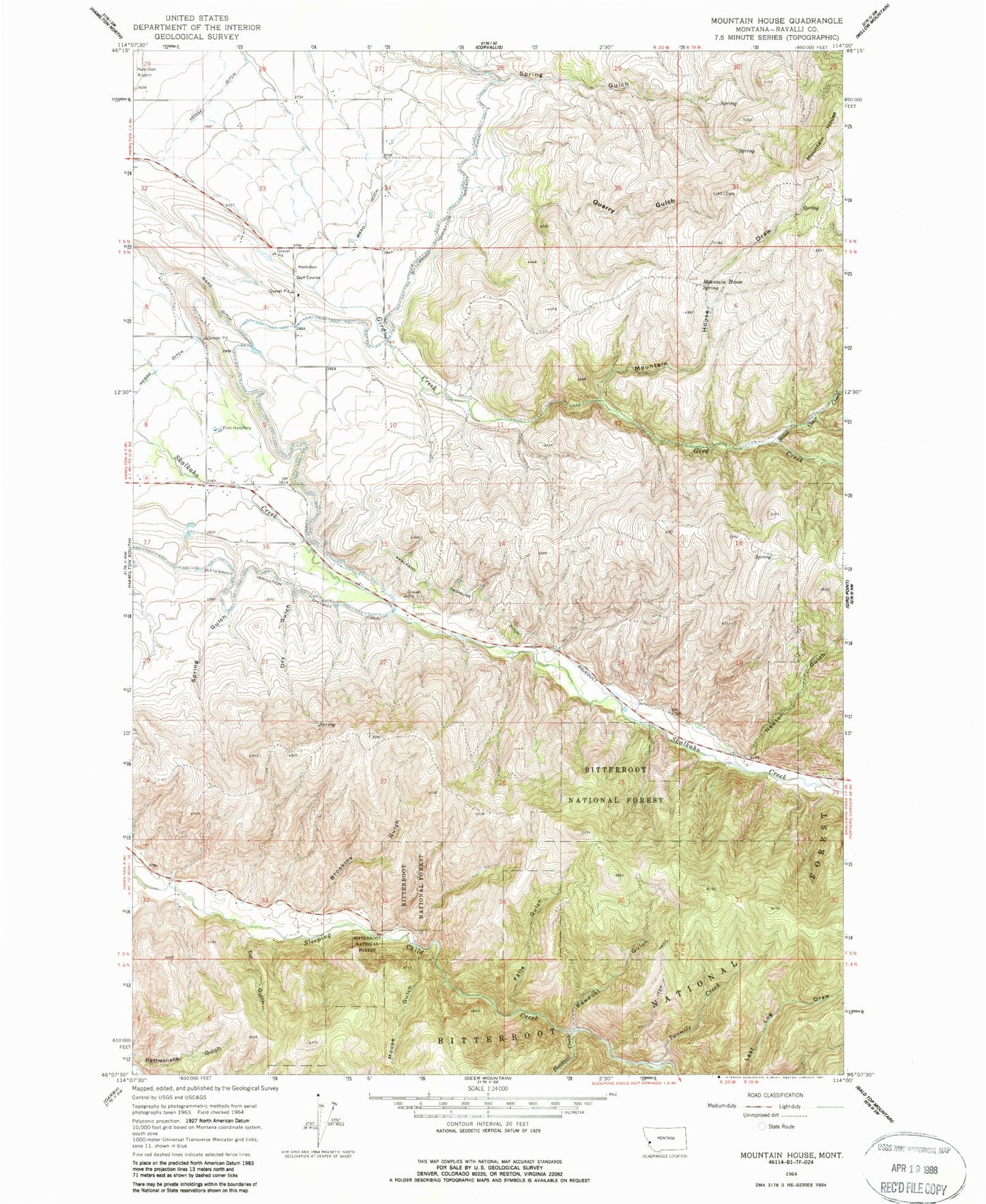
MyTopo
Classic USGS Mountain House Montana 7.5'x7.5' Topo Map
Couldn't load pickup availability
Historical USGS topographic quad map of Mountain House in the state of Montana. Map scale may vary for some years, but is generally around 1:24,000. Print size is approximately 24" x 27"
This quadrangle is in the following counties: Ravalli.
The map contains contour lines, roads, rivers, towns, and lakes. Printed on high-quality waterproof paper with UV fade-resistant inks, and shipped rolled.
Contains the following named places: 05N20W04ACD_01 Well, 05N20W10BAAC01 Well, 05N20W23BAC_01 Well, 05N20W23BBA_01 Well, 05N20W33BCCD01 Well, Blacktail Creek, Brookins Gulch, Dry Gulch, Falls Gulch, Hamilton Division, Hamilton Golf Course, Moose Gulch, Mountain House, Mountain House Draw, Mountain House Spring, Newton Gulch, Quarry Gulch, Saint Clair Creek, Sawdust Gulch, Skalkaho Highline Ditch, Spring Gulch, SW NE Section 2 Mine, Tip Gulch, Twomile Creek, Ward Ditch