MyTopo
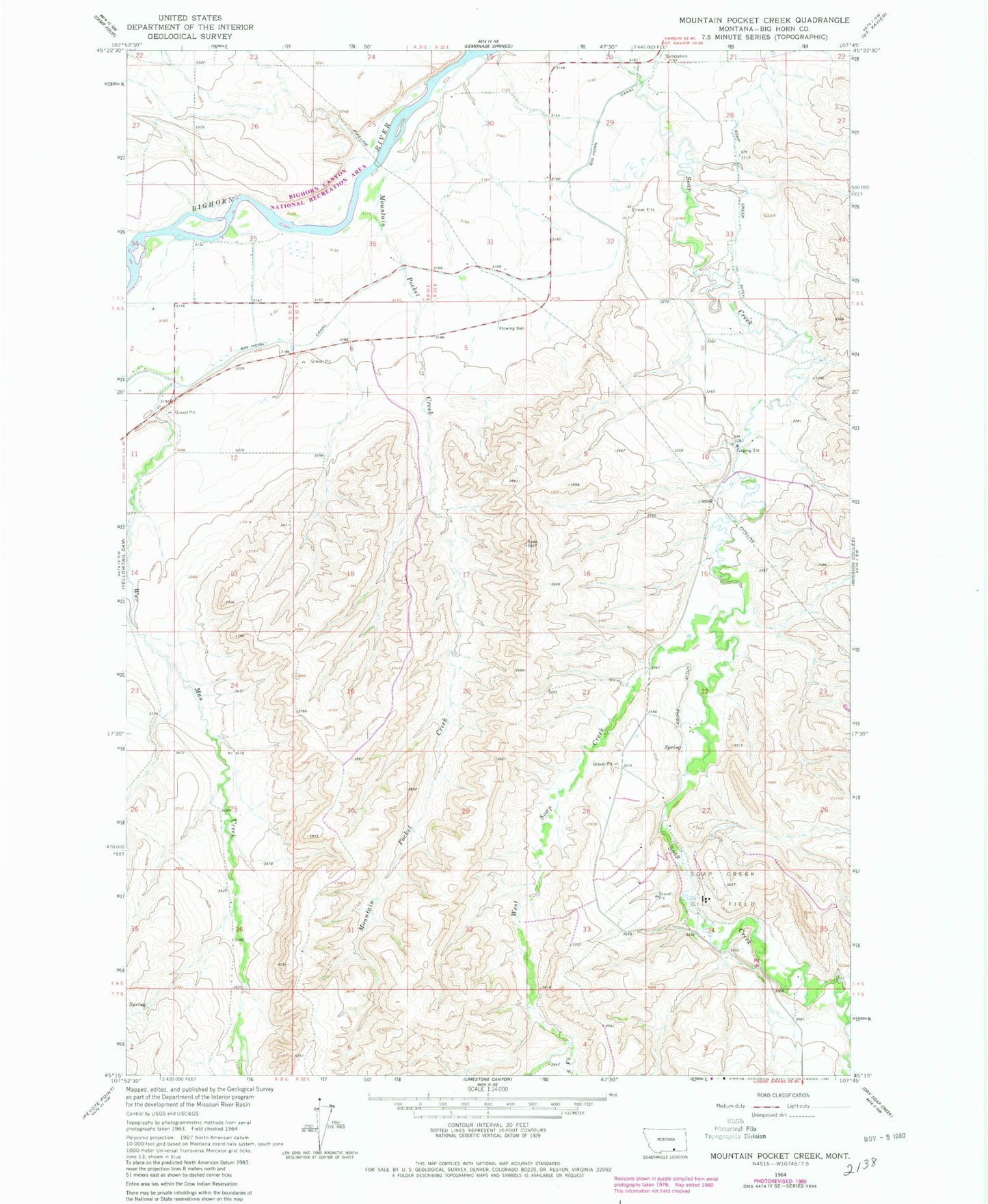
Classic USGS Mountain Pocket Creek Montana 7.5'x7.5' Topo Map
Couldn't load pickup availability
Historical USGS topographic quad map of Mountain Pocket Creek in the state of Montana. Map scale may vary for some years, but is generally around 1:24,000. Print size is approximately 24" x 27"
This quadrangle is in the following counties: Big Horn.
The map contains contour lines, roads, rivers, towns, and lakes. Printed on high-quality waterproof paper with UV fade-resistant inks, and shipped rolled.
Contains the following named places: 05S31E35CCC_02 Well, 05S31E36DBB_01 Well, 06S32E27CD__01 Well, 06S32E34ACC_01 Well, 07S32E02BB__01 Well, Deer Creek, Dry Soap Creek, Krone Ditch, Mountain Pocket Creek, Soap Creek Oilfield, South Fork West Soap Creek, War Man Creek, Warman School, West Soap Creek, Wolf Ranch