MyTopo
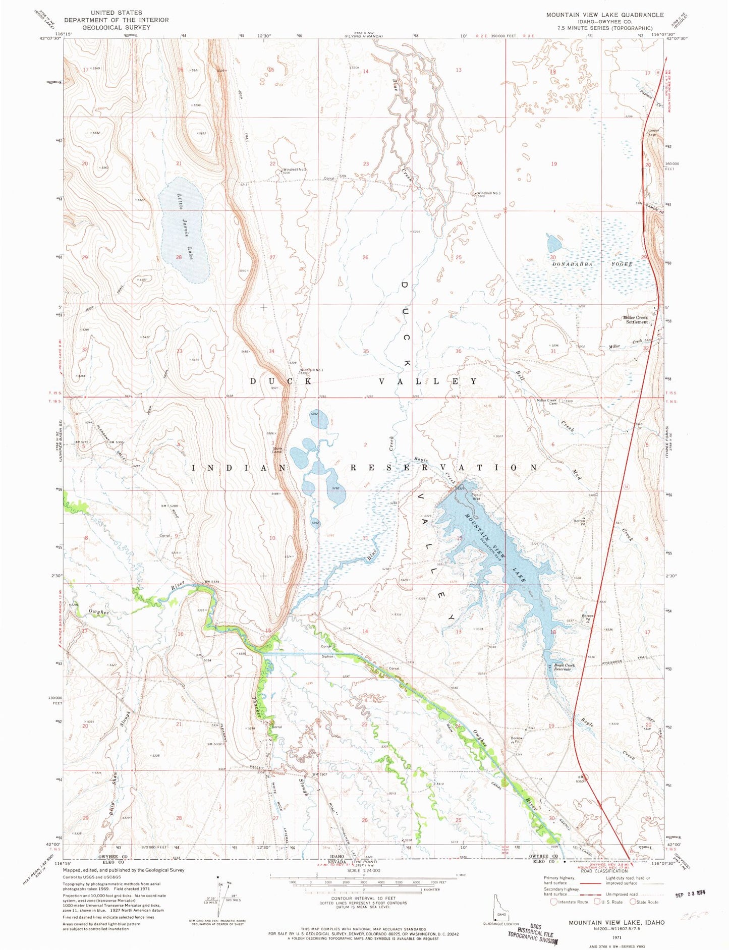
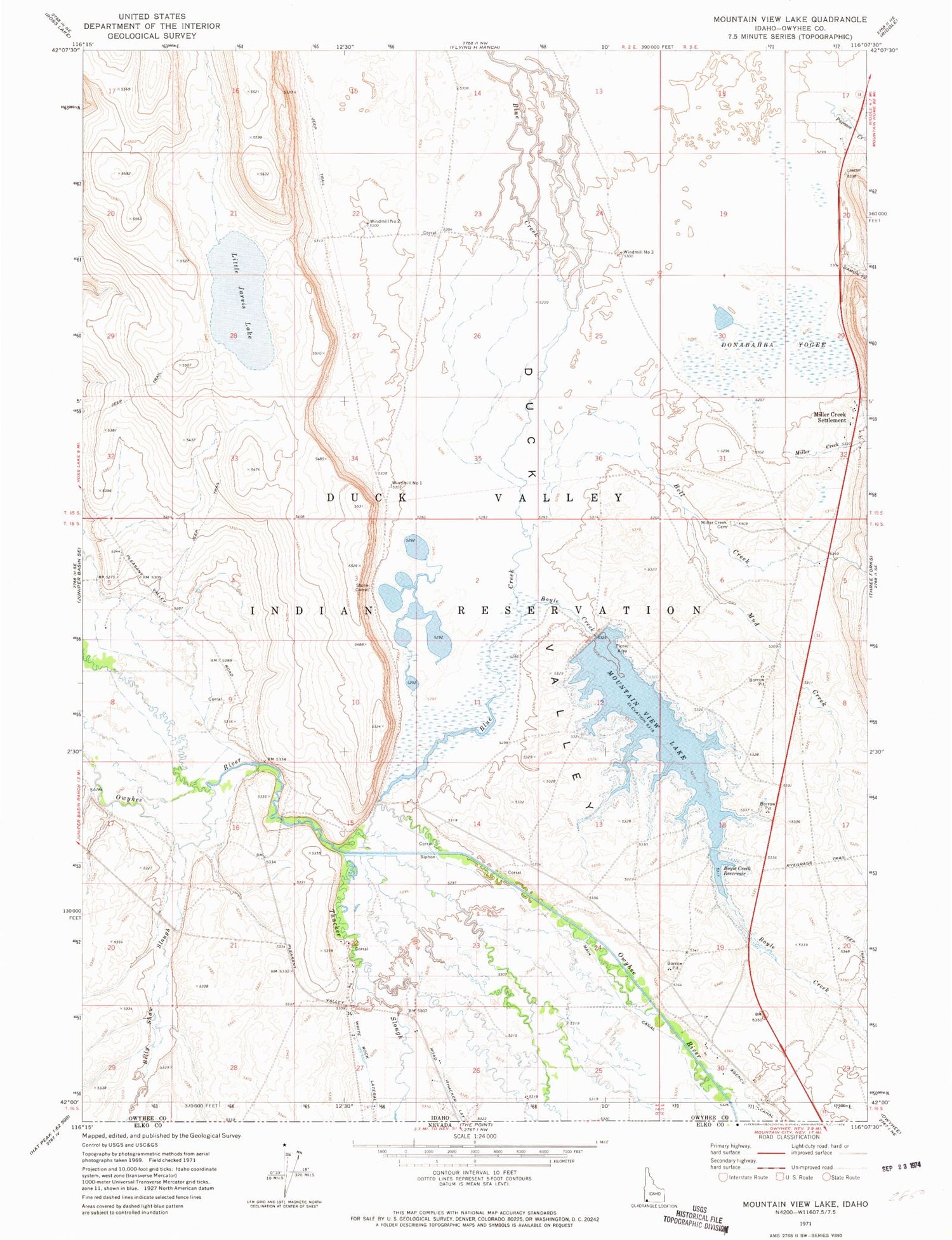
Classic USGS Mountain View Lake Idaho 7.5'x7.5' Topo Map
Couldn't load pickup availability
Historical USGS topographic quad map of Mountain View Lake in the state of Idaho. Map scale may vary for some years, but is generally around 1:24,000. Print size is approximately 24" x 27"
This quadrangle is in the following counties: Owyhee.
The map contains contour lines, roads, rivers, towns, and lakes. Printed on high-quality waterproof paper with UV fade-resistant inks, and shipped rolled.
Contains the following named places: Bell Creek, Billy Shaw Slough, Blue Creek, Boyle Creek, Boyle Creek Reservoir, Damon Trail Creek, Donabahba Yogee, Duck Valley Division, Little Jarvis Lake, Miller Creek, Miller Creek Cemetery, Miller Creek Settlement, Mountain View Dam, Mountain View Lake, Mud Creek, Stone Corral, Thacker Lateral, Thacker Slough, Windmill Number 1, Windmill Number 2, Windmill Number 3