MyTopo
Classic USGS Mountain View School Montana 7.5'x7.5' Topo Map
Couldn't load pickup availability
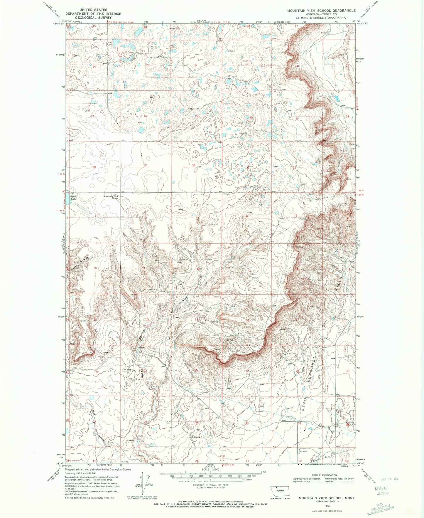
Historical USGS topographic quad map of Mountain View School in the state of Montana. Map scale may vary for some years, but is generally around 1:24,000. Print size is approximately 24" x 27"
This quadrangle is in the following counties: Toole.
The map contains contour lines, roads, rivers, towns, and lakes. Printed on high-quality waterproof paper with UV fade-resistant inks, and shipped rolled.
Contains the following named places: 35N03W18CA__01 Well, 35N04W01DB__01 Well, 35N04W02CA__01 Well, 35N04W03AA__01 Well, 35N04W03AA__02 Well, 35N04W11AA__01 Well, 35N04W11DC__01 Well, 35N04W11DC__02 Well, 35N04W11DD__01 Well, 35N04W12BB__01 Well, 35N04W12BC__01 Well, 35N04W12BD__01 Well, 35N04W12BD__02 Well, 35N04W12CA__01 Well, 35N04W12CB__01 Well, 35N04W12CB__02 Well, 36N03W19BB__01 Well, 36N03W19CC__01 Well, 36N03W30CB__01 Well, 36N03W30DD__01 Well, 36N03W32CD__01 Well, 36N04W22AD__01 Well, 36N04W22DC__01 Well, 36N04W25AB__01 Well, 36N04W34AD__01 Well, 36N04W35AA__01 Well, 36N04W35AB__01 Well, 36N04W35AD__01 Well, 36N04W35AD__02 Well, 36N04W36DA__01 Well, Benton Trail Lakes, Cowboys Lake, Foxtail Lakes, Frenchman Lake, Kevin Sunburst Oil Field, Mountain View School, Rocky Springs