MyTopo
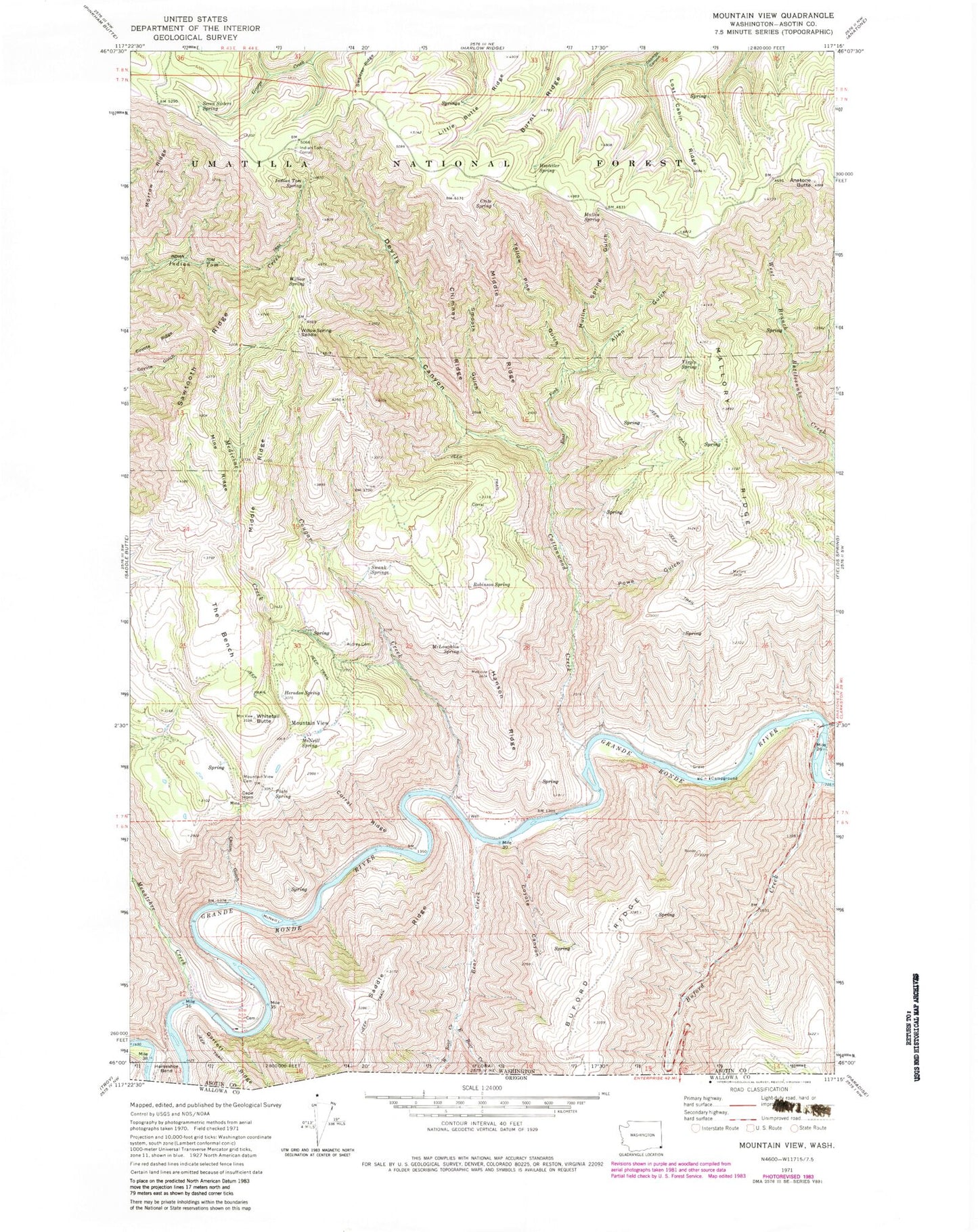
Classic USGS Mountain View Washington 7.5'x7.5' Topo Map
Couldn't load pickup availability
Historical USGS topographic quad map of Mountain View in the state of Washington. Map scale may vary for some years, but is generally around 1:24,000. Print size is approximately 24" x 27"
This quadrangle is in the following counties: Asotin.
The map contains contour lines, roads, rivers, towns, and lakes. Printed on high-quality waterproof paper with UV fade-resistant inks, and shipped rolled.
Contains the following named places: Allen Gulch, Anatone Butte, Autrey Cemetery, Bear Creek, Buford Creek, Burnt Ridge, Cape Horn, Chimney Ridge, Chitim Gulch, Corral Ridge, Cottonwood Creek, Cougar Creek, Coyote Canyon, Coyote Ridge, Crite Spring, Devils Canyon, Devils Slide, East Bear Creek, East Fork Cottonwood Creek, Hanson Ferry, Hanson Ridge, Herndon Spring, Hostetler Spring, Indian Tom Spring, Indian Tom Trail, Little Butte Ridge, Lost Cabin Ridge, Mallory Ridge, McLoughlin Spring, McMillan Spring, McNeil Spring, McNeill Island, Medicine Creek, Menatchee Creek, Middle Ridge, Mine Ridge, Morrow Ridge, Mount View School, Mountain View, Mountain View Cemetery, Mullin Spring, Mullin Spring Gulch, Plato Spring, Powe Gulch, R Barber Ranch, Rattlesnake Creek, Robinson Spring, Saddle Ridge, Sawtooth Ridge, Seven Sisters Spring, Short Ridge, Smooth Gulch, Swank Springs, Sweitzer Ridge, The Bench, Virgin Spring, West Bear Creek, Whitetail Butte, Willow Spring, Willow Spring Saddle, Yellow Pine Gulch